What to expect
Highlights
- The long dam bund and reservoir.
- The garden below the dam.
- Boating and the open water.
Hidkal Dam — the Raja Lakhamagouda dam — is a large dam across the Ghataprabha near Hidkal in Hukkeri taluk.

Its reservoir is a mainstay of the district’s irrigation, with a garden and boating below the bund and open water views.
Road km to Belagavi; ghat roads and traffic vary — allow extra.
August to February, when the reservoir is full.
Live forecast loads in your browser.
Sun and moon are calculated for this location and shown in IST. Photography windows are the hour around sunrise and sunset; the sunset bearing is degrees clockwise from true north. Moon phase is accurate to about half a day.
Verified hotels, homestays, restaurants, experiences, sights, shops and rentals around Hidkal Dam — commission-free, with direct contact. Filter by what you need.
Verified places are being added. The category filters will fill in as approved stays, restaurants, experiences, sights, shops and nature listings go live.
List your placeRoampedia is commission-free — own or know a stay, eatery, guide or shop near Hidkal Dam? List it and it appears here once verified.
Add a nearby businessEntry: Free or nominal
~60 km from Belagavi near Hidkal, off the Gokak road; by road
If you are travelling by bus or ferry, check the return service with the operator before setting out. Leave time to reach the stop or jetty after your visit.
Ask at the bus stand for the time of the last service back, not the next one. If you miss it, an auto or app cab is the fallback — agree the fare before you get in.
If you need step-free access, contact the site before travelling. Ask about a level entrance, steps along the route, the nearest drop-off point, seating and accessible toilets.
Emergency numbers are verified against official government and state tourism sources. 112 works anywhere in India.
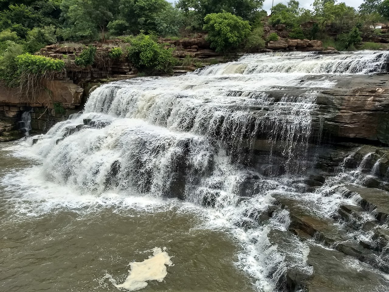
A two-tier waterfall where the Markandeya river drops through a forested valley near Gokak, also called Markandeya Falls; reached by a short trek and fullest after the monsoon.
9.5 km · ~16 min by cab · straight line
A 52 m horseshoe fall where the Ghataprabha plunges over a sandstone gorge in Gokak taluk — the 'Niagara of Karnataka' — spanned by a colonial hanging footbridge and site of one of India's earliest hydro-electric works (1887).
15.3 km · ~25 min by cab · straight line
The oval Kote fort of Belagavi, first raised by the Ratta dynasty around 1204 and later held by the Vijayanagara, Bahmani, Adil Shahi, Maratha and British — a water-girt fort of curved ramparts and bastions enclosing old temples, Jain bastis and mosques.
34.1 km · ~57 min by cab · straight lineAn Adil Shahi–era mosque within Belagavi Fort, its pillared prayer hall said to reuse columns from earlier temples, with Persian inscriptions set over the arches.
34.2 km · ~57 min by cab · straight line
A 12th-century Jain temple (basadi) inside Belagavi Fort, named for the lotus (kamala) carved on its black-stone mandapa ceiling; it enshrines a fine image of Neminatha and is a protected relic of the Ratta capital.
34.2 km · ~57 min by cab · straight lineA colonial-era Roman Catholic church in the Belagavi cantonment, one of the oldest in the Camp, with British-period architecture and old stained glass.
35.4 km · ~59 min by cab · straight lineA modern Shiva temple associated with the Maratha Light Infantry in Belagavi cantonment. Visitors should follow current gate and photography instructions and avoid photographing military installations.
36.2 km · ~60 min by cab · straight line
Karnataka's second, granite-and-dome legislature building, opened in 2012 on the edge of Belagavi so the assembly can hold a winter session in the north — a monumental modern landmark modelled on Bengaluru's Vidhana Soudha and floodlit at night.
37.4 km · ~62 min by cab · straight line
A hill fort south of Belagavi whose surviving walls and high plateau overlook the western approaches to the city. Go in daylight and treat the exposed edges and monsoon grass with care.
44.7 km · ~74 min by cab · straight line
The Malaprabha dam and Renuka Sagara reservoir at Navilutirtha, which the Belagavi district administration places 10 km from Saundatti in a valley between two hills.
60.3 km · ~100 min by cab · straight lineA small historic fort at Munavalli north of Saundatti, mapped around a surviving walled enclosure. Treat it as an unstaffed local heritage stop rather than a serviced monument.
60.6 km · ~101 min by cab · straight line
A living Veerabhadra and Bhadrakali pilgrimage temple at Godachi in Ramdurg taluk, known for its annual jatre. Confirm the current festival dates, worship hours and traffic arrangements locally.
61.0 km · ~102 min by cab · straight lineAugust to February, when the reservoir is full.
Entry: Free or nominal. Timings: Daylight hours.
About 60 km from Belagavi near Hidkal, off the Gokak road; reached by road. Fullest after the monsoon; a car is best for the trip.
1 to 1.5 hours.
Nearby you can pair Godachinamalki Falls (9.5 km), Gokak Falls (15.3 km), Belagavi Fort (34.1 km), Safa Masjid, Belagavi (34.2 km).
We have not published a story about Hidkal Dam itself yet. These cover Hukkeri and the wider district, with separate journeys between stops.
Route-level itineraries and practical guides for the rest of Karnataka.



Photographs: Shil.4349, CC BY-SA 3.0, via Wikimedia Commons (CC BY-SA 3.0). Wikimedia Commons.