Places to Visit in Gajendragad

The north-east corner of Gadag around Gajendragad — the Maratha hill fort and its Kalakaleshwara shrine, and the twin-towered Naganatha temple at nearby Sudi.

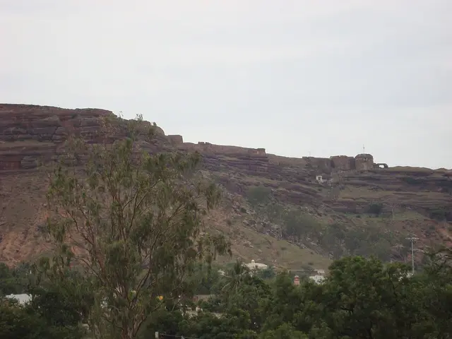
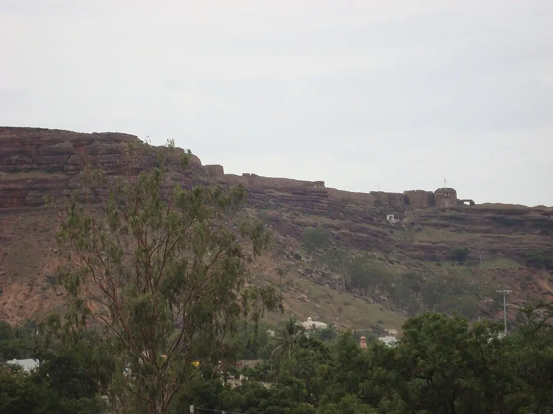
Gajendragad Fort, Gajendragad
Practical guide

Plan Gajendragad

Who's going?Tailor Gajendragad to your trip
DistrictGadag
RoleFort & twin-temple base
Places to visit2
What to expect

Highlights

  • Gajendragad Fort — A Maratha-era hill fort above Gajendragad in Gadag district, fortified in the 17th century — bastioned walls, bunkers, a dargah and temple ruins crowning the ridge, with the Kalakaleshwara "Dakshina Kashi" shrine on the same hill.
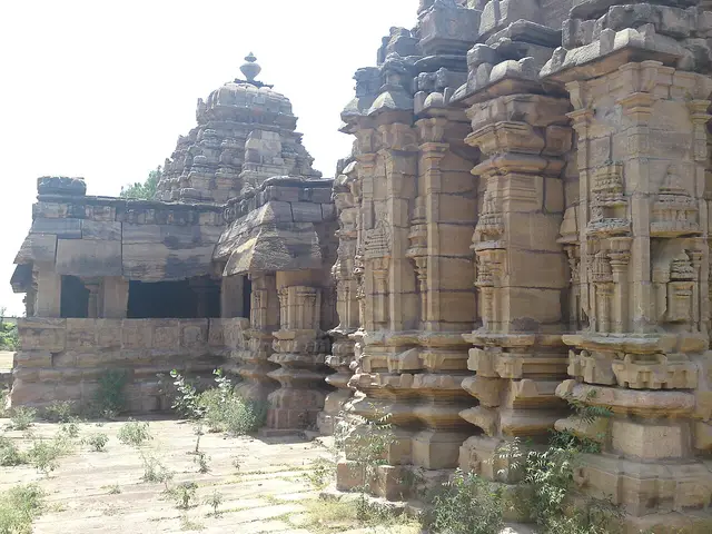
  • Naganatha Temple, Sudi — The twin-towered "Jodu Kalasa" temple at Sudi, built in 1069 CE by Nagadeva, minister of the Chalukya king Someshwara II — two sanctums sharing a common Nandi mandapa, a rare dvikutachala plan in the Chalukyan country.
Getting there

How to visit

  • Nearest airport: Hubballi (HBX) ~55 km; Belagavi (IXG) ~150 km; Bengaluru (BLR) ~420 km
  • Rail gateway: Gadag Junction (GDG) on the Hubballi–Guntakal and Solapur lines, with trains from Hubballi, Bengaluru, Vijayapura and Solapur
  • NH-67 and state highways; KSRTC and private buses from Hubballi (~55 km), Koppal, Bagalkot and Bengaluru (~420 km); a car is best for Lakkundi, Dambal, Lakshmeshwar and Gajendragad.

Distance by road

  • Hubballi113 km
  • Vijayapura145 km
  • Ballari149 km
  • Davanagere175 km
  • Belagavi184 km
  • Kalaburagi251 km
  • Bengaluru407 km

Road distances measured on real routed roads to Gajendragad itself, not to the district headquarters, on 24 August 2026. Driving time is deliberately not published: free-flow routing badly understates a Deccan single-carriageway highway, so allow more than the distance suggests.

Timing

Best time to visit Gajendragad

Weather in GajendragadSeasonal guide

Live forecast loads in your browser.

Today at Gajendragad
Sunrise6:14 am
Sunset6:37 pm
Golden hour best light5:37 pm–6:37 pm
Blue hour after sunset6:37 pm–7:02 pm
Sun sets toward compass bearingW · 278°
Moon tonight🌗 Last quarter · 51%
South-west monsoon. June to September is the south-west monsoon in Karnataka. Expect heavy showers, mostly in bursts rather than all day — carry rain cover, allow extra time for getting around, and note that ferries and open-air sites are the first things affected.

Sun and moon are calculated for this location and shown in IST. Photography windows are the hour around sunrise and sunset; the sunset bearing is degrees clockwise from true north. Moon phase is accurate to about half a day.

Nearby bases

Where to go from Gajendragad

Trikuteshwara Temple, Gadag, GadagFeatured: Trikuteshwara Temple, Gadag
Town / base

Gadag

The twin district town of Gadag-Betageri — the Trikuteshwara temple with its lathe-turned Saraswati pillars, the Veeranarayana temple of the poet Kumaravyasa, and the Binkadakatti zoo; a base for the Lakkundi and Dambal temple runs.

Trikuteshwara Temple, GadagVeeranarayana Temple, GadagBinkadakatti Zoo
Open Gadag guide →
Kasivisvesvara Temple, Lakkundi, LakkundiFeatured: Kasivisvesvara Temple, Lakkundi
Town / base

Lakkundi

The old Chalukya capital of Lakkundi, "the town of 101 temples and 101 wells" — the twin Kasivisvesvara temple, the Brahma Jinalaya basadi, the Nanneshwara and Manikeshwara temples with their carved stepwell, and the ASI sculpture museum.

Kasivisvesvara Temple, LakkundiBrahma Jinalaya, LakkundiNanneshwara Temple, LakkundiManikeshwara Temple, Lakkundi
Open Lakkundi guide →
Doddabasappa Temple, Dambal, DambalFeatured: Doddabasappa Temple, Dambal
Town / base

Dambal

The temple town of Dambal in Mundargi taluk — the unique 24-point star-plan Doddabasappa temple of the Western Chalukyas.

Doddabasappa Temple, Dambal
Open Dambal guide →
Magadi Bird Sanctuary, ShirahattiFeatured: Magadi Bird Sanctuary
Town / base

Shirahatti

The Shirahatti belt south of Gadag — the Magadi bird wetland with its wintering bar-headed geese and the Kappatagudda biodiversity hills.

Magadi Bird SanctuaryKappatagudda Wildlife Sanctuary
Open Shirahatti guide →
Someshwara Temple, Lakshmeshwar, LakshmeshwarFeatured: Someshwara Temple, Lakshmeshwar
Town / base

Lakshmeshwar

The ancient town of Lakshmeshwar (Puligere) — the walled Someshwara temple with its many inscriptions and the 8th-century Shankha Jain basadi with its Sahasrakuta pillar.

Someshwara Temple, LakshmeshwarShankha Basadi, Lakshmeshwar
Open Lakshmeshwar guide →
Itagi Bhimambika Temple, RonFeatured: Itagi Bhimambika Temple
Town / base

Ron

The Ron belt (ancient Dronapur) — the Bhimambika goddess temple and its Chalukya Shambhulinga shrine at Itagi.

Itagi Bhimambika Temple
Open Ron guide →
Nargund Fort, NargundFeatured: Nargund Fort
Town / base

Nargund

The town of Nargund — the ancient hill fort of the 1857 Nargund revolt above the Malaprabha plain.

Nargund Fort
Open Nargund guide →
In the district

Where Gajendragad sits in Gadag district

Nearest airportHubballi (HBX) ~55 km; Belagavi (IXG) ~150 km; Bengaluru (BLR) ~420 km
Rail gatewayGadag Junction (GDG) on the Hubballi–Guntakal and Solapur lines, with trains from Hubballi, Bengaluru, Vijayapura and Solapur
Bus / road accessNH-67 and state highways; KSRTC and private buses from Hubballi (~55 km), Koppal, Bagalkot and Bengaluru (~420 km); a car is best for Lakkundi, Dambal, Lakshmeshwar and Gajendragad.
District HQGadag-Betageri
LandscapeCentral-north Karnataka plateau district in the Kalyana-Karnataka Deccan, on the Malaprabha–Tungabhadra watershed, ~650 m

Gadag district is known for: The Chalukyan temples and stepwells of Lakkundi, the Trikuteshwara and Veeranarayana temples of Gadag town, the 24-point star Doddabasappa temple at Dambal, the Someshwara temple and Jain basadis of Lakshmeshwar (Puligere), the Gajendragad hill fort, and the Magadi bird wetland and Kappatagudda hills.

Kasivisvesvara Temple, LakkundiDoddabasappa Temple, DambalMagadi Bird Sanctuary
Stay · eat · do · rent · see · shop

Places in Gajendragad

Every verified place in Gajendragad — filter by what you’re after.

Verified inventory is being added here.

Verified places are being added. The category filters will fill in as approved stays, restaurants, experiences, sights, shops and nature listings go live.

List your place
For hotels, homestays and local businesses

Get listed in Gajendragad for free

Roampedia is commission-free. Travellers discover your business, book directly and contact you through official details. Basic listings are free, while Gold and Platinum package upgrades can be requested from the owner dashboard after approval.

List your business — free
Ranked guide modules

Top Gajendragad experiences

1 pick

Gajendragad-scoped cards for local planning: verified places, practical routes and source-checked visitor context.

Map

Where things are in Gajendragad

FAQ

Gajendragad travel FAQs

What are the best places to visit in Gajendragad?

Top places to visit in Gajendragad include Gajendragad Fort, Naganatha Temple, Sudi — each has a full guide with how to reach it and what to see nearby on this page.

How do I reach Gajendragad?

The nearest airport to Gajendragad is Hubballi (HBX) ~55 km; Belagavi (IXG) ~150 km; Bengaluru (BLR) ~420 km. The rail gateway is Gadag Junction (GDG) on the Hubballi–Guntakal and Solapur lines, with trains from Hubballi, Bengaluru, Vijayapura and Solapur. NH-67 and state highways; KSRTC and private buses from Hubballi (~55 km), Koppal, Bagalkot and Bengaluru (~420 km); a car is best for Lakkundi, Dambal, Lakshmeshwar and Gajendragad.

What is the best time to visit Gajendragad?

October to February is the coolest, most comfortable season to visit Gajendragad and the rest of Karnataka. March to May is hot on the plains, and the June–September southwest monsoon brings the main rains, heaviest along the coast and Western Ghats.