What to expect
Highlights
- The Bala Hisar tower and ramparts.
- The rock-cut water channels and gateways.
- The prehistoric rock paintings nearby.
Mudgal Fort is a great rock hill fort near Mudgal in Lingsugur taluk, long fought over by the Bahmani and Vijayanagara empires and later the Adil Shahis.

A Bala Hisar tower, cut-rock water channels and layered gateways survive, with prehistoric rock paintings in the hills nearby.
Road km to Raichur; ghat roads and traffic vary — allow extra.
October to February; early morning or late afternoon.
Live forecast loads in your browser.
Sun and moon are calculated for this location and shown in IST. Photography windows are the hour around sunrise and sunset; the sunset bearing is degrees clockwise from true north. Moon phase is accurate to about half a day.
Verified hotels, homestays, restaurants, experiences, sights, shops and rentals around Mudgal Fort — commission-free, with direct contact. Filter by what you need.
Verified places are being added. The category filters will fill in as approved stays, restaurants, experiences, sights, shops and nature listings go live.
List your place2 more places around Lingsugur. Open a guide to plan the visit and onward journey.
27.1 km · ~45 min by cab
An island fort in the Krishna near Lingsugur — a "fort on water" of seven gates on a rocky river island, held by the Adil Shahis, where the Krishna cascades in the seasonal Jaladurga falls. (The island is Raichur district; the opposite bank is Yadgir.)
31.7 km · ~53 min by cab
Hutti (Hatti) in Lingsugur taluk is India's only major working gold mine — a landscape of ancient hand-dug workings overlaid by the modern deep underground mine of the state gold company.
Roampedia is commission-free — own or know a stay, eatery, guide or shop near Mudgal Fort? List it and it appears here once verified.
Add a nearby businessEntry: Free
At Mudgal, ~100 km west of Raichur in Lingsugur taluk; by road, a car is best
If you are travelling by bus or ferry, check the return service with the operator before setting out. Leave time to reach the stop or jetty after your visit.
Ask at the bus stand for the time of the last service back, not the next one. If you miss it, an auto or app cab is the fallback — agree the fare before you get in.
If you need step-free access, contact the site before travelling. Ask about a level entrance, steps along the route, the nearest drop-off point, seating and accessible toilets.
Emergency numbers are verified against official government and state tourism sources. 112 works anywhere in India.
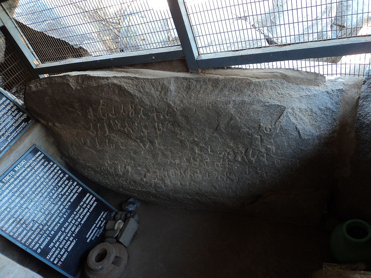
A Minor Rock Edict of Emperor Ashoka carved on a granite boulder at Maski — the first edict found to name "Devanampriya Ashoka", which conclusively identified the title Devanampriya with the emperor Ashoka; an ASI monument of national importance.
23.5 km · ~39 min by cab · straight lineAn island fort in the Krishna near Lingsugur — a "fort on water" of seven gates on a rocky river island, held by the Adil Shahis, where the Krishna cascades in the seasonal Jaladurga falls. (The island is Raichur district; the opposite bank is Yadgir.)
27.1 km · ~45 min by cab · straight lineHutti (Hatti) in Lingsugur taluk is India's only major working gold mine — a landscape of ancient hand-dug workings overlaid by the modern deep underground mine of the state gold company.
31.7 km · ~53 min by cab · straight lineThe old ruined hill fort of Manvi, birthplace of the Haridasa saint Jagannatha Dasa, with a hilltop Mallikarjuna shrine and an internal dargah within its bastioned walls.
65.7 km · ~109 min by cab · straight lineOctober to February; early morning or late afternoon.
Entry: Free. Timings: Daylight hours.
At Mudgal, about 100 km west of Raichur in Lingsugur taluk; reached by road, a car is best. Wear good shoes and carry water; go by day.
1.5 to 2 hours with the climb.
Nearby you can pair Maski Ashokan Edict (23.5 km), Jaladurga Fort (27.1 km), Hutti Gold Mines (31.7 km), Manvi Fort (65.7 km).
We have not published a story about Mudgal Fort itself yet. These cover Lingsugur and the wider district, with separate journeys between stops.
Route-level itineraries and practical guides for the rest of Karnataka.


Photographs: Manjunath Doddamani Gajendragad at en.wikipedia, Public domain, via Wikimedia Commons (Public domain), Manjunath Doddamani Gajendragad at en.wikipedia (Public domain), Manjunath Doddamani Gajendragad at English Wikipedia (Public domain). Wikimedia Commons.