What to expect
Highlights
- The twin black karst rock spires.
- The Shiva cave shrine at the base.
- The forest walk through rich Sahyadri greenery.
Yana is famous for two towering spires of black crystalline karst rock — the Bhairaveshwara Shikhara and the smaller Mohini Shikhara — rising abruptly from dense Sahyadri forest, among the most unusual rock formations in the Western Ghats.

A cave shrine to Shiva at the base of the Bhairaveshwara rock makes it a pilgrimage site as well as a trekking and nature spot, reached by a forest walk.
Road km to Uttara Kannada; ghat roads and traffic vary — allow extra.
October to February; the forest is lush just after the monsoon but wet and leechy.
Live forecast loads in your browser.
Sun and moon are calculated for this location and shown in IST. Photography windows are the hour around sunrise and sunset; the sunset bearing is degrees clockwise from true north. Moon phase is accurate to about half a day.
Verified hotels, homestays, restaurants, experiences, sights, shops and rentals around Yana — commission-free, with direct contact. Filter by what you need.
Verified places are being added. The category filters will fill in as approved stays, restaurants, experiences, sights, shops and nature listings go live.
List your place7 more places around Sirsi. Open a guide to plan the visit and onward journey.
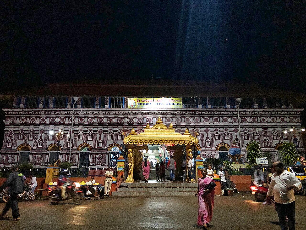
The largest temple to the goddess Marikamba (Durga) in Karnataka, at Sirsi, famous for its biennial Marikamba Jatra — one of the biggest fairs in the state.
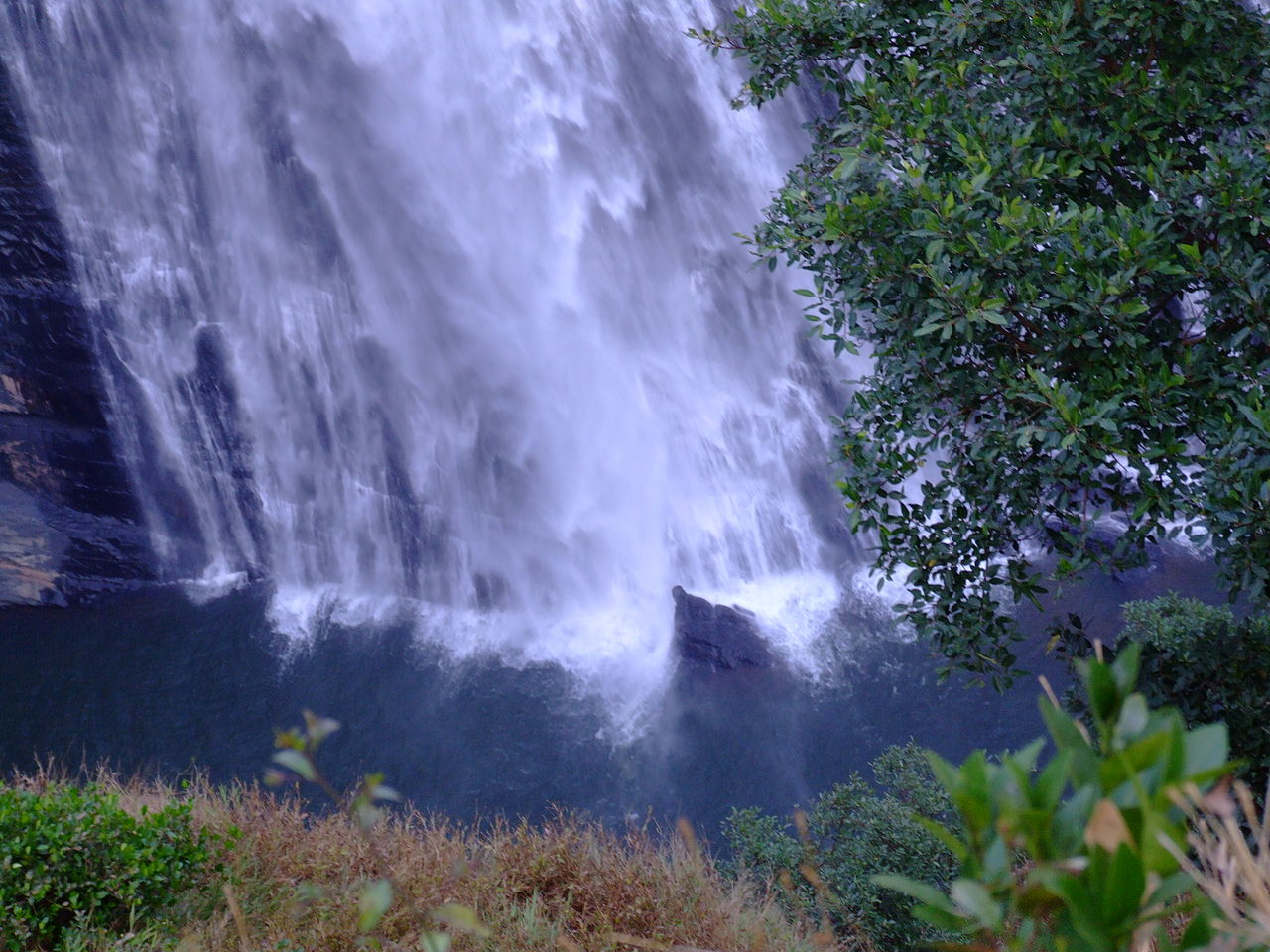
28.0 km · ~47 min by cab
Also called Lushington Falls — where the Aghanashini river plunges about 116 m into a forested gorge near Siddapura, viewed from a platform after a short forest walk.

A wide waterfall where a tributary of the Kali drops into a pool amid forest near Yellapur, backed by the Kodasalli reservoir.

A waterfall near Yellapur where the Bedti (Gangavali) river drops in two leaps of around 200 m into a wooded gorge, seen from a viewpoint.

Over a thousand Shiva lingas and Nandis carved into the bed and banks of the Shalmala river ~14 km from Sirsi — exposed in the dry season and submerged in the monsoon.
The Vadiraja (Sode) matha at Sonda ~20 km from Sirsi — one of the Ashta Mathas of Udupi and a major Dvaita pilgrimage centre around the Vadiraja Brindavana, with a Jain basadi nearby.
11.1 km · ~19 min by cab
A forest Venkataramana (Vishnu) temple ~26 km from Sirsi — a regional pilgrimage sometimes called the “Tirupati of Uttara Kannada”.
Roampedia is commission-free — own or know a stay, eatery, guide or shop near Yana? List it and it appears here once verified.
Add a nearby businessEntry: Free or nominal
~40 km from Sirsi, ~25 km from Kumta; drive to trailhead + ~30-min walk
If you are travelling by bus or ferry, check the return service with the operator before setting out. Leave time to reach the stop or jetty after your visit.
Ask at the bus stand for the time of the last service back, not the next one. If you miss it, an auto or app cab is the fallback — agree the fare before you get in.
If you need step-free access, contact the site before travelling. Ask about a level entrance, steps along the route, the nearest drop-off point, seating and accessible toilets.
Emergency numbers are verified against official government and state tourism sources. 112 works anywhere in India.

A multi-tier limestone waterfall in the forests of Ankola taluk near Yana, often paired with the Yana rock spires.
1.9 km · 23 min walk · straight lineA forest Venkataramana (Vishnu) temple ~26 km from Sirsi — a regional pilgrimage sometimes called the “Tirupati of Uttara Kannada”.
11.1 km · ~19 min by cab · straight lineA multi-tier forest waterfall ~25 km from Siddapur reached by a trek — its name means “butter pool”, for the milky look of its water.
11.4 km · ~19 min by cab · straight line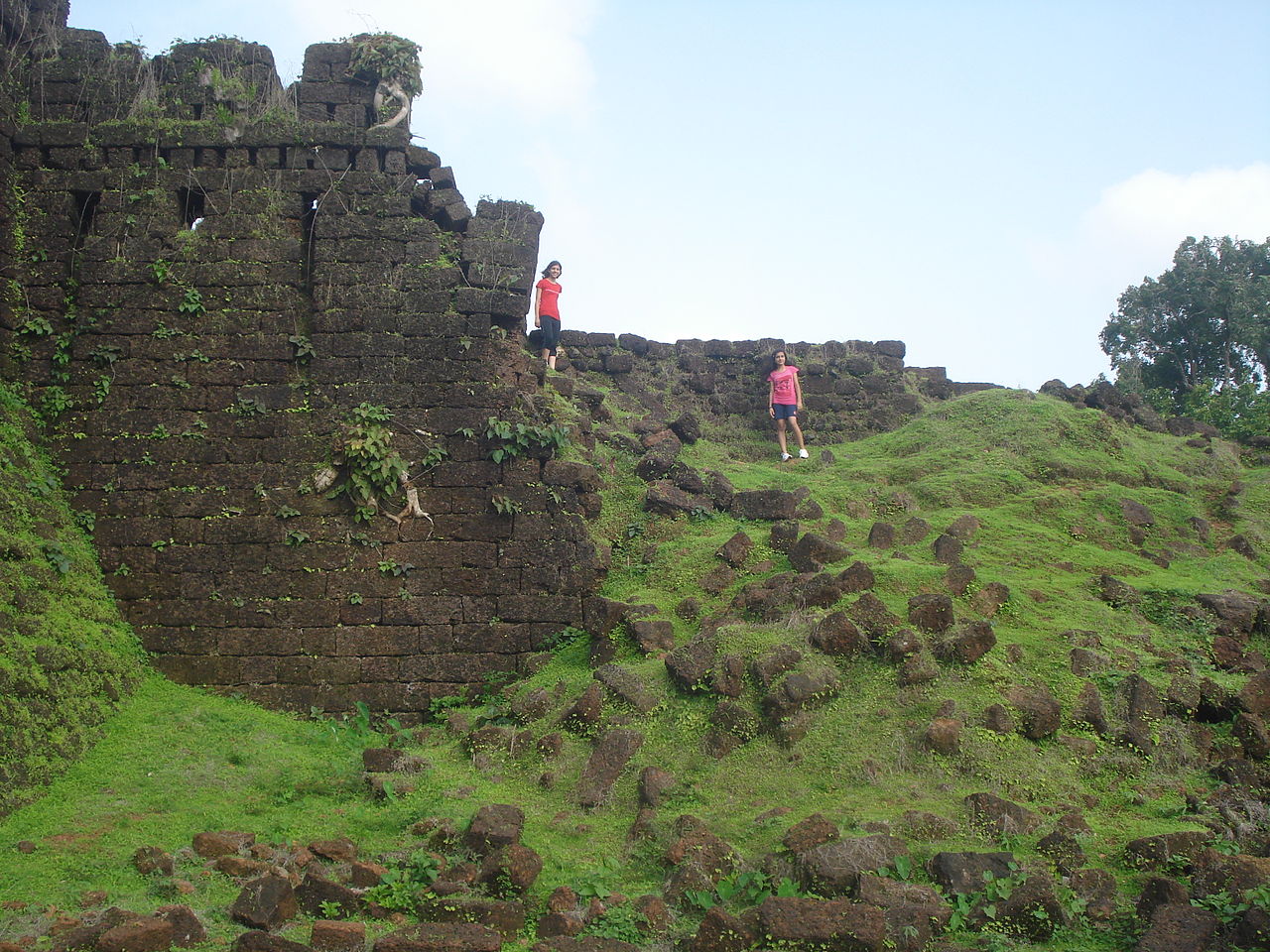
A laterite-stone fort near Kumta on the Aghanashini estuary, with high bastions and stepped wells amid greenery, linked to the 16th-century pepper-trading queen Chennabhairadevi.
19.5 km · ~33 min by cab · straight line
The Ramsar-listed mangrove estuary where the un-dammed Aghanashini river meets the sea — rich in bivalve fisheries, birdlife and boat backwaters.
23.0 km · ~38 min by cab · straight line
The most remote of the Gokarna beaches (also called Full Moon), reached by boat or a long cliff trek — an isolated stretch popular for camping where permitted.
25.9 km · ~43 min by cab · straight line
A small half-moon cove reached by a cliff trek or boat beyond Om Beach — quiet and secluded, with just a few shacks.
26.6 km · ~44 min by cab · straight line
A beach curved into the shape of the Om (ॐ) symbol south of Gokarna — the most popular of the town’s beaches, with shacks, water sports and a laid-back scene.
27.1 km · ~45 min by cab · straight line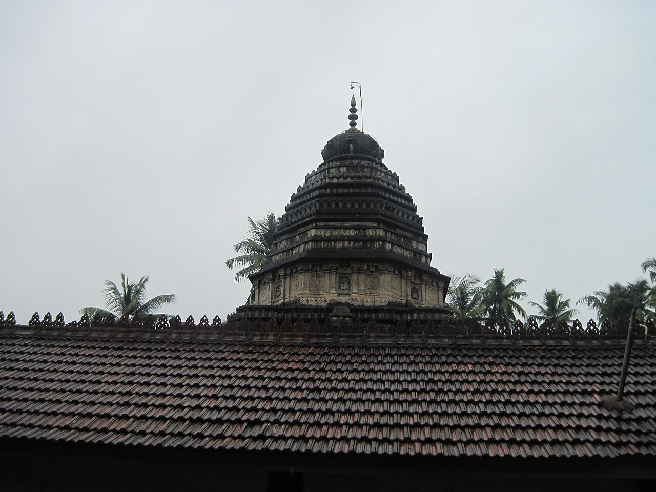
An ancient Shiva temple at Gokarna enshrining the Atmalinga, one of the most sacred lingas in South India (a "Dakshina Kashi") — a classic Dravidian temple by the sea and the centre of the Maha Shivaratri car festival.
27.4 km · ~46 min by cab · straight line
A crescent of sand between Gokarna town and Om Beach, reached by a short cliff walk — a mellow backpacker favourite for sunsets and yoga.
27.8 km · ~46 min by cab · straight line
The long town beach in front of Gokarna, used by pilgrims for ritual bathing and by visitors for a relaxed shore walk; the starting point of the cliff trail to the quieter southern beaches.
27.8 km · ~46 min by cab · straight lineAlso called Lushington Falls — where the Aghanashini river plunges about 116 m into a forested gorge near Siddapura, viewed from a platform after a short forest walk.
28.0 km · ~47 min by cab · straight lineOctober to February; the forest is lush just after the monsoon but wet and leechy.
Entry: Free or nominal. Timings: Daylight; forest walk.
~40 km from Sirsi and ~25 km from Kumta; drive to the trailhead, then a forest walk of ~30 minutes to the rocks. Wear good shoes for the walk; it can be slippery and leech-prone after rain — carry water and go in daylight.
2 to 3 hours including the walk.
Nearby you can pair Vibhooti Falls (1.9 km), Manjuguni Venkataramana Temple (11.1 km), Benne Hole Falls (11.4 km), Mirjan Fort (19.5 km).
We have not published a story about Yana itself yet. These cover Sirsi and the wider district, with separate journeys between stops.
Route-level itineraries and practical guides for the rest of Karnataka.


Photographs: Photos Worldwide, CC0, via Wikimedia Commons (CC0), VasuVR (CC BY 4.0). Wikimedia Commons.