What to expect
Highlights
- A fort ruin absorbed into Western Ghats forest.
- Streams and lateritic hill terrain.
- A demanding contrast to road-accessible Halasi.
Sada Fort is a remote forest ruin in the western Khanapur hills. Karnataka Tourism describes the approach as a trek rather than a conventional road-and-ticket visit.
Attempt it only on a currently authorised route with local guidance; a map pin is not proof that the forest approach is open.
Road km to Belagavi; ghat roads and traffic vary — allow extra.
Only when the authorised route and weather are suitable.
Live forecast loads in your browser.
Sun and moon are calculated for this location and shown in IST. Photography windows are the hour around sunrise and sunset; the sunset bearing is degrees clockwise from true north. Moon phase is accurate to about half a day.
Verified hotels, homestays, restaurants, experiences, sights, shops and rentals around Sada Fort — commission-free, with direct contact. Filter by what you need.
The mapped eco-sensitive-zone boundary associated with Bhimgad Wildlife Sanctuary, identifying protected forest context rather than a public entrance gate.
Book with the place itself. India’s cyber-crime coordination centre warned in April 2025 that convincing copies of hotel and pilgrimage booking sites are being pushed through sponsored search and social ads, taking payment for rooms the property never hears about. Every listing here links to the business’s own contact details and its own Google or Bing profile — we take no commission and sit in nobody’s payment path. If a booking page reached you through an ad, check the address bar against the property’s own site before you pay. Fraud can be reported on cybercrime.gov.in or on 1930.
3 more places around Khanapur. Open a guide to plan the visit and onward journey.

54.6 km · ~91 min by cab
A Vishnu temple at Halasi (Halsi) in Khanapur taluk, an old Kadamba capital; the Bhuvaraha Narasimha shrine and its neighbours preserve fine early sculpture in a village dotted with ancient temples.
25.6 km · ~43 min by cab
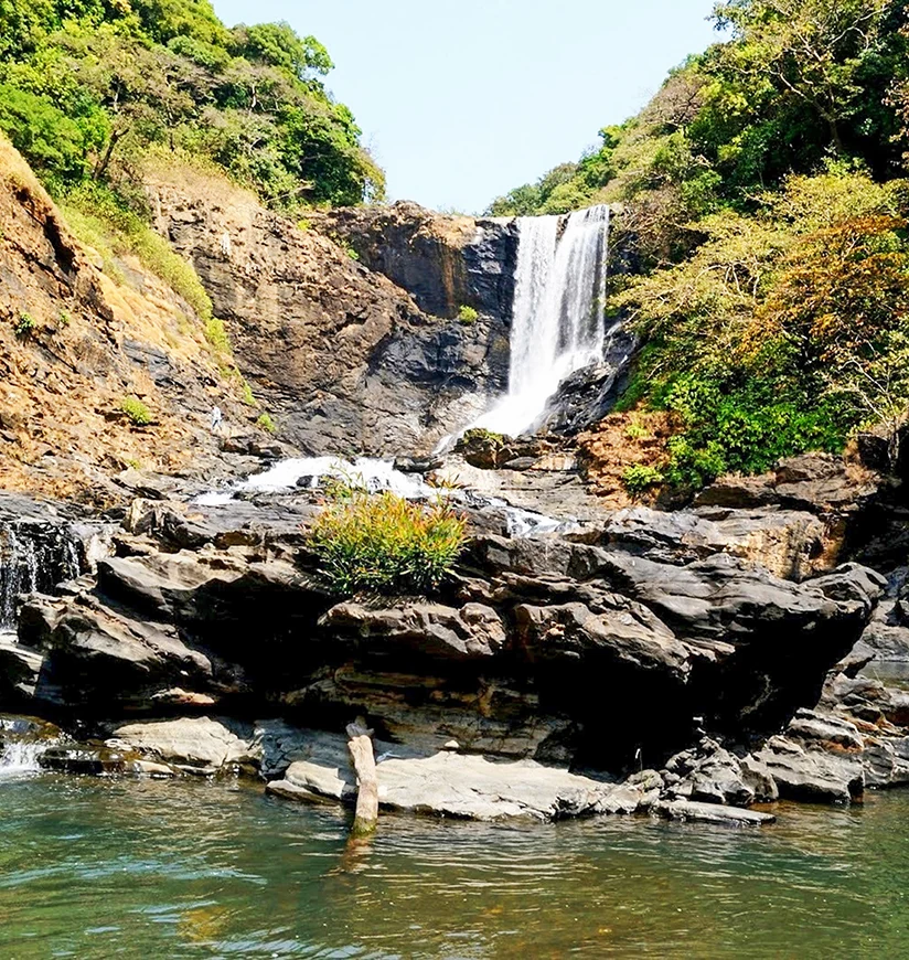
A high, seasonal waterfall on the Mahadayi (Mandovi) headwaters deep in the Jamboti forests of Khanapur near the Goa border — a monsoon spectacle reached by a forest trek.

29.1 km · ~48 min by cab
A protected Western Ghats forest on the Karnataka–Goa border, containing Bhimgad fort and the breeding habitat of Wroughton's free-tailed bat. Entry, routes and cave restrictions must be confirmed with the Forest Department.
Roampedia is commission-free — own or know a stay, eatery, guide or shop near Sada Fort? List it and it appears here once verified.
Add a nearby businessA high, seasonal waterfall on the Mahadayi (Mandovi) headwaters deep in the Jamboti forests of Khanapur near the Goa border — a monsoon spectacle reached by a forest trek.
25.6 km · ~43 min by cab · straight lineA protected Western Ghats forest on the Karnataka–Goa border, containing Bhimgad fort and the breeding habitat of Wroughton's free-tailed bat. Entry, routes and cave restrictions must be confirmed with the Forest Department.
29.1 km · ~48 min by cab · straight line
A hill fort south of Belagavi whose surviving walls and high plateau overlook the western approaches to the city. Go in daylight and treat the exposed edges and monsoon grass with care.
46.6 km · ~78 min by cab · straight lineA modern Shiva temple associated with the Maratha Light Infantry in Belagavi cantonment. Visitors should follow current gate and photography instructions and avoid photographing military installations.
47.4 km · ~79 min by cab · straight lineA colonial-era Roman Catholic church in the Belagavi cantonment, one of the oldest in the Camp, with British-period architecture and old stained glass.
47.5 km · ~79 min by cab · straight line
A 12th-century Jain temple (basadi) inside Belagavi Fort, named for the lotus (kamala) carved on its black-stone mandapa ceiling; it enshrines a fine image of Neminatha and is a protected relic of the Ratta capital.
49.6 km · ~83 min by cab · straight line
An Adil Shahi–era mosque within Belagavi Fort, its pillared prayer hall said to reuse columns from earlier temples, with Persian inscriptions set over the arches.
49.8 km · ~83 min by cab · straight lineThe oval Kote fort of Belagavi, first raised by the Ratta dynasty around 1204 and later held by the Vijayanagara, Bahmani, Adil Shahi, Maratha and British — a water-girt fort of curved ramparts and bastions enclosing old temples, Jain bastis and mosques.
49.9 km · ~83 min by cab · straight line
Karnataka's second, granite-and-dome legislature building, opened in 2012 on the edge of Belagavi so the assembly can hold a winter session in the north — a monumental modern landmark modelled on Bengaluru's Vidhana Soudha and floodlit at night.
52.8 km · ~88 min by cab · straight lineA Vishnu temple at Halasi (Halsi) in Khanapur taluk, an old Kadamba capital; the Bhuvaraha Narasimha shrine and its neighbours preserve fine early sculpture in a village dotted with ancient temples.
54.6 km · ~91 min by cab · straight lineOnly when the authorised route and weather are suitable.
Confirm Forest Department permission, route, guide and weather before leaving Khanapur. Do not improvise tracks or attempt it after heavy rain.
A full day if access is confirmed.
Nearby you can pair Vajrapoha Falls (25.6 km), Bhimgad Wildlife Sanctuary (29.1 km), Rajhansgad Fort (46.6 km), Military Mahadev Temple (47.4 km).
We have not published a story about Sada Fort itself yet. These cover Khanapur and the wider district, with separate journeys between stops.
These guides explore Khanapur and the surrounding area. Choose a visit that fits your interests, allowing separately for travel between stops.


Route-level itineraries and practical guides for the rest of Karnataka.


