Places to Visit in Kemmanagundi

The old Mysore-era hill station on the Baba Budan (Chandra Drona) hills in Tarikere taluk — terraced gardens and sunset viewpoints, the Kalhattigiri falls below, and the Hoysala temple at Amruthapura nearby.

Kemmanagundi
Practical guide

Plan Kemmanagundi

Who's going?Tailor Kemmanagundi to your trip
DistrictChikkamagaluru
RoleHill-station base
Time neededOne night is right for most people
Places to visit2Listed businesses5

Kemmanagundi — Kemmannugundi on the older signs — is a hill station in Tarikere taluk, about 1,434 m up on the Baba Budan or Chandra Drona range, with the ridge above it reaching 1,863 m. The name is three Kannada words: kempu, red, mannu, soil, gundi, pit. Red soil pit. It is also called Sri Krishnarajendra Hill Station, because Krishnaraja Wodeyar IV made it his summer retreat and then donated it to the Government of Karnataka, and the state Horticulture Department has run the place ever since.

That history explains what Kemmanagundi is and, more usefully, what it is not. It is not a resort town. There is no bazaar, no strip of restaurants, no nightlife, and at the top of the hill essentially one place to sleep and one kitchen — the government guest houses and restaurant, run by Jungle Lodges and Resorts since a government order handed them over on 1 March 2021, alongside the Horticulture Department’s own Raj Bhavan inside the gardens. Homestays sit lower down on the approach road. Anyone expecting a hill station in the Ooty or Madikeri sense will be surprised by how small and how institutional this is.

What there is instead is a terraced government flower garden with the valley dropping away beyond its wall, a rock garden facing the sunset, a steep forty-five-minute walk up to the Z Point viewpoint with Shanthi Falls on the way, and Hebbe Falls in a working coffee estate about 8 km below, reached by four-wheel-drive jeep and a walk. Kallathi and its rock-cut Veerabhadra temple are about 10 km off. It is a place for two walks and a night, not for a week.

It is also the base for the north of Chikkamagaluru district, which is the part visitors skip. The Hoysala temple at Amruthapura is 37.7 km down the hill by road, the Bhadra reservoir at Lakkavalli about the same, and Tarikere — the railhead, the fuel, the ATMs and the nearest hospital of any substance — is roughly 30 km below. Everything practical happens in Tarikere; the hill is for looking at things.

What to expect

Highlights

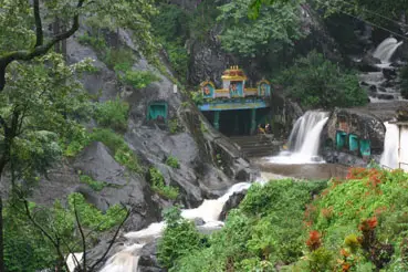
  • Kalhattigiri Falls — A waterfall at the foot of the Chandra Drona (Baba Budan) hills near Kemmanagundi, where the stream drops past a Veerabhadra temple set into the rock; fullest in and just after the monsoon.
  • Amrutesvara Temple, Amruthapura — A Hoysala temple of 1196 CE to Amrutesvara (Shiva) at Amruthapura in Tarikere taluk, on a star-shaped plan with a fine tower, a long inscribed hall and detailed friezes — a quieter cousin of Belur and Halebidu.
Getting there

How to visit

  • Nearest airport: Mangaluru (IXE) at about 211 km by road, roughly three hours; Bengaluru (BLR) is about 260 km and the one with the international network. Neither is close, and there is no airstrip anywhere near.
  • Rail gateway: Tarikere, roughly 30 km down the hill, is the nearest station, with Birur and Kadur the larger junctions beyond it. Trains and hill are two different journeys: the train gets you to Tarikere, and the last 30 km is a bus or a taxi up the ghat.
  • Buses run up from Tarikere and Chikkamagaluru, and there is a long-standing private service from Lingadahalli. Hill services are thin and the last bus down goes in the afternoon, so anyone without a car should check the return before committing to a day trip. Fill the tank in Tarikere — there is no fuel on the hill.

Distance by road

  • Chikkamagaluru61 km
  • Shivamogga71 km
  • Hassan117 km
  • Davanagere148 km
  • Udupi202 km
  • Mangaluru211 km
  • Mysuru242 km
  • Bengaluru251 km

Road distances measured on real routed roads to Kemmanagundi itself, not to the district headquarters, on 24 August 2026. Driving time is deliberately not published: free-flow routing badly understates a Deccan single-carriageway highway, so allow more than the distance suggests.

Timing

Best time to visit Kemmanagundi

October to February. The rain has finished, the ridges are still green, the views are actually there, and nights are cold enough to want a fleece — this is 1,434 m. March to May is warm by hill standards and hazy, and the falls are thinning. June to September is the south-west monsoon and Kemmanagundi takes it hard: spectacular, empty, and largely inside cloud, with the hill road slow and the Hebbe jeeps sometimes unable to get down at all. The compromise most people want is October to December, when Hebbe still has water and the viewpoints are clear.

Weather in KemmanagundiSeasonal guide

Live forecast loads in your browser.

Today at Kemmanagundi
Sunrise6:16 am
Sunset6:38 pm
Golden hour best light5:38 pm–6:38 pm
Blue hour after sunset6:38 pm–7:03 pm
Sun sets toward compass bearingW · 278°
Moon tonight🌖 Waning gibbous · 64%
South-west monsoon. June to September is the south-west monsoon in Karnataka. Expect heavy showers, mostly in bursts rather than all day — carry rain cover, allow extra time for getting around, and note that ferries and open-air sites are the first things affected.

Sun and moon are calculated for this location and shown in IST. Photography windows are the hour around sunrise and sunset; the sunset bearing is degrees clockwise from true north. Moon phase is accurate to about half a day.

The story

The story of Kemmanagundi

A king’s summer camp on a red-soil ridge at 1,434 m, given away to the state and run ever since by the Horticulture Department — which is why the prettiest hill station in Chikkamagaluru district feels less like a resort than like a very well-kept public garden with a guest house in it.

The name is the plainest thing about the place: kempu, red; mannu, soil; gundi, pit. Red soil pit. It describes the iron-rich laterite of the Baba Budan range, and anyone who has walked the Z Point path in the rain and looked at their shoes will not need it explained.

What made it a hill station was one man’s summer. Krishnaraja Wodeyar IV, the Maharaja of Mysore from 1902 to 1940, took this ridge as his hot-weather retreat, and the second name Kemmanagundi still carries — Sri Krishnarajendra Hill Station — is the mark of respect for it. He then gave the place to the Government of Karnataka, and the Horticultural Department has developed and maintained the resort and its surroundings ever since.

That single administrative fact governs the whole experience, and it is the thing visitors most often fail to anticipate. Kemmanagundi was never developed commercially. There is no bazaar, no promenade of hotels, no line of restaurants; there are terraced flower beds, a rock garden, a guest house called Raj Bhavan inside the park, and a government resort. When the state handed the guest houses and the restaurant to Jungle Lodges and Resorts on 1 March 2021, that was a transfer between two arms of the same government, not the arrival of the private sector.

The geography is the second thing. The station sits at 1,434 m with its peak at 1,863 m, on the Chandra Drona or Baba Budan range — the same range that carries Mullayanagiri, at about 1,930 m the highest point in Karnataka, and the Baba Budan cave shrine after which coffee in India is traditionally said to have begun. Kemmanagundi is on the northern shoulder of all that, which is why the view from Z Point is of ridge behind ridge rather than of a single valley.

And it is wet. The climate here is sub-tropical highland: three seasons, a December mean around 17 °C, an April mean around 22 °C, and July alone bringing an average of 591 mm of rain. February is the driest month. Four months of the year the hill is inside cloud, the road is slow and the viewpoints show you nothing at all — which is the single most useful thing to know before booking.

The walks are what people come back for. Z Point is a steep forty-five minutes up from Raj Bhavan with Shanthi Falls on the way, and it is where everyone staying on the hill is sent for sunset. Hebbe Falls is the opposite direction and the opposite kind of trip: about 8 km down inside the Kodays coffee estate, where a Bhadra headstream drops roughly 168 m in two stages, Dodda Hebbe and Chikka Hebbe. You do not drive to it; the estate track takes shared four-wheel-drive jeeps and then about a kilometre on foot through the stream.

About 10 km off at Kallathipura the Kallathi falls come over the cliff past a Veerabhadra temple built into the rock, attributed to Vijayanagara times, with local tradition tying the site to the sage Agastya. There is a second Horticulture Department guest house down there, which tells you how long people have been coming.

The last thing worth saying is what Kemmanagundi is the base for. The north of Chikkamagaluru district — Tarikere, the Bhadra reservoir at Lakkavalli, and the Hoysala temple of 1196 at Amruthapura 37.7 km down the hill — is the part of the district visitors skip entirely on their way to the coffee estates. From up here it is a morning.

More about Kemmanagundi

History

Early twentieth century — Krishnaraja Wodeyar IV, Maharaja of Mysore 1902–1940, takes the ridge as his summer retreat. The hill station takes his name in the form Sri Krishnarajendra Hill Station.

The Maharaja donates the resort to the Government of Karnataka. The Horticultural Department of Karnataka takes over its development and upkeep, lays out the Krishnarajendra botanical park and the Rock Garden, and runs the Raj Bhavan guest house inside the park — the arrangement that still governs the hill.

A second Horticulture Department guest house is established at Kallathi village, beside the Kallathi falls and the rock-cut Veerabhadra temple attributed to Vijayanagara times.

1 March 2021 — by government order, Jungle Lodges and Resorts Ltd, a Karnataka government company, takes over the operation and management of the guest houses and the restaurant at Kemmanagundi. The rooms are grouped into named blocks and cottages — Virupaksha, Budangiri, Narayana Kuteera and Kallathi — and sold as packages including meals, a guided Z Point trek and the jeep trip to Hebbe Falls.

⚠ The published road distances to Kemmanagundi disagree and we print both. Wikipedia gives 53 km from Chikkamagaluru, 17 km from Lingadahalli, 71 km from Shivamogga and 212 km from Mangaluru; Wikivoyage gives Tarikere 30 km and Chikkamagaluru 55 km; routed on real roads on 25 August 2026 from the hill station itself we measure 61 km to Chikkamagaluru, 71 km to Shivamogga and 211 km to Mangaluru. The Shivamogga and Mangaluru figures agree closely, which is a good sign; the Chikkamagaluru spread is a route-choice difference over the hill.

Why visit

For two walks that are genuinely worth the drive: forty-five steep minutes up to Z Point for the ridges at sunset, and the jeep-and-wade descent to Hebbe Falls. Everything else on this hill is scenery you look at; these are things you do.

For a hill station that was never commercialised. No bazaar, no strip of hotels, no boat rides — a government flower garden on a terraced hillside with the valley beyond the wall, which is a rarer thing in south India every year.

For the emptiness on a weekday. Kemmanagundi is small enough that a Tuesday in November can feel like having the range to yourself, which is not an experience Ooty or Madikeri can offer at any price.

And as the base for the part of Chikkamagaluru district nobody visits — the Hoysala temple at Amruthapura, the Bhadra reservoir at Lakkavalli, and Tarikere on the plain below.

Before you go

Kemmanagundi — at a glance

HoursThe gardens keep daylight hours and the hill itself never closes, but the practical clock here is the last bus and the sunset. Public transport up and down is thin and the last service down leaves in the afternoon, so a day trip without a car has to be planned backwards from that. The Z Point path is unlit and loose underfoot; whatever the gardens say, start that walk with real daylight in hand.

Entry: There is no charge to be in Kemmanagundi. The Horticulture Department gardens — the Krishnarajendra flower park and the Rock Garden — have historically taken a small entry charge at the gate, and we deliberately print no figure, because a stale rupee amount is worse than none. The Z Point walk and the roads are free. Hebbe Falls is the one that costs: the shared four-wheel-drive jeep down through the coffee estate is a paid ride arranged on the hill, and there may be an estate or forest charge on top. Settle all of it before you get in the jeep.

Parking: Free and informal — you leave the vehicle by the gardens or at Raj Bhavan, and on a weekday there is nothing to it. Weekends and the October-to-February season are different, and the space by the gardens fills. There is no fuel on the hill and no ATM: fill up and draw cash in Tarikere on the way, which is also the last dependable place for either if you are going on to Amruthapura or the Bhadra reservoir afterwards.

Getting here

How to reach Kemmanagundi

On the Baba Budan (Chandra Drona) range in Tarikere taluk, Chikkamagaluru district, at about 1,434 m. Tarikere and its railway station are roughly 30 km down the hill, Chikkamagaluru 61 km by road and Shivamogga 71 km. Everything arrives by road, and the last stretch climbs.

Getting around

Getting around Kemmanagundi

The gardens, the Rock Garden and Raj Bhavan are all within a few hundred metres of each other and you walk between them. Z Point is a footpath and nothing drives up it. Hebbe Falls is the exception and the one thing you cannot do on your own: the estate track is not for ordinary cars, and the accepted way is a shared four-wheel-drive jeep arranged on the hill, followed by about a kilometre on foot with stream crossings. If you have come without a car, arrange the jeep and your way back down to Tarikere at the same time — sorting one and not the other is how people end up stuck.

  • 🚕︎ Online taxis Nothing works up here. Neither Uber nor Ola has a presence in Tarikere taluk, and there is no driver idling at the top of a hill road for a return fare. A booking may connect in Shivamogga, Chikkamagaluru or Bengaluru for the journey in; it will not get you out. The dependable arrangements are three: your own vehicle, a car and driver hired for the trip from Chikkamagaluru or Shivamogga, or the bus up from Tarikere with the return leg checked before you travel.
Getting back

Work out your return before you settle into the day. Services in Karnataka thin out sharply in the evening, and Kemmanagundi is easier to reach than to leave once the last long-distance bus has gone. We do not publish departure times: there is no official live feed we are permitted to republish, and a wrong time here would strand you. Check the operator directly on the day.

Ask at the bus stand for the time of the last service back, not the next one. If you miss it, an auto or a taxi is the fallback — agree the fare before you get in.

Do

Things to do in Kemmanagundi

  • Walk the Krishnarajendra botanical park — terraced beds on the hillside, roses in quantity, level paths and benches, with the valley beyond the wall. This is the Wodeyar hill station as it was left to the state.
  • Take the Rock Garden a few hundred metres east for the sunset if you are not walking up to Z Point. It faces west, the paths are cut through the rock, and half an hour covers it.
  • Climb to Z Point from Raj Bhavan — forty-five minutes, steep, no vehicles — for the western face of the range falling away in ridges. Start with daylight in hand.
  • Stop at Shanthi Falls on the way up. It is on the Z Point path rather than a place you drive to, which is why day visitors miss it.
  • Go down to Hebbe Falls by jeep and on foot: about 168 m in two stages, Dodda Hebbe and Chikka Hebbe, inside a working coffee estate. Best June to December; a trickle by March.
  • Drive the 10 km to Kallathipura for the Kalhattigiri falls and the Veerabhadra temple cut into the rock beneath them, attributed to Vijayanagara times.
  • Go down the hill for the day to the Hoysala temple at Amruthapura, 37.7 km, or the Bhadra reservoir at Lakkavalli — the part of this district almost nobody sees.
Plan

Good to know

  • Come between October and February. Outside that window you are looking at either haze or cloud, and the whole point of this hill is being able to see off it.
  • Book before you drive up. There is essentially one resort and one guest house at the top; turning up hopefully on a season weekend does not work.
  • Fill the tank and draw cash in Tarikere. No fuel, no ATM on the hill, and nothing useful on the 30 km of road between.
  • Carry water and food for the walks. There is nothing at Z Point and nothing at Hebbe Falls — the only regular kitchen on the hill is the resort restaurant.
  • Start the Z Point walk early enough to come down in daylight. The path is loose and unlit, and this is the one way people actually get hurt here.
  • Ask about the Hebbe jeeps before you plan a morning around them. In heavy rain they sometimes cannot get down the estate track.
  • Bring a warm layer. It is 1,434 m and November to February nights are properly cold, which surprises people who drove up from the coast.
  • Check the last bus down before you commit to a day trip without a car. It goes in the afternoon, and there is no app cab to fall back on.
  • Drive the hill road in daylight. It is narrow in places and wet for four months of the year.
Facilities

On site

  • The Horticulture Department gardens — the Krishnarajendra flower park and the Rock Garden — with level paths and benches.
  • Kemmannugundi Hill Resort, run by Jungle Lodges and Resorts since 1 March 2021, with the only regular restaurant on the hill.
  • Raj Bhavan, the Horticulture Department guest house inside the gardens, booked through the department rather than a website.
  • A second Horticulture Department guest house down at Kallathi village by the falls.
  • Homestays on the approach road below the hill station.
  • Shared four-wheel-drive jeeps to Hebbe Falls, arranged on the hill.
  • Tea and coffee stalls. No bazaar, no shops of any size, no ATM, no fuel.
  • Tarikere, roughly 30 km down, for fuel, banks and ATMs, pharmacies, the bus stand, the railway station and the nearest hospital.
Stay safe

Safety

  • The Z Point path is the real hazard: steep, loose underfoot and unlit, and people come down it in the dark after staying too long for the sunset. Turn round with light in hand.
  • Do not climb the rocks beside Hebbe Falls. Wet basalt with a hundred and sixty metres of water landing on it is exactly as bad as it sounds, and this is a remote spot.
  • Leeches through the monsoon on the paths and in the coffee estate — harmless, unpleasant, and best dealt with by covering your ankles.
  • The stream crossings on the walk in to Hebbe rise fast in heavy rain. If the jeep drivers say no, the answer is no.
  • Mobile coverage is patchy on the hill and thins further on the road down. Do not count on calling for help between here and Tarikere.
  • The nearest medical help of any substance is Tarikere, roughly 30 km and the better part of an hour down a ghat road; anything serious goes on to Bhadravathi or Shivamogga.
  • The hill road is narrow and wet for four months of the year. Drive it in daylight and do not overtake on the bends.
Getting around KemmanagundiPartly wheelchair accessible
From the entrance
Two different places in one. The Horticulture Department gardens around Raj Bhavan are terraced but laid out with made paths and benches, and the level parts of them are the easiest ground on the hill. Everything else is not: Z Point is a steep, loose, unmade footpath of about forty-five minutes with no vehicle access at all, the Rock Garden runs through cuttings in the rock, and Hebbe Falls needs a four-wheel-drive jeep down an estate track and then about a kilometre on foot with stream crossings.
Step-free access
The made paths in the Krishnarajendra park are usable and the view over the wall is the same view everyone comes for, so the gardens are worth the trip. Beyond them nothing is: Z Point, Shanthi Falls, the Rock Garden cuttings and Hebbe Falls all involve unmade, steep or wet ground with no handrails. We have not assessed any individual building, and there is nobody on the hill to arrange assistance.
Prams
Fine on the made paths in the gardens. Not on the Z Point path, the Rock Garden cuttings or anywhere near Hebbe Falls.
  • The Z Point path is steep, loose and unlit, and the commonest injury here is coming down it in the dark after staying for the sunset.
  • Leeches on the paths and in the coffee estate through the monsoon, and stone and rock slippery for four months of the year.
  • No fuel, no ATM and no hospital on the hill; the nearest of each is Tarikere, roughly 30 km down a ghat road.

Checked 25 August 2026 against source 1source 2source 3source 4. Conditions change and surfaces vary with weather — if step-free access is essential, confirm with the site before you travel.

If you need help at Kemmanagundi
112All emergencies (police · fire · medical)The single number to call in any emergency (ERSS).

Emergency numbers are verified against official government and state tourism sources. 112 works anywhere in India.

In the district

Where Kemmanagundi sits in Chikkamagaluru district

Nearest airportMangaluru (IXE) at about 211 km by road, roughly three hours; Bengaluru (BLR) is about 260 km and the one with the international network. Neither is close, and there is no airstrip anywhere near.
Rail gatewayTarikere, roughly 30 km down the hill, is the nearest station, with Birur and Kadur the larger junctions beyond it. Trains and hill are two different journeys: the train gets you to Tarikere, and the last 30 km is a bus or a taxi up the ghat.
Bus / road accessBy road via Hassan and Kadur (~245 km, 5–6 hours from Bengaluru); KSRTC and private buses, with a taxi or own vehicle best for the ghat and estate routes.
District HQChikkamagaluru
LandscapeWestern Ghats coffee highland in south-central Karnataka, ~1,090 m at the town; includes Mullayanagiri (~1,930 m), the highest peak in the state

Chikkamagaluru district is known for: The birthplace of Indian coffee and a Western Ghats highland — Mullayanagiri and the Baba Budan range, the Kemmanagundi hill station, the Sringeri Sharada Peetham and the Kudremukh range.

MullayanagiriBaba BudangiriSharadamba Temple, Sringeri
Stay · eat · do · rent · see · shop

Places in Kemmanagundi

Every verified place in Kemmanagundi — filter by what you’re after.

Hebbe Falls — Waterfall
Top pick
Waterfall
Hebbe Falls

A tiered waterfall on a Bhadra headstream that drops about 168 metres in two stages, the upper Dodda Hebbe and the lower Chikka Hebbe. It stands in the middle of a working coffee estate roughly 8 km below Raj Bhavan, and the last stretch is not driveable in an ordinary car: the accepted way in is a shared four-wheel-drive jeep from Kemmanagundi followed by a walk of about a kilometre, with stream crossings. Full and loud from June to about December; a trickle by March.

DirectionsView details
K
Kemmannugundi Hill Resort
Place to stay
Top pick
Resort
Kemmannugundi Hill Resort

The Karnataka government's own accommodation on the hill, run by Jungle Lodges and Resorts, which took over the guest houses and the restaurant here on 1 March 2021 by government order. Rooms are spread across named blocks and cottages — Virupaksha, Budangiri, Narayana Kuteera and Kallathi — and packages include meals, a guided Z Point trek and the jeep trip down to Hebbe Falls. Book direct through the numbers below rather than an agent; this is the only sizeable place to sleep at the top of Kemmanagundi.

Directions Commission-freeView details
K
Krishnarajendra Botanical Park
Nature
Top pick
Garden
Krishnarajendra Botanical Park

The terraced flower garden that is the centre of Kemmanagundi, laid out on the hillside and maintained by the Horticulture Department of Karnataka, with roses grown in quantity. The hill station was Krishnaraja Wodeyar IV's summer retreat and he gave it to the state; the gardens and the Raj Bhavan guest house inside them are what he left behind. Level walking, benches, and the view straight out over the valley — the part of Kemmanagundi that suits people who are not going to walk up to Z Point.

DirectionsView details
Z
Z Point
Sight
Top pick
Viewpoint
Z Point

The vantage point above Kemmanagundi, reached by a steep uphill walk of about forty-five minutes from Raj Bhavan — no vehicle goes up, and Shanthi Falls is passed on the way. The reward is the open western face of the Baba Budan range falling away in ridges, and it is the sunset walk everyone staying on the hill is sent on. Start it with daylight in hand: coming down the same path in the dark, on loose ground, is how people get hurt here.

DirectionsView details
R
Raj Bhavan (Horticulture Department Guest House)
Place to stay
Top pick
Guest house
Raj Bhavan (Horticulture Department Guest House)

The state Horticulture Department's guest house, standing inside the Krishnarajendra botanical park and still called Raj Bhavan after the Mysore king whose summer retreat this was. It is the landmark everything on the hill is measured from — the Z Point path and the Hebbe Falls jeeps both start here — and it takes visitors in a plain, government-run way rather than as a resort. Rooms go through the Horticulture Department, not through a booking site, so enquire ahead; turning up unannounced in season is optimistic.

Directions Commission-freeView details
K
Kalhatti Veerabhadreshwara Temple
Sight
Temple
Kalhatti Veerabhadreshwara Temple

The Veerabhadra temple built into the rock at Kallathi, about 10 km from Kemmanagundi, where the stream comes over the cliff above and falls past the shrine. The temple is attributed to Vijayanagara times, and local tradition ties the place to the sage Agastya. It is a living temple rather than a monument, so footwear comes off and the rock underfoot is wet and slick most of the year. The waterfall itself has its own page on this site.

DirectionsView details
T
The Last Resort, Kemmanagundi
Place to stay
Homestay
The Last Resort, Kemmanagundi

A homestay of independent cottages on Glendale Farms at Ballavara, on the Kemmanagundi road below the hill station, taking guests since 2010. It sits in its own grounds with a swimming pool, a campfire and walks out through the plantation, and it books direct on its own site and phone rather than through a platform. Being partway up the hill it works as a base for both Kemmanagundi and the Baba Budan range, and it is a different proposition from the government rooms at the top.

Directions Commission-freeView details
R
Rock Garden
Nature
Garden
Rock Garden

A garden of paths cut through the rock a few hundred metres east of the main flower park, planted along the cuttings and also kept by the Karnataka Horticulture Department. It faces west and it is where people gather for the sunset if they do not want the climb to Z Point. Small — half an hour covers it — and best combined with the botanical park next door rather than made a trip of its own.

DirectionsView details
K
Kemmannugundi Hill Resort Restaurant
Where to eat
Restaurant
Kemmannugundi Hill Resort Restaurant

The restaurant attached to the government hill resort, and effectively the only regular kitchen at the top of Kemmanagundi — everything else on the hill is a tea stall. Jungle Lodges has run it along with the guest houses since March 2021, and meals are built into the resort packages. If you are not staying, ring ahead or ask at the reception rather than assuming you can walk in, and if you are heading out to Hebbe Falls or Z Point for the day, carry water and something to eat, because there is nothing at either end.

Directions Commission-freeView details
S
Shanthi Falls
Sight
Waterfall
Shanthi Falls

A small waterfall on the footpath between Raj Bhavan and Z Point, about a kilometre up from the gardens — water coming off the hill above and dropping into the valley beside the trail. Nobody drives to it; you meet it because you are walking to the viewpoint, which is why it is often missed by visitors who only do the gardens. Modest for most of the year and worth the detour after rain.

DirectionsView details
K
Kallathi Horticulture Department Guest House
Place to stay
Guest house
Kallathi Horticulture Department Guest House

A second Horticulture Department guest house, this one down at Kallathi village beside the Kallathigiri falls and the rock-cut Veerabhadra temple, about 10 km from the Kemmanagundi gardens. It is basic government accommodation rather than a hotel and it exists mainly because the falls draw people, but it is a genuine option if the rooms at the top of the hill are full. Enquire through the Horticulture Department; there is no booking site.

Directions Commission-freeView details

Book with the place itself. India’s cyber-crime coordination centre warned in April 2025 that convincing copies of hotel and pilgrimage booking sites are being pushed through sponsored search and social ads, taking payment for rooms the property never hears about. Every listing here links to the business’s own contact details and its own Google or Bing profile — we take no commission and sit in nobody’s payment path. If a booking page reached you through an ad, check the address bar against the property’s own site before you pay. Fraud can be reported on cybercrime.gov.in or on 1930.

For hotels, homestays and local businesses

Get listed in Kemmanagundi for free

Roampedia is commission-free. Travellers discover your business, book directly and contact you through official details. Basic listings are free, while Gold and Platinum package upgrades can be requested from the owner dashboard after approval.

List your business — free
Read before you go

Kemmanagundi guides, stories & itineraries

Stories & history of Kemmanagundi

Written about Kemmanagundi itself — its history, its legends and the arguments about them.

Nearby in Chikkamagaluru

Wider reading from Chikkamagaluru. The stories about Kemmanagundi itself are above.

Planning a trip to Kemmanagundi

The practical half — what is actually here, in what order to see it, and how to arrive.

Karnataka-wide guides & itineraries

Route-level itineraries and practical guides for the rest of the state.

See all 13 Chikkamagaluru guides & stories →

Map

Where things are in Kemmanagundi

FAQ

Kemmanagundi travel FAQs

How do you get to Kemmanagundi?

By road, and the last stretch climbs. Routed on real roads on 25 August 2026: 61 km from Chikkamagaluru, 71 km from Shivamogga, 117 km from Hassan, 211 km from Mangaluru and 251 km from Bengaluru. The nearest railway station is Tarikere, roughly 30 km down the hill, with Birur and Kadur the larger junctions beyond. Buses run up from Tarikere and Chikkamagaluru and there is a long-standing private service from Lingadahalli, but hill services are thin and the last one down goes in the afternoon.

Where do you stay at Kemmanagundi?

At the top, the choice is essentially governmental: the Kemmannugundi Hill Resort, run by Jungle Lodges and Resorts since 1 March 2021, and Raj Bhavan, the Horticulture Department guest house inside the gardens, which is booked through the department rather than a website. Below the hill on the approach road there are homestays in their own grounds. It is a small place — book ahead in season rather than driving up hopefully.

What is there to eat?

The resort restaurant, and tea and coffee at stalls. There is no bazaar and no line of eating houses. If you are walking up to Z Point or going down to Hebbe Falls, carry water and something to eat, because there is nothing at either end.

When is the best time to visit?

October to February. The rain has stopped, the ridges are clear and the falls still have water into December. The south-west monsoon from June to September is heavy here — July alone averages 591 mm — and while it is spectacular, the hill spends much of it inside cloud and the Hebbe jeeps sometimes cannot get down. November to February nights are cold at 1,434 m; bring a layer.

Can you drive to Hebbe Falls?

Not in an ordinary car. The falls are about 8 km below Raj Bhavan inside a working coffee estate, and the estate track is not a road. The accepted way is a shared four-wheel-drive jeep arranged on the hill, then about a kilometre on foot with stream crossings.

Why is it called Kemmanagundi?

From three Kannada words — kempu (red), mannu (soil) and gundi (pit) — for the iron-rich red soil of the range. It is also called Sri Krishnarajendra Hill Station after Krishnaraja Wodeyar IV, who made it his summer retreat and later gave it to the Government of Karnataka.

How long do you need?

One night for most people: the gardens and the Rock Garden in the afternoon, Z Point for sunset, Hebbe Falls the next morning. Two if you also want Kallathi and the Hoysala temple at Amruthapura down on the plain. A day trip from Chikkamagaluru is possible at 61 km but wastes the drive — you arrive in the flat midday light, which is when the ridges look like nothing.

What are the best places to visit in Kemmanagundi?

Top places to visit in Kemmanagundi include Kalhattigiri Falls, Amrutesvara Temple, Amruthapura — each has a full guide with how to reach it and what to see nearby on this page.

Photographs: Arunkm44, CC BY-SA 4.0, via Wikimedia Commons (CC BY-SA 4.0), Bdeepu at English Wikipedia (CC BY-SA 3.0), Dinesh Valke from Thane, India (CC BY-SA 2.0), Yathin S Krishnappa (CC BY-SA 3.0), Vijay Sawant from Bangalore, India (CC BY 2.0). Wikimedia Commons.

Image credits