What to expect
Highlights
- The tiered ruined gateways.
- The herb-rich hill slopes.
- The quiet hilltop views.
Channarayana Durga is a 17th-century hill fort built by Chennappa Gowda about 10 km from Madhugiri, at some 1,130 m.

It has ruined tiered gateways and herb-rich slopes — a rewarding, quieter trek than Madhugiri.
Road km to Tumakuru; ghat roads and traffic vary — allow extra.
October to February; early morning.
Live forecast loads in your browser.
Sunset is in about 48 minutes.
Sun and moon are calculated for this location and shown in IST. Photography windows are the hour around sunrise and sunset; the sunset bearing is degrees clockwise from true north. Moon phase is accurate to about half a day.
Verified hotels, homestays, restaurants, experiences, sights, shops and rentals around Channarayana Durga — commission-free, with direct contact. Filter by what you need.
Verified places are being added. The category filters will fill in as approved stays, restaurants, experiences, sights, shops and nature listings go live.
List your place3 more places around Madhugiri. Open a guide to plan the visit and onward journey.

6.7 km · ~17 min by auto
A fort climbing one of Asia’s largest monolithic granite hills at Madhugiri, ~45 km north-east of Tumakuru, with multi-tier gateways, cisterns and a Gopalakrishna temple ruin near the top — the district’s signature trek, ASI-protected.
26.5 km · ~44 min by cab
A ruined hill fort about 22 km north of Madhugiri with a summit Hanuman shrine and old fortifications — a lesser-known trek of the northern Tumakuru country.

20.1 km · ~34 min by cab
The state’s protected blackbuck grassland at Maidenahalli in Madhugiri taluk, on the Tumakuru–Andhra frontier, home to a large blackbuck herd along with wolves, foxes and grassland birds.
Roampedia is commission-free — own or know a stay, eatery, guide or shop near Channarayana Durga? List it and it appears here once verified.
Add a nearby businessEntry: Free
About 10 km from Madhugiri; by road to the base, then a climb
If you are travelling by bus or ferry, check the return service with the operator before setting out. Leave time to reach the stop or jetty after your visit.
Ask at the bus stand for the time of the last service back, not the next one. If you miss it, an auto or app cab is the fallback — agree the fare before you get in.
If you need step-free access, contact the site before travelling. Ask about a level entrance, steps along the route, the nearest drop-off point, seating and accessible toilets.
Emergency numbers are verified against official government and state tourism sources. 112 works anywhere in India.
A fort climbing one of Asia’s largest monolithic granite hills at Madhugiri, ~45 km north-east of Tumakuru, with multi-tier gateways, cisterns and a Gopalakrishna temple ruin near the top — the district’s signature trek, ASI-protected.
6.7 km · ~17 min by auto · straight lineA popular Mahalakshmi pilgrimage temple at Goravanahalli in Koratagere taluk, ~30 km north-east of Tumakuru, revered for its self-manifested idol and busiest at its Friday poojas.
15.9 km · ~26 min by cab · straight lineThe state’s protected blackbuck grassland at Maidenahalli in Madhugiri taluk, on the Tumakuru–Andhra frontier, home to a large blackbuck herd along with wolves, foxes and grassland birds.
20.1 km · ~34 min by cab · straight line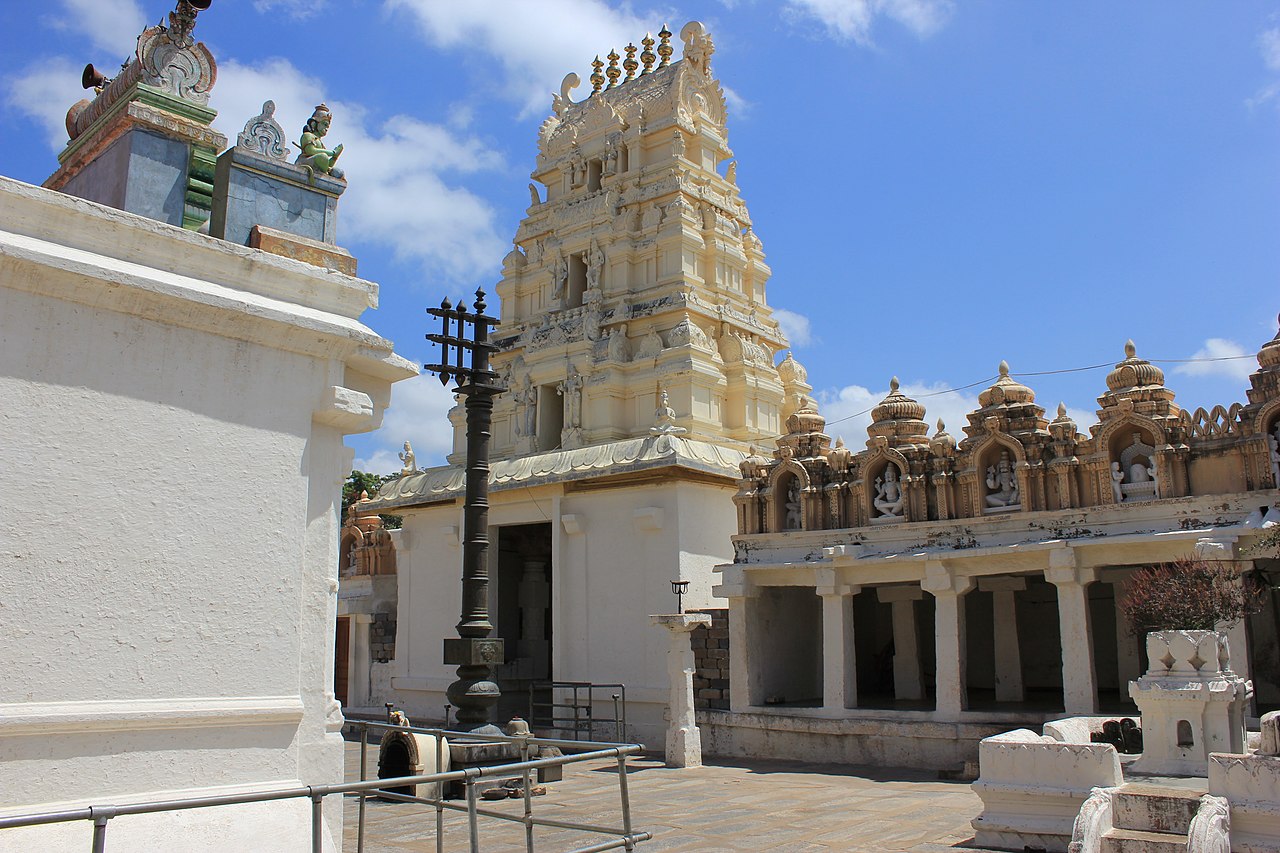
A Lakshminarasimha temple at Seebi on the Tumakuru–Sira road, celebrated for its 18th-century painted ceilings and terracotta and stucco work — one of the district’s most colourful temple interiors.
23.6 km · ~39 min by cab · straight line
A forested granite hill about 16 km east of Tumakuru with the twin Yoganarasimha (base) and Bhoganarasimha (summit) temples built and renovated by the Mysore Wodeyars, plus a Sanjeevaraya (Hanuman) shrine — the district’s signature hill-temple climb.
24.1 km · ~40 min by cab · straight line
A perennial rock spring in the Devarayanadurga foothills, said in legend never to dry (Rama’s arrow), with an adjoining deer park and nursery — nearly always paired with the Devarayanadurga hill temples.
25.4 km · ~42 min by cab · straight lineA ruined hill fort about 22 km north of Madhugiri with a summit Hanuman shrine and old fortifications — a lesser-known trek of the northern Tumakuru country.
26.5 km · ~44 min by cab · straight lineThe Veerashaiva monastery near Kyatsandra of the late Shivakumara Swami — the "walking god" — with a Siddhalingeshwara shrine on the rock and a vast free residential school; one of Karnataka’s most revered living maths.
30.7 km · ~51 min by cab · straight line
A rocky hill on the Tumakuru–Gubbi border, also called Basadi Betta, topped by old Jain basadis and the modern Sri 1008 Chandraprabha Digambar Jain complex, reached by a long stone stairway with wide plateau views.
33.0 km · ~55 min by cab · straight line
A Hoysala temple about 10 km south of Tumakuru at Kaidala, the village of the legendary sculptor Amarashilpi Jakanachari, holding a fine Chennakeshava (Kesava) image; the Someshwara and Kodirameshwara shrines stand nearby. (Distinct from the Chennakeshava temples of Belur and Somanathapura.)
35.6 km · ~59 min by cab · straight line
The four-sided fort of Sira, founded by Rangappa Nayaka and later a Bijapur–Mughal Deccan provincial capital, with the ASI-protected 17th-century Jama Masjid and the nearby Malik Rihan tomb complex — a Deccan-Islamic heritage cluster ~54 km north-west of Tumakuru.
36.4 km · ~61 min by cab · straight lineThe Chennabasaveshwara math-temple of the historic trading town of Gubbi on NH-206 west of Tumakuru, with the nearby Gadde Malleshwara shrine — an anchor of the town’s Veerashaiva heritage.
42.8 km · ~71 min by cab · straight lineOctober to February; early morning.
Entry: Free. Timings: Daylight hours only.
About 10 km from Madhugiri; by road to the base, then a climb. An unguarded hill fort — wear good shoes, carry water and start early; mind the loose stone.
Half a day with the trek.
Nearby you can pair Madhugiri Fort (6.7 km), Goravanahalli Mahalakshmi Temple (15.9 km), Jayamangali Blackbuck Reserve (20.1 km), Seebi Narasimha Temple (23.6 km).
Photographs: Prasree8531, CC BY-SA 4.0, via Wikimedia Commons (CC BY-SA 4.0). Wikimedia Commons.