Anayirankal’s lake fills much of the visitor’s view, but its engineering purpose extends beyond the shoreline. KSEB’s emergency action plan identifies it as an upstream augmentation reservoir for the Ponmudi reservoir and Panniyar hydroelectric system. The dam stores water within a connected system rather than generating electricity through a power station at every scenic lakeside stop.
Storage before generation
The project was commissioned in 1965. Its relationship with Ponmudi matters because a reservoir and a generating station do different jobs. Water held higher in the system can support the downstream arrangement; the generating machinery need not stand beside the dam that appears in a holiday photograph.
KSEB describes a low-level outlet through which stored water is released downstream. The outlet is part of the operational system, with its own engineering purpose. It should not be confused with the spillway, which serves a different function in handling water at the dam.
This distinction is useful when reading the landscape. The broad water surface is storage. The long structure closing the valley is the dam. Channels and outlets belong to controlled water movement. Together they explain more than a general claim that the lake is used for electricity.
Reading the embankment
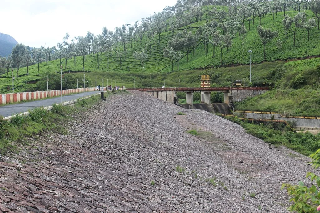
Anayirankal is an earth-and-rockfill dam, with a masonry spillway identified as ungated in KSEB’s asset description. In the photograph, a broad stone-covered slope descends beside the crest road, while a separate concrete-lined channel occupies the adjoining ground. The scene looks quite different from the tall curved face associated with Idukki Arch Dam.
The visible stone covering is part of the embankment’s constructed surface. It is not a hillside of loose stones inviting exploration. A crest, outlet building or channel may be easy to recognise from a photograph while remaining subject to operational restrictions during an actual visit.
The distinction between dam types also keeps the wider Idukki story accurate. Anayirankal belongs to the Panniyar arrangement described by KSEB. It should not be casually inserted into the three-dam Idukki reservoir system simply because all these assets lie in the same district.
A visitor’s view of working infrastructure
Look for the relationship between the water, the embankment and the surrounding slopes from the area the operator permits. The tea-covered hill behind the structure gives a sense of scale: this is infrastructure fitted into a cultivated mountain landscape.
A photograph showing people on the crest records a particular moment. It cannot establish that the same route is open today. Use the dam’s visitor information for current access, and keep the separate tourism centre’s availability distinct from the continuing operation of the hydel asset.
Anayirankal becomes more interesting when the water is understood as part of a working sequence. The reservoir view remains scenic, but it also points downstream to storage management and power generation beyond the frame.
Plan the visit: Anayirankal Dam.