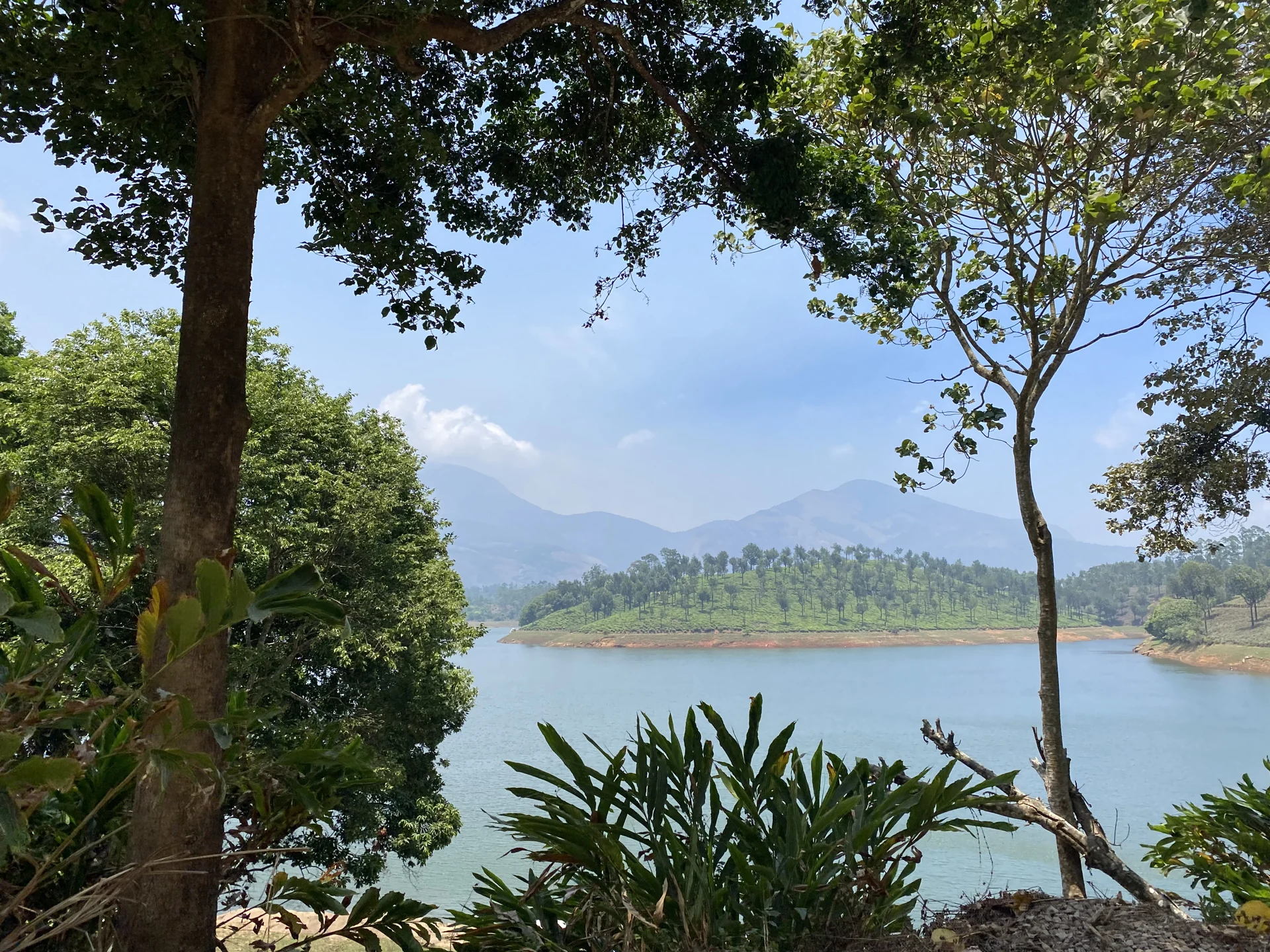
At Anayirankal, the meeting of cultivated slopes and stored water creates the scene. Tea follows the shape of the hills, taller trees rise above it, and projecting land divides the reservoir into separate arms. The mountain skyline sits farther away, beyond the immediate pattern of planting and shore.
Three distances in one view
Start with the nearest layer. A shaded lakeside position may frame the water between trunks and leaves, as in the photograph heading this story. Those foreground plants give the view depth; they also remind us that a lake panorama is made from a particular place on its edge.
Across the water, the planted hill has a more regular texture. Lines and patches in the tea surface differ from the irregular crowns of taller trees. Looking at that contrast is more rewarding than treating every green part of the scene as the same vegetation.
The distant mountains form a third layer. Haze can soften their outlines while the nearer tea remains sharply visible. A bright day and an overcast day therefore reveal different parts of the landscape, even when the observer stands in the same permitted area.
A shoreline that belongs to a reservoir
The exposed strip between water and vegetation is especially worth noticing. In photographs taken at different times, its width and colour can vary. Anayirankal is managed storage, so the edge should not be imagined as a permanent line defining a beach or walking path.
A broad exposed bank also says little about safe access. Soft ground, changing levels and the lack of a permitted path can make the water’s edge unsuitable for a closer look. Read the shoreline from the visitor area rather than using a photograph to invent a route down to it.
Projecting tea-covered slopes help reveal the reservoir’s shape. What looks like a separate island in a tightly framed picture may be connected to land outside the frame. A wider view can clarify that relationship without requiring a definitive label for every small landform.
Cultivation and the larger outing
The plantation setting continues beyond the dam stop. Roads through the high ranges connect settlements, estates and accommodation, and a lake visit can fit into that journey. An estate road visible across the reservoir still belongs to its own access arrangement; the panorama does not include a plantation tour.
For photography, allow the weather to decide which layer deserves attention. Clear conditions may favour the full mountain backdrop. Mist or low cloud may make the tea pattern and nearer shore more expressive. Neither condition guarantees a particular reflection or colour on the water.
Anayirankal’s identity lies in these relationships: water contained by engineered storage, tea shaped around hills, and a skyline that extends the view beyond the immediate basin. Seeing those layers makes a short stop more specific than another photograph of an unnamed Munnar lake.
Plan the visit: Anayirankal Dam.