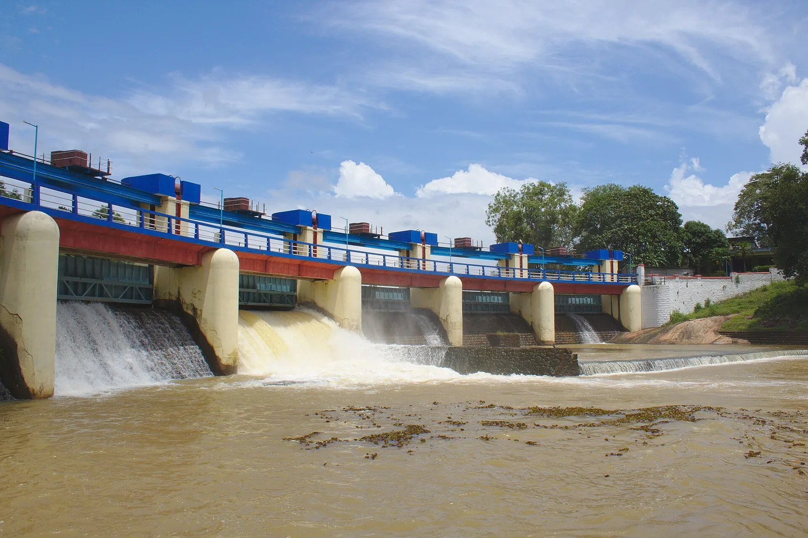
The Karamana is not a long river. Sixty-eight kilometres from source to sea, draining a catchment of about 702 square kilometres, entirely inside Thiruvananthapuram district. You can drive its whole length in a morning.
In that distance it is dammed twice, supplies a state capital, and passes two places where people worship it — Aruvikkara at the top and Thiruvallam at the bottom. Between them it becomes one of the more damaged small rivers in south India.
The top
It rises in the Agasthyamala foothills, in the massif that dominates the far south of the Western Ghats, and its upper catchment is forest — much of it inside the Peppara Wildlife Sanctuary, where the Peppara dam, about 423 metres long with a 3 MW hydroelectric station, was completed in 1983.
A protected catchment above an intake is not sentiment; it is the cheapest water treatment there is. Forest that stays forest holds soil that would otherwise arrive as silt and nutrients that would otherwise arrive as algae. The reason the water reaching Aruvikkara is good enough to drink after conventional treatment is substantially that nobody is farming the headwaters.
The middle
At Aruvikkara the river is taken out for the city — four pipelines, a plant of about 74 MLD built in 2010 under a Japanese-assisted scheme, another of roughly 75 MLD since. What continues downstream is what is left after a capital has had its share.
Then it receives what the capital returns. The reported picture through the urban reaches is bad and specific: highly acidic water with very high bacterial contamination at Thrikkannapuram, unauthorised sand mining in the same stretch, encroachment along the banks, and a solid-waste system running well over capacity — treatment for about 90 tonnes a day against accumulation reported at around 203 tonnes. Domestic effluent, drainage and sewage arrive through the Parvathy Puthanar canal, the Travancore-era cut that runs behind this coast.
The health consequences are not abstract for the people living along it. Leptospirosis outbreaks and dengue risk are part of the standard reporting on this river, and both are diseases of standing, contaminated water in an inhabited place.
The bottom
The Karamana reaches the sea at Thiruvallam, where it meets the Killi and the backwater — the confluence at which the district performs its ancestral rites, and where at the Karkidaka Vavu new moon in the last month of the Malayalam year thousands of people enter the water together to make offerings for the dead.
That is the sharp end of the problem. The most sacred point on the river is downstream of everything the city does to it. A rite that requires immersion is performed in water that reporting on this river describes as bacterially contaminated. Both facts are true at once and neither is going to displace the other.
Why small rivers get treated this way
Partly because they are short enough to be somebody’s whole problem and nobody’s big one. A river that crosses three states acquires a commission; a river that begins and ends inside one district is a municipal matter competing with roads.
Partly because the parts people care about are at the ends. Aruvikkara has fish and a shrine; Thiruvallam has the rites. The reaches through Thrikkannapuram and the eastern suburbs have neither, and nobody goes there to look at the river, which means the degradation happens where no constituency is watching.
Seeing the whole thing
It is an unusually legible river, if you take it in order: Peppara for the protected catchment, Aruvikkara for the abstraction, the eastern suburbs for what a city does, Thiruvallam for what people still believe about water regardless. Four stops, one morning, sixty-eight kilometres.
Most visitors see one of the four and take it for the whole. The fish at Aruvikkara are lovely. They are also the top of a system, and the top of a system is always the flattering part.
Frequently asked questions
How long is the Karamana river?
About 68 km, with a catchment of roughly 702 square kilometres, running entirely within Thiruvananthapuram district from the Agasthyamala foothills to the Arabian Sea at Thiruvallam.
Which dams are on the Karamana?
Two. Peppara, about 423 m long with a 3 MW hydroelectric station, completed in 1983 inside the Peppara Wildlife Sanctuary; and Aruvikkara downstream, the intake for Thiruvananthapuram’s drinking water, whose present masonry gravity dam dates from 1972 on a scheme going back to the 1930s.
Is the Karamana polluted?
Severely, through its urban reaches. Reporting on the river describes highly acidic water and very high bacterial contamination at Thrikkannapuram, unauthorised sand mining, bank encroachment, and domestic effluent and sewage entering through the Parvathy Puthanar canal, against a solid-waste system treating about 90 tonnes a day while accumulation runs near 203.
Why is the water clean at Aruvikkara but not downstream?
Because Aruvikkara is above the city and is managed as a drinking-water intake, with a largely forested and protected catchment above it. The contamination is added by the city itself, downstream of the abstraction point.
What happens where the river meets the sea?
It reaches the Arabian Sea at Thiruvallam, joining the Killi river and the backwater at the confluence where the district performs its ancestral rites — most intensively at the Karkidaka Vavu new moon, when large numbers enter the water to make offerings for the dead.
Where does the Karamana rise?
In the Agasthyamala foothills, the massif that dominates the far south of the Western Ghats. Its upper catchment lies substantially within the Peppara Wildlife Sanctuary, which is one reason the water reaching the Aruvikkara intake is as good as it is.