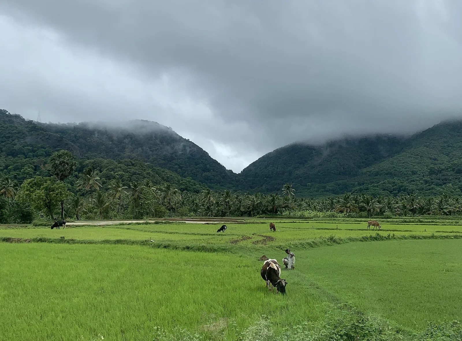
The Western Ghats run about 1,600 kilometres down the west of India as a more or less continuous wall. There are three large breaks in it: Palghat, Shencottah and Goa.
Aryankavu sits in one of them, and everything that has ever happened in this village is downstream of that fact.
Seven and a half kilometres
The Shencottah Gap — also the Sengottai Gap, the Aryankavu Pass, Aryankavu Churam — is about 7.5 km wide. For comparison, the Palghat Gap to the north is roughly 30 km wide and drops to around 100 metres, which makes it the deepest and widest break in the range.
Shencottah is the narrower, higher one. The pass itself is mapped at about 339 metres, against roughly 275 at the village. It is enough of an opening to get a railway and a highway through, and not much more.
The inversion nobody writes about
Here is the finding that makes this more than a geography lesson, and it runs opposite to what you would expect.
A 2021 review in the Journal of the Indian Institute of Science, looking at how the Ghats’ gaps have shaped genetic diversity, reports that the Palghat Gap is a major barrier for a wide range of taxa — populations on either side of it have diverged. The Shencottah Gap largely is not. The same review notes it has not been identified as a geographical barrier for the distribution of species, with the exception of the grey-breasted laughing thrush, while still allowing that it may have shaped evolution in the range.
So this gap is decisive for people and almost irrelevant to animals and plants. The one notch in the mountains that human beings could not ignore is the one the forest barely notices.
Which is worth holding on to when you read about what is proposed to go through it next.
What has already gone through
A kingdom’s first railway. The Kollam–Sengottai line was surveyed from 1888, built from 1900, and carried its first passengers in 1904 — the first railway in Travancore, and an internal line, because the border it now crosses did not exist until 1956. The tunnel at the top was dug in 1901–03, and the state boundary now sits 672 metres inside it.
And a national highway. NH 744 runs Kollam to Madurai through this pass; the descent on the Tenkasi side is the celebrated and notorious S-bend hairpin.
The distances that result are the ones that define the village: Aryankavu is 22 km from Tenkasi in Tamil Nadu and 36 km from Punalur, its own taluk town. It is nearer to another state’s market town than to its own administrative centre, and always has been.
The argument that is still running
This is current news rather than history, and it is the reason to pay attention to the gap now.
The National Highways Authority has sought wildlife clearance for the Puliyarai–Aryankavu–Kadampattukonam economic corridor under Bharatmala: 61.7 km overall, with Package 1 — the 23 km between Puliyarai in Tenkasi district and Edamon in Kollam district — identified as the ecologically sensitive stretch. It would link NH-744 to NH-66 as an east–west freight route.
The plan is reported to include four tunnels, at Kottavasal, Edapalayam, Kazhuthurutty and the Thenmala hills, two of them over three kilometres long — which would be the largest road tunnel in Kerala. We flag that the tunnel list comes from press reporting we could not fully verify. Conservationists warn the corridor would cut a wildlife corridor and raise landslide risk in the gap. Separately, the National Green Tribunal held in January 2023 that no environmental clearance was needed for the NH-744 expansion.
And note where the first of those tunnels would go. Kottavasal is the other portal of the railway tunnel — the 1901–03 one. A road tunnel is being proposed through the same hill the railway went through a hundred and twenty years ago, for the same reason: it is the only sensible place to cross.
Fifty-one people per square kilometre
Close on the emptiness, because it is the least expected fact about a place in Kerala.
Aryankavu grama panchayat covers 198.84 square kilometres and held 10,144 people at the 2011 Census. That is about 51 people per square kilometre, in a state whose average is near 860. It is one of the emptiest inhabited panchayats in Kerala, and the reason is that almost all of that area is forest, plantation and ghat.
So: a 7.5 km notch that carries a kingdom’s first railway, a national highway, a state border younger than both, an unresolved proposal for the largest road tunnel in Kerala — and, on either side of all that traffic, a panchayat with fewer people in two hundred square kilometres than live in a few streets of Kollam town.
Frequently asked questions
What is the Shencottah Gap?
One of only three large breaks in the Western Ghats, along with Palghat and Goa. It is about 7.5 km wide — narrower and higher than the roughly 30 km Palghat Gap — and it is why a railway, a national highway and a village exist here at all.
Is the gap a barrier for wildlife?
Largely not, which is the surprise. A 2021 review in the Journal of the Indian Institute of Science finds the Palghat Gap to be a major barrier for many taxa, while the Shencottah Gap "has not been identified as a geographical barrier for the distribution of species" apart from the grey-breasted laughing thrush. It is decisive for infrastructure and weak for species.
What is the proposed road tunnel?
Part of the Puliyarai–Aryankavu–Kadampattukonam economic corridor under Bharatmala — 61.7 km overall, with the 23 km between Puliyarai and Edamon as the ecologically sensitive package, linking NH-744 to NH-66. Reports describe four tunnels, two of them over 3 km, which would be the largest road tunnel in Kerala. We could not fully verify the tunnel list; the NGT held in January 2023 that no environmental clearance was needed for the NH-744 expansion.
How far is Aryankavu from Tenkasi and Punalur?
22 km from Tenkasi in Tamil Nadu and 36 km from Punalur, its own taluk town — closer to another state’s market town than to its administrative centre. The Tenkasi-side descent is the well-known S-bend hairpin ghat.
How thinly populated is Aryankavu?
About 51 people per square kilometre — 10,144 residents across 198.84 sq km at the 2011 Census, against a Kerala average near 860. Almost all of that area is forest, plantation and ghat.