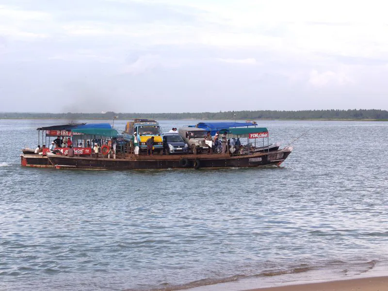
Stand on the Ponnani side of the Bharathapuzha estuary and you can see people on the other bank. Getting to them is the interesting part. There is no bridge across the mouth, so the road goes inland and round: from Ponnani town to Padinjarekkara measures 25.6 kilometres by road and takes about half an hour, and the way it does that is by going up to the Chamravattom crossing and back down the far side.
The boat
The alternative is the ferry, which takes foot passengers and bicycles across a little over a kilometre of water. It is the difference between a short trip and an outing, and it is the reason the two communities on this water have always been closer to each other than the road map suggests. What is not published anywhere is when it runs or what it costs. Ask at the jetty on the day.
What Chamravattom changed
Until 2012 the ferry was the only crossing of the lower river at all. The Chamravattom regulator-cum-bridge, opened on 17 May that year, put a road link between Ponnani and Tirur where none had existed, and in doing so it took 38 kilometres off the run between Kozhikode and Kochi. It is 978 metres long, ten and a half metres wide, and it was meant to do a second job as well — hold a freshwater pond behind 70 shutters and keep the sea out of the wells inland. It does not do that one. A technical investigation for the state government by the Indian Institute of Technology Delhi found the design at fault, and the ₹130-crore structure now works as a bridge.
- By road, Ponnani to Padinjarekkara: 25.6 km, about 30 minutes, via the Chamravattom bridge.
- By ferry: a little over a kilometre of water. Fares and timings are not published — ask at the jetty.
- From the railway: Tirur station to Padinjarekkara is 18.7 km by road, about 22 minutes.
- The Tirur–Koottayi road ends at Padinjarekkara. There is no through road across the mouth.
Frequently asked questions
Is there a bridge across the mouth of the Bharathapuzha?
No. The nearest crossing is the Chamravattom regulator-cum-bridge upstream, which is why the road between the two banks measures 25.6 kilometres. A ferry crosses the mouth itself.
How long does the road take from Ponnani to Padinjarekkara?
About half an hour for 25.6 kilometres, going round by Chamravattom.
What does the ferry cost?
No operator publishes a fare or a timetable for this crossing, so we do not print one. Ask at the jetty.