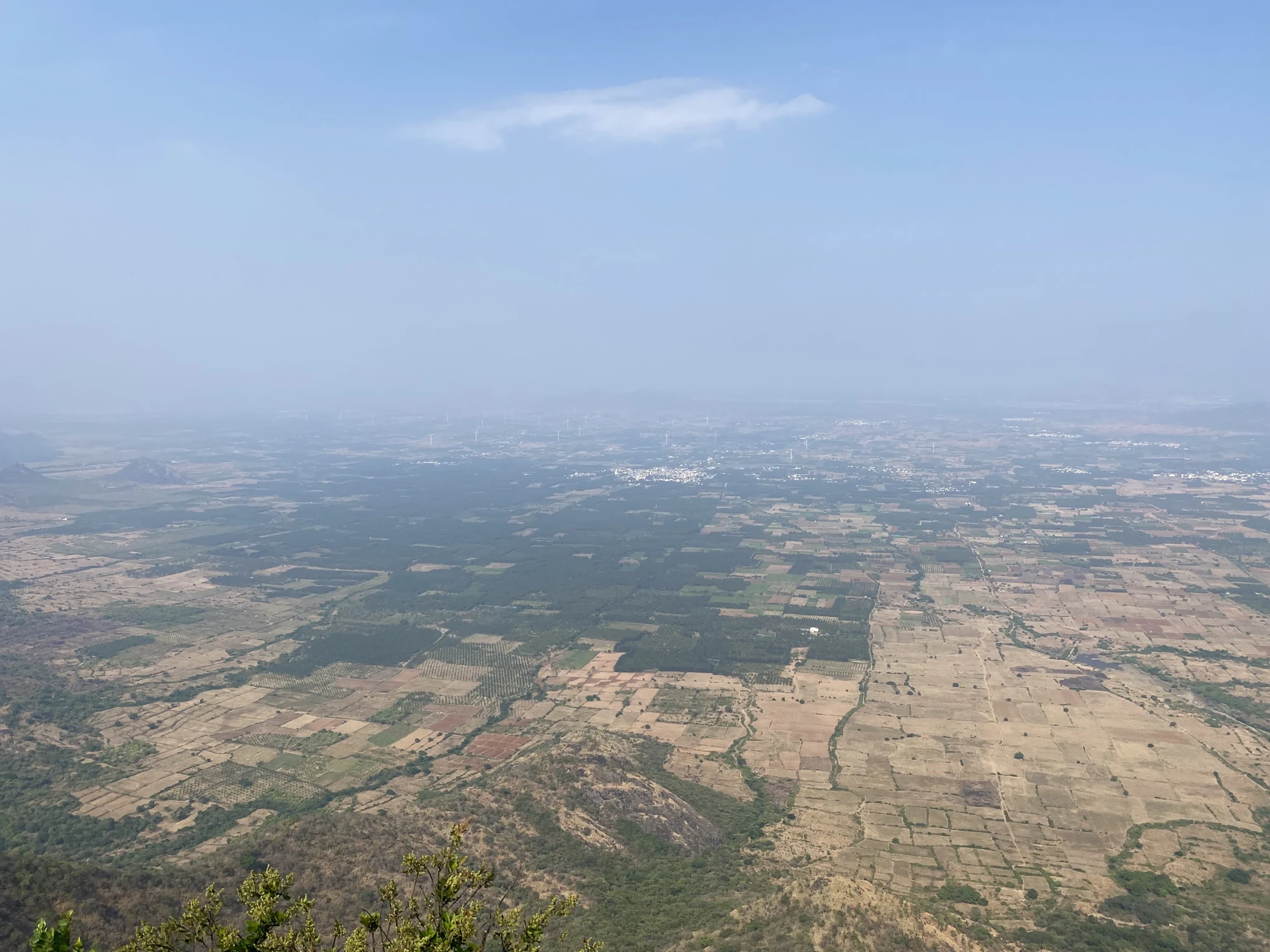
The view below Chathurangapara contains an abrupt change of scale. Near the ridge, rock and grass occupy the foreground. Beyond the steep slopes, fields spread out in small geometric blocks. A landscape that would take many separate road journeys to cross becomes visible as a pattern, framed by the sides of the Western Ghats.
Find the change in terrain first
Begin with the steep slopes below the viewing ground. Exposed rock faces interrupt the vegetation, and denser tree cover gathers in folds. Farther out, the relief softens into lower country where field boundaries become more obvious than ridgelines. Following that transition helps the eye make sense of the panorama before trying to identify individual places.
The village’s official geography places Thevaram and Pannaippuram, in Theni district, along its eastern boundary. That is a useful regional orientation for the lower view. It does not mean every visible cluster of roofs can be confidently assigned to one town from the viewpoint. Distant labels are less useful than understanding which side of the mountain landscape you are looking towards.
Read the agricultural pattern
In clear photographs, pale fields sit beside darker green blocks and regularly spaced tree rows. Some plots look recently bare, while others carry dense vegetation. Roads and settlement clusters create further lines within the pattern. These differences are enough to recognise a cultivated landscape without guessing the crop in a field too distant to inspect.
The small shapes can make the plain appear flatter than it feels at ground level. The viewpoint compresses distance: a nearby rocky spur overlaps fields that lie much farther away, and haze merges the most distant settlements into the horizon. Retaining a piece of the foreground ridge in a photograph gives the viewer a reference for that depth.
Look back towards the high ground
A second view across the neighbouring slopes restores the height that the plain can conceal. Broad rock faces, wooded hollows and rounded upper grasslands occupy different parts of the hill. The contrast is strongest where a cliff interrupts an otherwise green surface. Those changes in texture make Chathurangapara more specific than a generic description of rolling hills.
The turbines add another layer to this comparison. Their repeated forms sit on the crest, while the agricultural grid belongs to the lower country. The two are human uses of very different terrain. Seeing them together gives the panorama a practical meaning: this is an inhabited and worked border landscape, not merely a distant backdrop to a photograph.
Accept the limits of visibility
Haze can soften the field pattern until only broad areas of colour remain. Mist may hide the lower country altogether. Moving closer to the drop does not remove either condition. Stay on secure viewing ground and allow the near ridge to be the subject when the long view is unavailable; the rock faces and tower line still belong to this particular place.
Geographical reference: Chathurangappara Village Office’s account. Wider viewpoint context: Kerala Tourism.
Plan the visit: Chathurangapara Viewpoint.