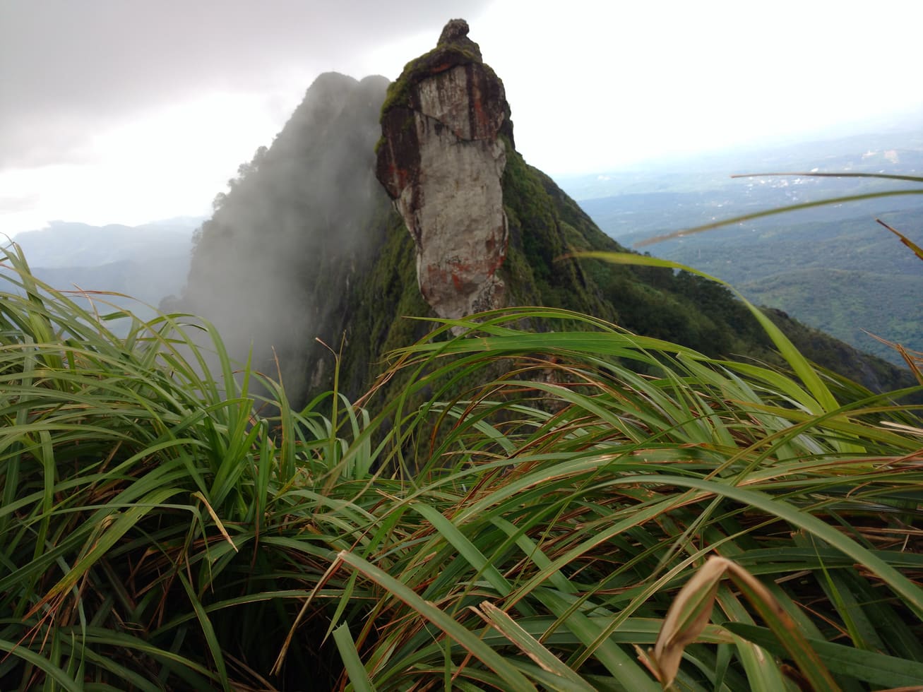
Illikkal Kallu rewards a short walk with an outsized thrill. The trek from the base to the summit is under a couple of kilometres, but it climbs steeply onto a rock so slender at the top that the ridge feels like the spine of some sleeping animal. Get the timing and the caution right and it is one of the finest half-days in the Kottayam highlands. Get careless on that edge and it is unforgiving. This guide covers both.
The climb: from base to the blade
You leave the road at a car park in the valley and climb on foot. Accounts of the distance vary from roughly one to two kilometres to the top — short in numbers, but relentlessly uphill, over rock steps, packed earth and open grass. Where the slope steepens near the summit, some sections are aided, and on busy days a local jeep runs part of the way up for those who would rather ride to the higher ground before walking the final stretch.
The mountain is not a single peak but a cluster of rocky humps, each with its own name and shape — an umbrella-like dome, a hunch-backed crag, and the narrow ridges that link them. The most talked-about feature is a wafer-thin natural span between the hills that locals call Narakapalam, the bridge to hell, said to be only about half a foot wide. It is best admired, not attempted.
Safety on the narrow edge
This is the part to read twice. The summit ridge is genuinely exposed, with steep drops on both sides and no railings for much of it. Wind gusts hard over the top, and the same mist that makes the place beautiful can erase the path in minutes.
- Wear proper grip shoes — the rock and grass turn slick when damp.
- Stay back from the edges; do not attempt the half-foot Narakapalam span.
- Climb in the first half of the day, before afternoon mist rolls in.
- Skip the summit in rain or high wind, and mind children closely throughout.
- Carry water; there is little shade on the open rock.
Best time to visit
There are two very different Illikkal Kallus. The post-monsoon and winter months — roughly October to March — bring cool air and clear skies, when the Arabian Sea can show as a thin line on the far horizon and the plains spread out below. This is the classic season for the big view, and mornings are clearest before afternoon cloud builds. The monsoon months, by contrast, wrap the rock in thick mist and drifting cloud — atmospheric, otherworldly and slippery. Heavy rain makes the steep trail hazardous and the long view usually vanishes; many love the moody light, but it trades clarity and safety for drama, and the exposed ridge is far less forgiving when wet.
| Season | What to expect |
| Oct–Mar (post-monsoon & winter) | Clear skies, best long views, cool and pleasant — the prime window |
| Apr–May (summer) | Warmer and hazier; go early to beat the heat and afternoon cloud |
| Jun–Sep (monsoon) | Misty, dramatic, very slippery; long views often lost, extra caution needed |
How to reach, timings and fitness
Illikkal Kallu sits in the Moonnilavu–Thalanadu highlands of Meenachil taluk, Kottayam district. It lies roughly 55–58 km from Kottayam town, reached via Pala and Erattupetta; from Erattupetta it is about 10 km more to the base. Drivers coming from the Pala side often take the Bharananganam–Kalathukadavu–Nellapara route. The nearest railhead is Kottayam (about 56 km) and the nearest airport is Cochin International (about 85 km).
- Entry fee: around ₹20 for adults, ₹10 for seniors.
- Camera fee: around ₹59; separate charges apply for video/photo shoots.
- Parking: small per-vehicle charges apply.
- Timings and access can change with weather and season.
On fitness: the walk is short but steep, and the last push onto the rock demands a steady head for heights more than great stamina. Reasonably active walkers manage it comfortably; anyone uneasy on exposed ground can enjoy the lower viewpoints without tackling the narrowest ridge. Start early, keep your pace easy on the climb, and leave the top with plenty of daylight in hand.
Frequently asked questions
How long is the Illikkal Kallu trek?
It is a short but steep walk from the valley car park to the summit — accounts range from about one to two kilometres. A local jeep covers part of the route on busier days.
Is the trek difficult or dangerous?
The distance is modest, but the summit ridge is steep and exposed with unguarded drops. It is safe for careful walkers with grip shoes in good weather; it is risky in rain, wind or mist.
When is the best time to visit Illikkal Kallu?
Roughly October to March, after the monsoon, gives the clearest skies and the best long views. Go in the morning before afternoon cloud builds up.
How do I get there from Kottayam?
It is about 55–58 km via Pala and Erattupetta, then roughly 10 km on from Erattupetta to the base. The nearest station is Kottayam and the nearest airport is Cochin International.