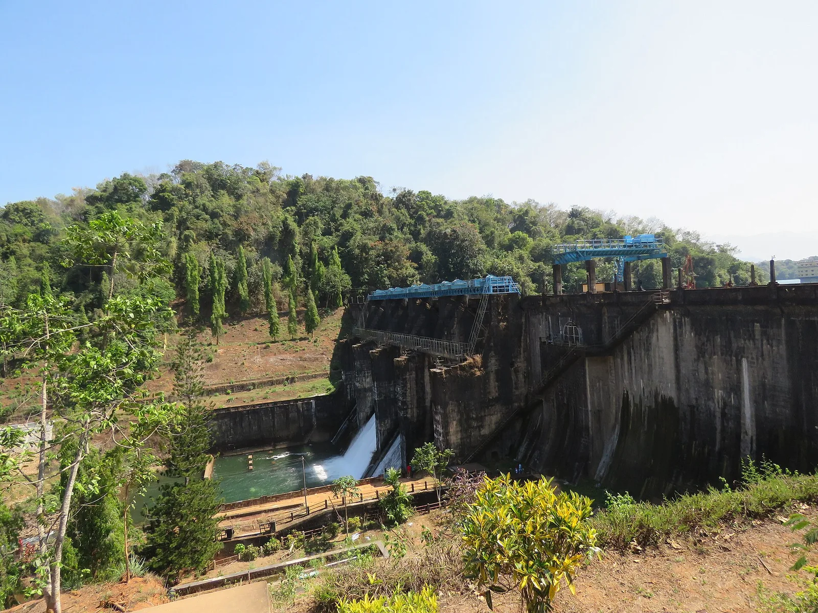
The board bolted to the dam at Kakkayam gives away the problem in two lines, if you read them together rather than separately. Drainage area above dam site: 15 square miles, 39 square kilometres. Effective storage: 1,200 million cubic feet, about 34 million cubic metres.
Those are small numbers. Thirty-nine square kilometres is a modest patch of hillside. Thirty-four million cubic metres is a modest reservoir. And the project they belong to is credited with 225 megawatts, which is the third-largest hydro scheme in Kerala.
The two do not reconcile, and the story of Kakkayam is essentially the story of how the Electricity Board spent forty years making them reconcile.
Why here at all
The site was never chosen for its catchment. It was chosen for its edge. The reservoir sits at a full supply level of 758.05 metres; the powerhouse is 2.8 kilometres away in a straight line and roughly 100 metres above sea level. The board gives the gross drop available as 2,160 feet — 658.4 metres.
That is a gradient of about one in four, and it is the entire reason the project exists. Hydro power is head multiplied by flow, and Kakkayam is almost pure head. It is why the machines in the 1972 station are Pelton wheels — bucket wheels struck by a jet, the design you choose for enormous height and comparatively little water — rather than the Francis or Kaplan turbines used on Kerala’s lowland dams.
The conduit is worth reading off the board in order: a power tunnel of 3,018 feet, about 920 metres, with a finished sectional area of 72 square feet; then a penstock tunnel in two stretches, 648 metres and 554 metres; then a surface penstock of 2,083 metres strapped down the hillside, with a second of 2,114 metres added later for the 2010 extension. Maximum discharge, 525 cusecs — under 15 cubic metres a second. A stream, falling the height of two Eiffel Towers.
The spilling problem
Head was never the constraint. Water was. The 39-square-kilometre catchment receives about 4,570 millimetres of rain a year, which sounds enormous and is — it delivers roughly 210 million cubic metres of inflow annually into a reservoir that can hold 34.
The consequence is exactly what you would expect. Through every monsoon the reservoir filled, and then spilled, and the surplus ran down the Kuttiyadi and out to sea without turning anything. KSEB said so plainly when it proposed the first extension: it was built "to avoid spillage and loss of generation potential from the reservoir during heavy monsoon".
Three answers, thirty-eight years
The first answer was more machinery. In January 2001 a single 50 MW unit from GE Canada was added beside the 1972 station by bifurcating the existing penstock — more capacity to swallow the peak flow when it came.
The second answer was more water, and it is the audacious one. In 2005 the Banasura Sagar dam was commissioned at Padinjarethara in Wayanad, on the far, eastern side of the Ghats crest. Its formal engineering name is the giveaway: the Kuttiyadi Augmentation Main Earthen Dam. It adds a catchment of 61.44 square kilometres — larger than Kakkayam’s own — receiving 6,247 millimetres of rain and storing 209 million cubic metres, six times what Kakkayam holds. It is drained westward into this reservoir through an interconnecting tunnel 4.678 kilometres long, lined and circular for the first 890 metres and unlined and D-shaped thereafter, with an inlet sill at 750.83 metres and a maximum diversion of 11.6 cubic metres a second.
The third answer was another powerhouse. In October 2010 the additional extension scheme brought two more 50 MW Pelton sets into a wholly new building next door, with its own two-kilometre penstock and 686-metre tunnel, built by a BHEL–L&T consortium. That took the complex to 225 MW.
And a fourth, smaller, sits at the bottom: from 2008 the tail race scheme puts three 1.25 MW Kaplan machines on water that has already been through the main stations, adding 15 million units a year before the flow rejoins the river.
The part that is genuinely strange
Follow the Banasura water backwards and it stops being an engineering detail. The Karamanathodu is a tributary of the Kabini. The Kabini joins the Kaveri. The Kaveri crosses the peninsula and reaches the Bay of Bengal.
Left alone, that water would have travelled several hundred kilometres east and emptied into the wrong ocean. Diverted at Kakkayam, it falls 658 metres down the western escarpment and reaches the Arabian Sea in a matter of hours. The tunnel is not moving water between two reservoirs. It is moving it between two watersheds and two seas.
What the meter says
For all that engineering, this remains a rain-fed machine, and the generation figures make it obvious. Combined output across the main and extension stations ran 634.52 million units in 2009-10, 558.67 in 2010-11, 766.01 in 2011-12, 501.23 in 2012-13, 842.09 in 2013-14 and 738.32 in 2014-15.
That is a swing of about forty per cent between a good monsoon and a poor one, on identical plant. Nine hundred metres of tunnel, four powerhouses, a diverted river and half a century of work, and the number at the end of the year is still mostly decided by how hard it rained.
Frequently asked questions
How much power does Kakkayam Dam generate?
None — the dam stores water and generates nothing itself. The Kuttiyadi project’s four powerhouses, 2.8 km away and about 658 metres lower, total 228 MW by KSEB’s reckoning: a 75 MW station of 1972, a 50 MW extension of 2001, a separate 100 MW extension of 2010 and a 3.75 MW tail race scheme, with 3 MW more under construction.
Why is the drop so important?
Hydro output is head times flow, and Kakkayam has very little water but an exceptional fall — 658.4 metres over under 3 km horizontally. That is why the turbines are Pelton wheels, the bucket-wheel design suited to high head and low flow.
Where does Kakkayam’s extra water come from?
From Banasura Sagar in Wayanad, whose formal name is the Kuttiyadi Augmentation Main Earthen Dam. It impounds the Karamanathodu on the eastern side of the Ghats and diverts it west into the Kakkayam reservoir through a tunnel about 4.678 km long at up to 11.6 cubic metres a second.
Is it true the water changes ocean?
Yes. The Karamanathodu is a tributary of the Kabini, which joins the Kaveri and flows to the Bay of Bengal. Diverted at Kakkayam, the same water instead descends the western escarpment to the Arabian Sea.