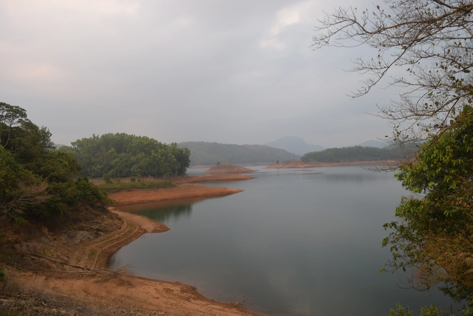
A Kulamavu reservoir photograph may contain no dam at all. Wooded peninsulas project into water, bare banks form pale bands below the trees and distant ridges overlap beyond the inlets. It is a view of stored water within a larger hydel landscape. Recognising that difference prevents a scenic reservoir image from becoming a misleading promise about access to the dam structure.
Follow the shoreline rather than looking for one lake shape
The water at Kulamavu occupies a landscape of slopes and branching valleys. In wide views, an inlet can disappear behind a wooded spur and reappear beyond it. What looks like several separate pools from one roadside angle may belong to the connected reservoir. The hills partly conceal the water’s continuity.
This makes the shoreline more informative than a single distant patch of blue. Notice where trees end, where exposed ground begins and how the bank wraps around a promontory. Those relationships explain the terrain beneath the stored water without requiring a walk down the bank.
Exposed land is not a public path
Photographs taken at lower water levels show broad bare margins and isolated-looking landforms. These reveal a changing boundary between water and land. They should not be read as a route map. An exposed reservoir bank may have steep sections, soft sediment and a return route that is difficult to judge from above.
The attractive shape of a peninsula is therefore a reason to look, not an automatic reason to descend. Remain within the visitor area or an established lawful viewpoint. A reservoir used within a power system is managed for operational needs as well as visited for scenery, and its shoreline is not a fixed beach.
Weather and water level change different things
Cloud, haze and reflections alter the photograph’s atmosphere. Water level changes which banks and landforms are visible. The two effects can occur together but should not be confused. A cloudy image is not proof of high storage, and a sunny image is not proof that the reservoir is at its lowest.
For a visitor, that means an archive frame is a guide to the kind of landscape rather than a forecast of the day’s appearance. The same viewpoint can reveal more exposed bank on one visit and more continuous water on another. The shape of the wooded ridges provides a more stable reference than the exact shoreline in an old picture.
The dam and reservoir have different visual signatures
Kulamavu Dam is a built retaining structure. Its downstream face, parapet and connection to the valley sides identify it as engineering. A reservoir view instead foregrounds inlets, slopes and water. Both belong in an account of Kulamavu, but the caption should say which one is shown.
The distinction extends to access. Being able to see the reservoir from a public road does not establish permission to stand on the dam or enter an operational gate. Kerala Hydel Tourism specifically restricts photography at the dam and parking nearby. A scenic view elsewhere must be treated according to the rules of its own location.
Read the view as part of the Idukki system
The reservoir is formed through the combined roles of Idukki, Cheruthoni and Kulamavu dams. The stored water supplies the project that generates electricity at Moolamattom. Keeping that relationship in mind changes a reservoir pause from a generic “lake view” into an encounter with a particular working landscape.
Look for the scale difference between a close bank and the distant ridges, the way water follows the terrain and the boundary between built infrastructure and wooded slopes. These are details available from an appropriate viewpoint. They offer a satisfying visit without turning the reservoir margin into an unmarked walking route.