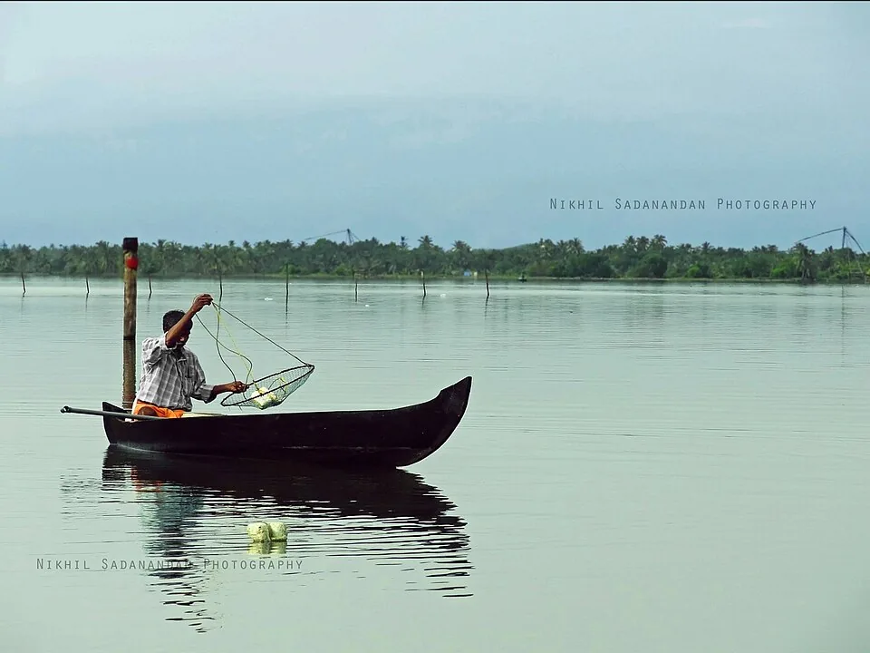
From a canoe, the Kumbalangi backwaters feel like a private system — a few square kilometres of creek belonging to one island, with mangrove on both banks and nothing visible beyond the next bend. That impression is wrong in a way worth correcting, because almost everything about how this water behaves is decided elsewhere.
You are on the longest lake in India
These creeks are the northern arm of Vembanad, which runs 96.5 kilometres down the coast and is the longest lake in the country. The Vembanad–Kol wetland was listed under the Ramsar Convention on 19 August 2002 — the largest of Kerala’s three Ramsar sites — and the complex supports something over 20,000 waterfowl, the third biggest such congregation in India.
Nobody here will tell you any of that, because nobody here calls it Vembanad. In this stretch it is simply the Kochi lake. Down at Alappuzha the same water is Punnamada; at Kottayam it is Vembanad. One body of water, three names, which is a large part of why visitors treat the Kumbalangi creeks and the Alappuzha houseboat routes as unrelated places. They are opposite ends of the same lake.
The wall thirty kilometres south
Between those two ends stands the Thanneermukkom barrage, proposed at 1,402 metres across the lake between Thanneermukkom in Alappuzha and Vechoor in Kottayam. ⚠ It was not built in one go, and the widely printed “1,252 m, commissioned 1976” is not the Irrigation Department’s own account: the Vechoor half (31 shutters, 2 navigation locks) was completed in 1965 and the Thanneermukkom half (31 shutters, 1 lock) in 1975, while the 428-metre middle could not be built at the time and the two halves were joined by an earthen cofferdam. The central stage opened to traffic only on 31 July 2018. Its job is blunt — keep salt water from pushing south into the Kuttanad paddy lands during the dry months, so that a rice crop can be grown on ground that lies below sea level. The gates are shut for much of the year and opened only partially in the monsoon to let floodwater through.
Kumbalangi sits north of that wall. Which means the salt that is being excluded from the southern half of the lake still arrives here twice a day, on the tide, exactly as it always did.
Why that is the reason this place is interesting
Every distinctive thing about the water around this island depends on being brackish and tidal. The pokkali rotation — salt-tolerant rice through the fresher months, then the sluice gates opened and the same field farmed for prawns — only works where the salt reliably comes and goes. The prawn filtration at the gates needs the tide. The clam beds, the crab, the pearl spot in the creeks: all of it belongs to a mixing zone.
South of the barrage, much of that mixing stopped. What you come to Kumbalangi to see is, in part, the half of the lake that was left alone — and the honest way to say that is that a village’s working landscape survives partly because an engineering decision was taken about somewhere else.
- Thanneermukkom barrage: proposed length 1,402 m; Vechoor half completed 1965, Thanneermukkom half 1975, the 428 m central stage opened to traffic 31 July 2018 (Kerala Irrigation Department).
- Purpose: block saline intrusion into below-sea-level paddy land to the south.
- North (Kumbalangi, Kochi lake): still fully tidal and brackish — pokkali, prawn filtration, clam beds intact.
- South (Kuttanad, Punnamada): salinity excluded for much of the year.
- Cost on the south side: stagnation instead of tidal flushing, water hyacinth spread, fish and prawn migration blocked at the gates.
What the wall cost
The barrage did what it was built to do and generated a second set of problems doing it. Blocking the tide removed the flushing that carried pollutants out of the southern lake, so effluent now sits where it lands. Water hyacinth, which brackish water suppresses, spread across the freshened stretches. And fish and prawns that once migrated up the lake to breed simply stop at the gates.
Stagnation also drops silt. Studies of the wetland describe the barrage increasing the share of fine clay in the bottom substrate — which matters, because siltation is the slow way a lake disappears.
A lake getting smaller and shallower
The numbers are not subtle. Vembanad’s water spread fell from about 290.85 square kilometres in 1917 to 227 by 1971 and 213.28 by 1990. Counting from its original extent, reclamation has taken the lake down to roughly a third of what it once covered — filled for paddy, for building, for ports and for roads.
Depth has gone the same way. Average depths recorded around 8.5 metres in the 1930s are now measured at between roughly 1.8 and 2.9 metres across the southern and central sectors. A lake that has lost two thirds of its area and most of its depth is not a lake with a pollution problem; it is a lake being deleted slowly, and the pollution is happening on top of that.
What to look for from the boat
You cannot see a barrage thirty kilometres away, but you can see everything it lets happen here. Watch a sluice gate being worked and you are watching the tide being used deliberately. Look at the stake lines and fixed nets standing in shallow water and note how shallow it is — that is siltation, made visible. Ask your boatman where the clam beds have moved to in the last ten years; the answer is usually specific, and usually about salinity.
And take the scale seriously. The creek you are on is three metres wide and joins a lake ninety-six kilometres long, which drains most of central Kerala’s rivers into one harbour mouth at Kochi. Everything upstream ends up going past this island.
Why it belongs on this page
Kumbalangi is sold as an intact village landscape, and it largely is one. But intactness here is not luck and it is not preservation — it is a by-product. The tide still runs through these fields because the decision to stop the tide was taken about a different part of the lake, and the systems that decision protected are now visibly struggling on the other side of it.
That makes this water worth understanding rather than only photographing. A canoe trip at first light is a lovely thing on its own. Knowing that you are on the unwalled end of India’s longest lake, and what that has spared and cost, is the difference between a nice morning and actually having seen the place.
Frequently asked questions
Are the Kumbalangi backwaters part of Vembanad Lake?
Yes — they are its northern arm. Vembanad runs 96.5 km and is India’s longest lake, but it changes name along its length: Kochi lake in this stretch, Punnamada at Alappuzha, Vembanad at Kottayam. Visitors often assume the Kumbalangi creeks and the Alappuzha houseboat routes are separate systems. They are the two ends of one.
What is the Thanneermukkom barrage and why does it matter here?
A barrage across the lake, proposed at 1,402 metres, built to keep saline water out of the below-sea-level paddy lands to the south. ⚠ Almost every source prints “1,252 m, commissioned 1976”; the Kerala Irrigation Department’s own record is that the Vechoor half was completed in 1965 and the Thanneermukkom half in 1975, with the 428 m middle left as an earthen cofferdam until the central stage opened to traffic on 31 July 2018. Kumbalangi lies north of it, so this water remains fully tidal and brackish — which is precisely what the pokkali rice-and-prawn rotation, the prawn filtration at the sluice gates and the clam beds all depend on.
What problems has the barrage caused?
Blocking the tide removed the natural flushing that carried pollutants out of the southern lake, so effluent accumulates. Water hyacinth, which brackish water holds back, spread across the freshened stretches. Fish and prawns that migrated upstream to breed are stopped at the gates. And stagnant water drops its sediment, increasing the share of fine clay on the lake bed.
Is Vembanad a protected wetland?
It is. The Vembanad–Kol wetland was designated under the Ramsar Convention on 19 August 2002 and is the largest of Kerala’s three Ramsar sites, supporting over 20,000 waterfowl — the third largest such population in India. The designation has not halted the physical decline, which is the uncomfortable part.
How much has the lake shrunk?
Its water spread went from roughly 290.85 sq km in 1917 to 227 sq km in 1971 and 213.28 sq km by 1990, and against its original extent reclamation has left about a third. Average depths have fallen from around 8.5 m in the 1930s to between about 1.8 and 2.9 m in the southern and central sectors.
Can I see the barrage from Kumbalangi?
No. Thanneermukkom is roughly thirty kilometres south, on the Alappuzha side of the lake, and there is no boat route to it from here. What you can see from a Kumbalangi canoe is what the barrage’s absence on this side permits: tidal sluice gates being worked, pokkali fields switching between rice and prawns, and fixed nets standing in water that is still brackish twice a day.