Published figures for the lighthouse at Andhakaranazhi do not agree — its height, its light character and its date all circulate in conflicting forms.
The Directorate General of Lighthouses and Lightships keeps a Master Ledger for each of its towers. This is what Manakkodam’s says.
The tower that was cancelled
A 30-metre cylindrical tower was designed for this site in 1972. It was never built. The ground here is the same soft coastal deposit the whole azhi sits on, and the foundation wells could not be asked to carry that much concentrated load.
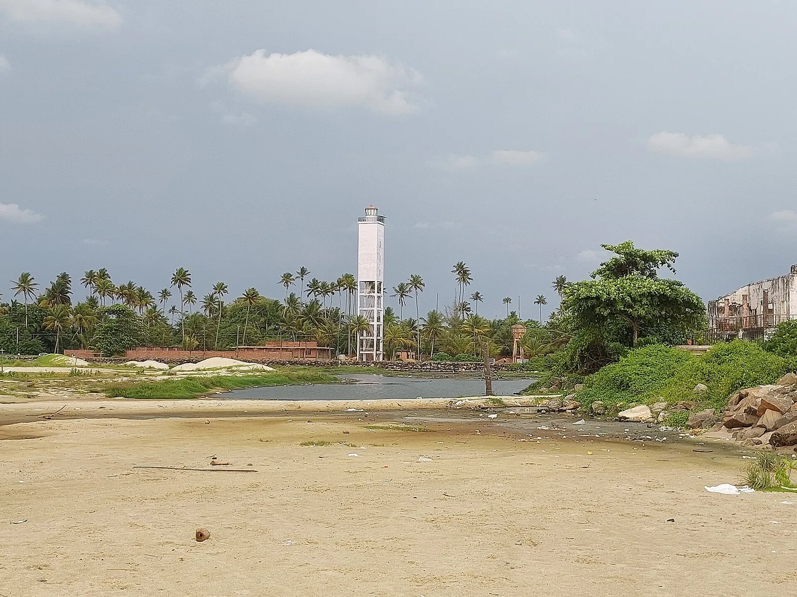
So the design changed. What went up instead — commissioned on 1 August 1979 — is a square reinforced-concrete shaft carried on four open columns, with a service room at the top and an external stair running up the legs. The height stayed at 30 metres. Only the shape gave way.
That is why the tower looks the way it does, and it is worth knowing before you see it. This is not a Victorian masonry column on a headland. It is a piece of 1970s engineering visibly solving a soil problem, standing in a coconut grove behind a village lane, with KSEB lines crossing in front of it.
The heights are not in conflict
Published figures for this lighthouse vary — 30 metres, 33.8 metres, 34 metres — and the temptation is to treat that as a dispute and pick one. The ledger shows it mostly is not a dispute.
The ledger gives the tower as 30 M and, separately, the elevation as 34 M above mean sea level. Those are two different measurements: the structure, and the height of the light above the sea. A source that prints one number without saying which it is measuring is not disagreeing with the other. It is being ambiguous. (The 33.8 m figure matches neither, and we do not use it.)
The rest of the ledger
Its character is Fl (2) W 10 s — two white flashes every ten seconds, each lasting 0.64 of a second — and its range is 16.6 nautical miles. The tower is white; the position is 9° 45.00′ N, 76° 17.10′ E; the international list number is F 0705.
The optic is a revolving 300 mm fourth-order lens assembly by J. Stone & Co. of Kolkata, four lenses turning at three revolutions a minute on a ball-bearing pedestal driven by a stepper motor. The original 1979 lamp gave way to a 400 W metal halide on 21 September 1998, and that to the present cluster of three 230 V / 150 W metal halide lamps on 22 November 2006. Effective beam intensity is 233,050 candela. The lantern above it is 2.4 m across, with twelve panes of glazing and eight ventilators.
The station stands on 0.6686 hectare inside a masonry compound wall, with six RCC buildings, mains power at 440 V three-phase from the KSEB, a 7.5 kVA Kirloskar generator and a 5 kW on-grid solar plant. It carries a racon, and it is run by two people: a Navigational Assistant Grade I and a Navigational Assistant Grade III. At the time of construction it cost ₹2,92,000.
Why we bother with the name
The ledger’s postal address is “Manakkodam Lighthouse, Andhakaranazhi P.O., Alappuzha District, Kerala 688531”, which is the whole naming question in one line. The tower is named for the locality it stands in. The post office it collects its letters from is the one everybody names it after.
The ledger also records how the keepers reach it: by rail to Cherthala station, then 14 km by road. Which is a fair description of where this place actually is.
Frequently asked questions
How tall is the Manakkodam lighthouse?
The DGLL Master Ledger gives the tower as 30 m and the elevation of the light as 34 m above mean sea level. Those are two different measurements, which is why published figures appear to disagree. A 33.8 m figure also circulates; it matches neither ledger entry and we do not use it.
What is its light character?
Fl (2) W 10 s — two white flashes every ten seconds, each of 0.64 seconds — with a range of 16.6 nautical miles, from a revolving 300 mm fourth-order optic turning at 3 rpm.
When was it built?
Commissioned on 1 August 1979. A 30 m cylindrical tower had been designed for the site in 1972 but was abandoned because the weak substrate could not carry the load on the foundation wells; the square four-column structure that stands there replaced it at the same height.
Why is it square and on legs rather than a round tower?
Because of the ground. The DGLL records that the 1972 cylindrical design had to be changed to a four-column RCC structure supporting a service room specifically to reduce the load on the foundation wells in the weak substrate.
Can I go up it?
We have no DGLL-published visiting hours or ticket for this station and are not going to invent either. Manned lighthouses in Kerala often admit visitors in the late afternoon, but ask at the gate rather than trusting a schedule from us.