Mathikettan Shola’s history is not explained by the phrase untouched forest. The park’s management plan describes a landscape shaped by reservation, cultivation pressures and changes in responsibility for land and trees. Understanding that sequence gives the present forest a more concrete story than a general account of green hills.
The older reserve landscape
The plan places Mathikettan within the history of the Cardamom Hill Reserve, established in 1897. Cardamom cultivation and forest cover were closely connected in the high ranges, but responsibility for the land did not always sit neatly with responsibility for the trees growing on it.
A 1958 administrative arrangement described in the plan separated those responsibilities between Revenue and Forest authorities. That detail helps explain why later conservation decisions involved more than drawing a new boundary around an already uncomplicated block of woodland. The management of cultivation, trees and forest habitat had to be considered together.
The plan records transfer to the Forest Department in 2002, followed by the national-park notification of 10 October 2003. The notification is a precise milestone for Mathikettan Shola National Park. It should not be confused with the much older reserve history or applied to a similarly named shola near Kodaikanal.
A park within a lived-in region
The forest does not stand outside human geography. The management plan identifies a Muthuvan settlement, Aduvilathankudi, outside the national park and describes an eco-development role in visitor activities. This is a relationship between a protected area and a neighbouring community, not a reason to treat the settlement as an unannounced tourist exhibit.
Guided visits can connect conservation with livelihoods when arranged through the responsible programme. A visitor benefits from local knowledge while the route and group movement remain within the forest’s access rules. The guide’s role is practical and interpretive, rather than an invitation to wander independently through the park.
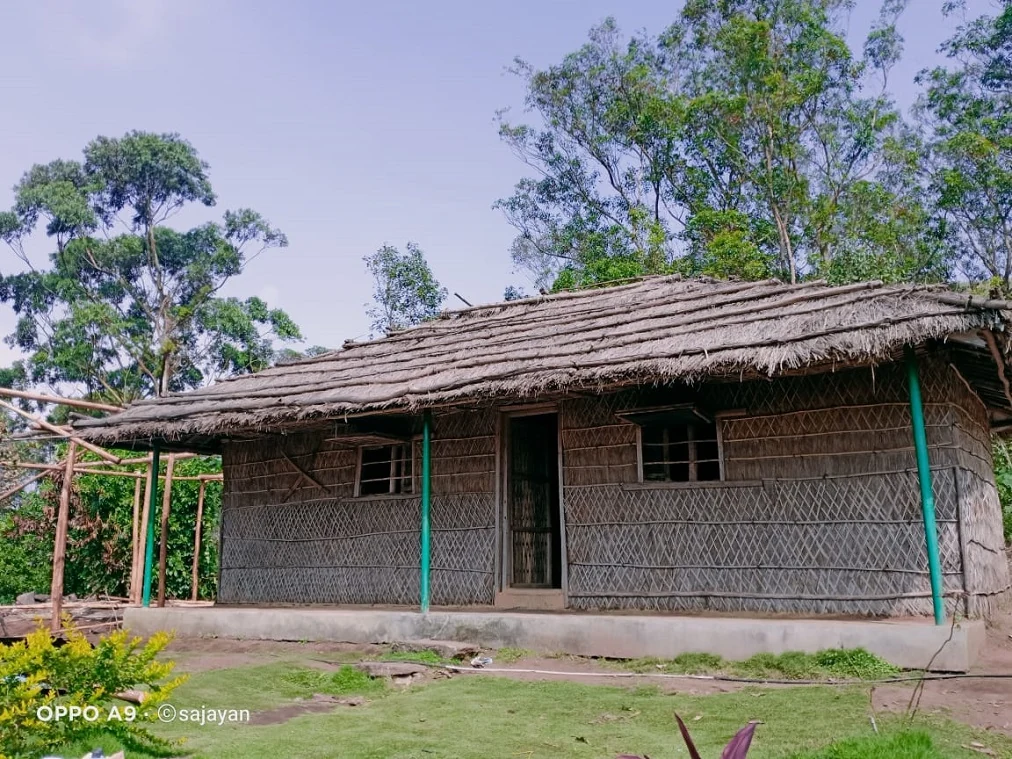
The operator’s older Chundal Ethnic Hut photograph shows a long thatched building with woven wall panels. It is a particular accommodation product, visibly credited to Sajayan in the frame. Its appearance should not be used to claim that every local home has the same form or that a stay automatically includes a cultural visit to a nearby settlement.
What the history asks us to notice
The forest’s value includes water sources, habitat and the movement of wildlife across a wider landscape. Its protection therefore concerns more than the trees visible from one path. A plantation edge, a native forest patch and a community’s access route may sit close together while serving different purposes.
On a guided outing, ask how the particular route fits that setting. Which part of the park is being visited, where does the approach begin, and how does the surrounding land differ from the protected forest? These questions make the historical account visible without turning the walk into a recitation of dates.
Mathikettan’s 2003 designation is best understood as a decision within a longer land history. The present visit can acknowledge both the protected forest and the people around it, while respecting the boundaries that make a managed nature programme possible.
Plan the visit: Mathikettan Shola National Park.