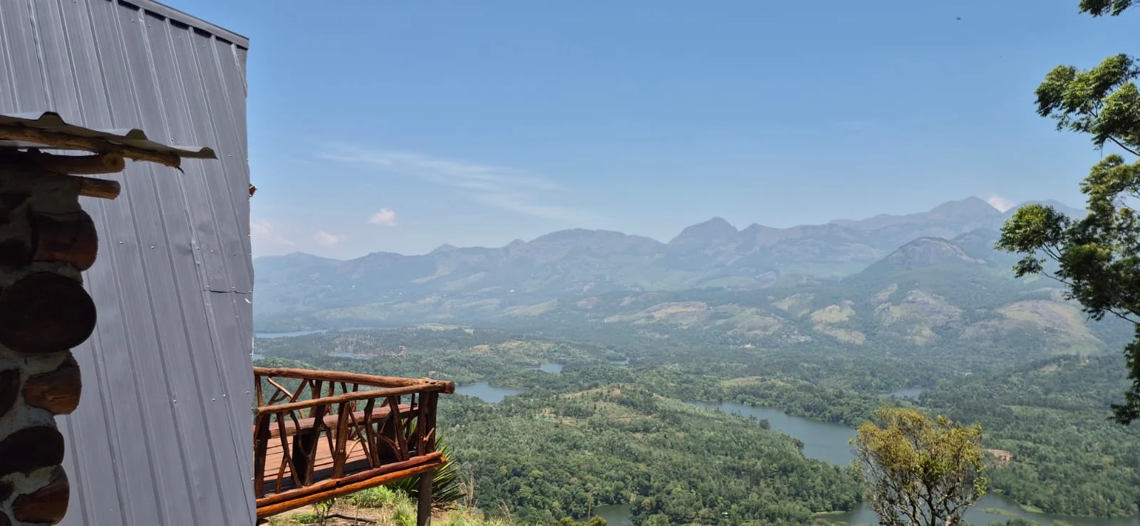
From the Choondal side of Mathikettan Shola, the view opens towards Anayirankal reservoir and the hills beyond it. The park’s management plan specifically identifies this outlook as part of the landscape’s value. It connects a forest visit with a wider water system, while keeping the national park and the dam as separate places.
Begin with the smaller streams
Mathikettan’s management plan names Uchinikuthipuzha, Mathikettanpuzha and Njandar among the streams associated with the park, linking them with the Panniyar drainage. These names bring the water story down to the scale of a forest catchment. The reservoir seen in the distance is only one visible part of a much larger arrangement of slopes and channels.
A stream crossing on an authorised route can be read in that context. Water is moving through a particular hollow, gathering from the land around it. The enclosing vegetation and the shape of the slope belong to the same observation; they are not merely scenery placed beside a watercourse.
The plan’s catchment role also explains why a forest visit should not be judged only by a summit or animal sighting. Protecting the smaller channels and the vegetation around them is part of the park’s purpose even when those features are less immediately dramatic than a large lake.
The reservoir from Choondal
The Forest Department’s Chundal A Frame Log House photographs show a high terrace looking across branching water and densely vegetated land towards a long mountain skyline. The view belongs to that named accommodation setting. It should not be promised from every point in Mathikettan or every room in the wider forest-stay catalogue.
The management plan’s identification of the Anayirangal view helps connect the photograph with the surrounding geography. The reservoir has its own role in KSEB’s hydel system, and the dam-side tourism centre has a separate operator and access arrangement. A view from the park does not include entry to dam infrastructure.
This is particularly important when planning a combined outing. A booked forest programme, a room at Choondal and a reservoir-side stop are three different commitments. If a tourism facility at the dam is unavailable, the fact that water remains visible from the hills does not make the boating programme available again.
Look at land and water together
In a broad panorama, the reservoir’s shape follows the lower ground between projecting slopes. Vegetation and cultivated land surround its edges, while the mountains create a more distant boundary. A good observation moves between those layers instead of treating the lake as an isolated blue surface.
Within the forest, the scale changes again. A guide may be able to explain which stream a permitted route crosses and where it belongs in the drainage. Avoid naming an unfamiliar channel from its appearance alone; the local name and the mapped catchment are more useful than a guess.
Mathikettan’s water story therefore runs from small headwaters to a wider high-range view. Enjoy each at the place where it can be responsibly observed, with the forest route, accommodation terrace and dam visit kept clear in the day’s plan.
Plan the visit: Mathikettan Shola National Park.