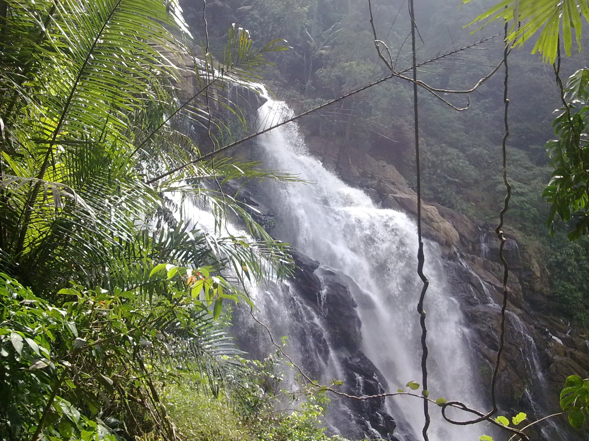
A waterfall photograph usually draws the eye straight to white water. At Vaduvanchal Meenmutty, the surrounding rock and forest are just as informative. They show a steep, enclosed setting in which the flow divides, disappears behind vegetation and rejoins lower down.
Follow the rock before the water
The main face is not a smooth vertical wall. Projecting blocks and sloping surfaces interrupt it. Water follows those variations, spreading into a broad sheet in one place and gathering into a narrower fall in another. Dark strips of exposed rock remain between the brighter channels.
The 2011 Wayanad District Census Handbook describes a principal waterfall and two smaller falls. A close image of one section should therefore not be read as a complete diagram of the whole sequence. The visible face contains its own smaller changes of level within the larger landform.
The forest narrows the view
In the photograph used here, fronds enter from the left and vines hang across the foreground. They partly conceal the falling water, while dense vegetation covers the farther slope. The composition records the waterfall within forest, rather than separating it from its setting as a freestanding attraction.
A second archived view looks towards a tall exposed cliff near the old approach. There is no waterfall visible in that frame, but the steep rock and enclosing trees explain the kind of country surrounding it. Together, the images give a more complete sense of place than several nearly identical close-ups of white water.
Flow changes the visible form
In a fuller-flow photograph, water covers much of the dark face and breaks into spray before reaching a brownish pool. In the oblique view, separate streams and rock surfaces are easier to trace. The difference is useful evidence of how the same landform can present different patterns.
It does not provide a dependable seasonal promise. A photograph records conditions at its capture time, and even a month label cannot predict the flow of a future visit. The interest lies in the relationship between fixed rock and changing water, not in choosing one image as the permanent appearance of Meenmutty.
The images also reveal the limits of what can be inferred. They do not measure the pool, show a maintained viewing apron or identify a presently admitted path. The closed forest approach should remain outside a visit plan; the photographs can explain the landscape without sending anyone back to the photographer’s position.
Looking closely still offers a real encounter with the place. Follow a channel around a protruding rock, notice where foliage hides its continuation and compare the scale of leaves with the larger cliff. These details distinguish the Vaduvanchal falls from a generic waterfall image while retaining the uncertainty beyond the edge of the frame.
Landform context comes from the Wayanad District Census Handbook. Current access context is stated in Wayanad DTPC’s distinction between Banasura and Meppadi Meenmutty. The close views here are archival, not route instructions.
Plan the visit: Meenmutty Falls trek.