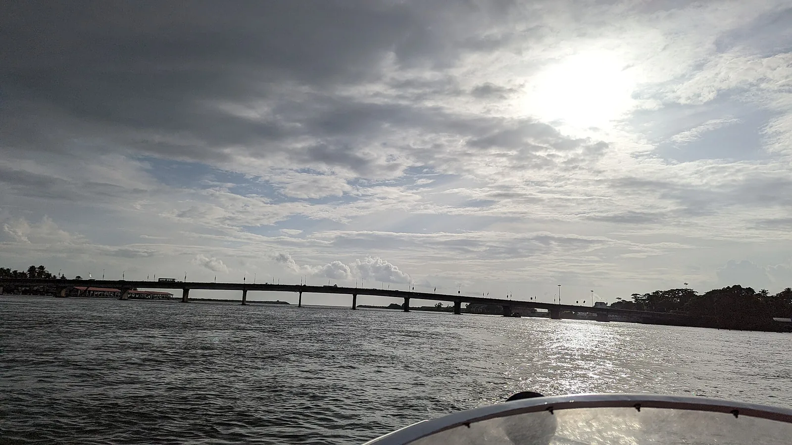
Almost every page about Neendakara sends you to the bridge for the view, and the view is good. Almost none of them mentions that the bridge is why there is a fishing harbour here instead of a port.
It was a port first
Portuguese traders entering Quilon in the early sixteenth century came in over the Neendakara bar, at roughly the spot the bridge now crosses. The bar is the whole reason the place exists: a gap in the coastal sand ridge where Ashtamudi’s eight arms finally reach the Arabian Sea, deep enough and stable enough to bring a ship through.
In the modern era Neendakara was classified as an intermediate port and carried cargo as well as fish. What it carried was specifically local: raw cashew, tying it to Kollam’s cashew-processing industry, and ilmenite, tying it to the mineral-sands belt at Chavara immediately to the north. Both of those industries are still there.
Then the road came
The Setu Lakshmi Bayi Bridge — 422.5 metres long, inaugurated on 24 February 1972 by the PWD Minister T. K. Divakaran — carried what is now NH-66 across the mouth and replaced the ferry. It is the second-longest bridge in Kollam district. It has a footpath. It is named for Maharani Sethu Lakshmi Bayi, a Travancore regent, and essentially nobody calls it that.
It is also low. It stands on squat piers barely clear of the water, and in doing so it drew a permanent ceiling over the channel.
Kerala port sources say the port could have been developed into a well equipped all-weather port well inside the Ashtamudi lake but for the bridge that came across it, and that this forestalled the development of Neendakara port into a modern minor port.
That reading is well attested across port-industry sources, but it is not a government finding, and it should be attributed rather than asserted. The obvious official source is not available to check it: the Kerala Maritime Board’s own Neendakara page returns a 404.
What got built instead
Everything here now is fishing infrastructure rather than a commercial port: two breakwaters of 680 and 380 metres, quays of 425 metres on the Neendakara side and 407 metres on the Sakthikulangara side, a natural depth of about twelve feet, auction halls, ice plants, parking and loading aprons. A reported 1992 sanction cost of ₹622 lakh appears in secondary sources but not in the Fisheries Department material, so treat it as uncorroborated.
Twelve feet of natural depth is a trawler’s depth. It is not a cargo ship’s.
There are two bridges now
This is the practical thing to know before you go, because directions written at different times contradict each other. A separate high-level NH-66 crossing stands beside the old low bridge, on tall piers. A geotagged Commons photograph taken from a boat on 20 June 2022 shows it complete with traffic on it; news coverage from the same period was still describing two new parallel bridges as under construction.
Traffic arrangements between the two bridges can change. For a pedestrian view, use the low 1972 bridge where access is allowed: it places you at water level, looking down the channel towards the moored fleet and out across the bar to sea. The high bridge is designed for through traffic rather than lingering views.
And while you are on the low one, look at its flank. A large pipeline runs along it — Commons files it under pipeline bridges in India — and the Indo-Norwegian Project laid a water main from Sasthamcotta to Kollam in the 1950s. Whether the pipe there today is that line is unverified. That a fisheries aid project put a lake’s water on this road is not.
The reading
Three pieces of geography, in order. The bar made the port: a natural gap deep enough for Portuguese traders. The fishery made the harbour: a Norwegian aid project that failed at beach fishing, switched to harbour-based shrimp trawling in 1960, and filled the basin with boats. And the bridge — built to serve a highway, named for a regent — settled which of the two Neendakara was going to be.
Frequently asked questions
What is the Neendakara bridge called?
Officially the Setu Lakshmi Bayi Bridge, after the Travancore regent Maharani Sethu Lakshmi Bayi. It is 422.5 m long, was inaugurated on 24 February 1972 by the PWD Minister T. K. Divakaran, replaced a ferry, and is the second-longest bridge in Kollam district. Almost nobody uses the official name.
How many bridges are there?
Two: the low 1972 bridge on squat piers and a separate high-level NH-66 crossing on tall piers beside it, photographed complete and in use in June 2022. Traffic arrangements can change, but the low bridge provides the water-level view when pedestrian access is open.
Did the bridge really stop Neendakara becoming a port?
That is the widely repeated reading and it should be attributed rather than asserted. Kerala port sources say the site could have been developed into a well equipped all-weather port well inside Ashtamudi but for the bridge, and that this forestalled its development as a modern minor port. It is not a government finding, and the Kerala Maritime Board’s own Neendakara page returns a 404.
What did the port carry?
As an intermediate port it carried cargo alongside fish — principally raw cashew, linked to Kollam’s cashew-processing industry, and ilmenite from the mineral-sands belt at Chavara just to the north.