Most descriptions of Neyyar treat the river as scenery — a name attached to a dam and a reservoir, with hills somewhere behind. The river is actually the explanation for everything else here.
The numbers
The Neyyar rises at around 1,860 metres on Agastya Mala — which is to say a few metres below the summit itself — and reaches the Arabian Sea after about 56 kilometres, gathering the Kallar, the Mullayar and the Karavaliyar on the way.
Set those two figures beside each other and the character of the place follows. Close to two kilometres of vertical descent in under sixty kilometres of horizontal distance is an extremely steep river profile. The Neyyar is not a river that meanders down to the coast; it falls off a mountain and then runs out of mountain.
What a steep profile does to a forest
It compresses the habitat zones. On a gentle gradient, the transition from lowland deciduous forest through semi-evergreen to wet evergreen is spread across tens of kilometres and you would need days to walk it. Here it is stacked almost vertically, which is why a half-day walk out of the sanctuary office crosses habitat types that elsewhere would be a week apart.
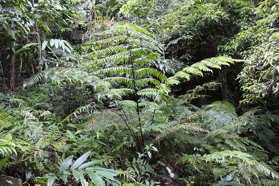
You feel it as a change in light and sound more than as a change in scenery. The lower slopes are moist deciduous, open and bright in the dry season, noisy with cicadas. Higher, the canopy closes; the understorey thickens; tree ferns appear; the light goes green and stays green. Above the walking routes altogether, past about 1,200 to 1,500 metres, the forest gives way to the shola-grassland mosaic of the high Ghats — patches of stunted evergreen in the folds, grass on the exposed slopes.
And to the reservoir
It also explains the dam. A steep catchment sheds rain fast: water that falls on Agastya Mala is in the reservoir in hours rather than days, which makes the Neyyar an efficient thing to impound and a volatile one to live below. The reservoir fills quickly after rain and the river below the wall is a very different watercourse from the one above it.
It is the same logic that explains why the forest above the dam is protected. A steep, wet, forested catchment holds its soil; a steep, wet, deforested one delivers it into the reservoir. Protecting the trees above an impoundment is not sentiment, it is the cheapest available method of keeping the reservoir from silting up.
A note on the name Kallar
One of the Neyyar’s tributaries is the Kallar, and this reliably confuses people, because there is also a well-known Kallar on the Ponmudi road with a waterfall and a picnic area on it. They are different streams.
Kallar simply means stone-stream, and Kerala has a good many. Where the name appears without a district and a river system attached, treat it as unresolved rather than assuming the famous one.
Walking it with the gradient in mind
The practical value of knowing all this is that it tells you what to look at. On the way up, watch the understorey rather than the view: the shift from open deciduous scrub to closed evergreen thicket happens over a surprisingly short distance and it is the most interesting thing on the walk.
And it tells you why the sanctuary is only 128 square kilometres and still holds elephant, gaur, sambar, sloth bear, Nilgiri langur and Malabar giant squirrel. A small area with a large vertical range is, ecologically, a much bigger place than its map footprint suggests.
Frequently asked questions
Where does the Neyyar river rise?
At around 1,860 metres on Agastya Mala, a few metres below the summit. It reaches the Arabian Sea after about 56 km, gathering the Kallar, Mullayar and Karavaliyar on the way.
Why does the forest change type so quickly on the walk?
Because the gradient is extreme — close to two kilometres of descent in under sixty. That compresses the habitat zones, so a transition from moist deciduous through semi-evergreen to wet evergreen that would take days to walk on gentler ground happens here within a morning.
What is a shola?
The stunted evergreen forest of the high Western Ghats, growing in sheltered folds with grassland on the exposed slopes between. It appears above roughly 1,200 to 1,500 metres — higher than the Neyyar day walks reach, but within the same protected block.
Is the Kallar here the same as the Kallar at Ponmudi?
No. Kallar means stone-stream and there are several in Kerala. The Neyyar’s tributary is a different watercourse from the Kallar on the Ponmudi road with its waterfall and picnic area.
How big is Neyyar Wildlife Sanctuary?
Roughly 128 square kilometres, constituted in 1958, running from about 100 m at the reservoir to the 1,868 m summit of Agasthyakoodam at its far end. The large vertical range within a small footprint is why it holds so much.
Why is the catchment above the dam protected?
Because a steep, wet, forested catchment holds its soil while a deforested one delivers it into the reservoir as silt. Protecting the forest above an impoundment is the cheapest way of protecting the impoundment.