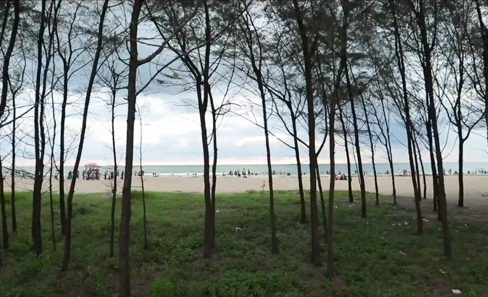
Tipu Sultan Road runs about 6.2 kilometres down this piece of coast from Koottayi in the north, and at Padinjarekkara it ends. Not at a junction, not at a car park with a barrier — it simply arrives at a government park behind a line of trees, and beyond the trees there is sand and then the Arabian Sea. Nothing continues. Everyone who comes here comes back up the same road.
Sea on one hand, river on the other
What the road is running down is a spit: a bank of sand laid along the shore with water behind it. The mapped beach on the seaward face runs a little over a kilometre north to south, and the spit is narrow enough to cross on foot in a couple of minutes. On one side there is open surf. On the other there is flat river water, and islands in it — Murikkumad among them — which are reached by boat rather than by road. It is an unusually legible piece of geography: you can stand in one place and see both kinds of water at once.
The trees are the reason it works
A continuous belt of casuarina runs the length of the spit between the sand and the water behind it — thin grey trunks set close together, a high open canopy, and grass and bare ground underneath. Casuarina is not native here. It is an Australian coastal tree planted along this coast as a shelter belt: it binds loose sand, it tolerates salt wind, and it grows fast. What it produces at four in the afternoon on a west-facing beach is shade with a breeze moving through it, and that is the difference between an hour outside and ten minutes.
Pine, or casuarina
The district tourism council describes the beach as surrounded by pine and coconut; Kerala Tourism describes a long line of casuarina separating the beach from the river. Both are describing the same belt of trees. Casuarina equisetifolia carries pine among its common names because of the needles, and the sound people mean when they say the trees here whistle is the wind going through them.
- 6.2 km — the length of Tipu Sultan Road down the coast from Koottayi to the beach, where it ends.
- 1.2 km — the north-to-south run of the mapped beach on the seaward face of the spit.
- 18.7 km — Tirur railway station to the beach by road, about 22 minutes.
- 11.8 km — the road distance to Purathur bus stand, which is 1.5 km away in a straight line.
Frequently asked questions
What kind of trees are behind Padinjarekara Beach?
Casuarina, planted as a shelter belt along the spit. Some official descriptions call them pine; they are the same trees, and they are what makes the beach comfortable in the afternoon.
Does the road continue past Padinjarekkara?
No. Tipu Sultan Road comes down the spit from Koottayi and finishes at the beach. There is nothing beyond it but sand and the sea.
How wide is the Padinjarekkara spit?
Narrow enough to walk across in a couple of minutes — open surf on the seaward face, still river water and islands on the landward one.