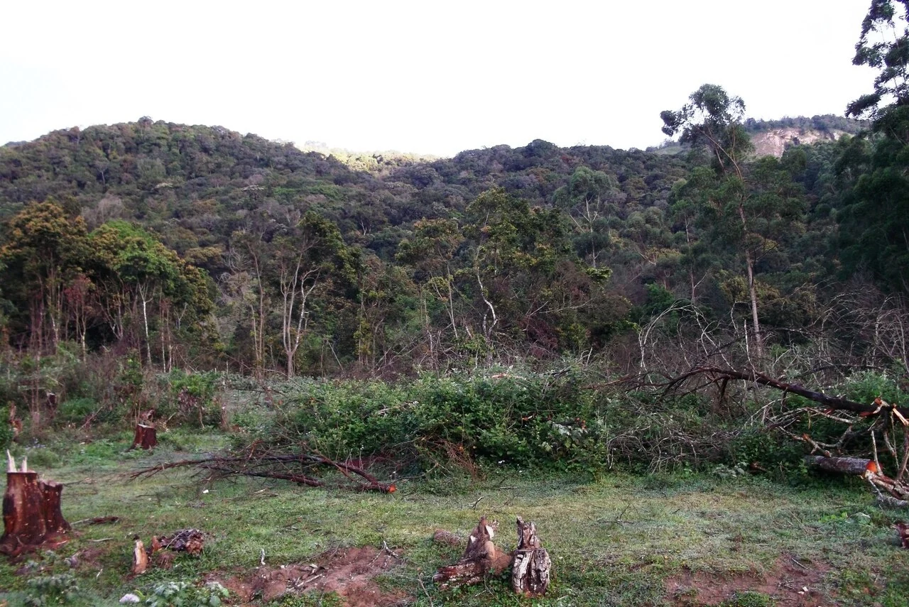
A clearing with cut stumps can be an unsettling sight in a national-park photograph. At Pampadum Shola, understanding the landscape requires more than dividing every frame into green forest and damaged ground. The park has a history of native vegetation, older tree planting and planned restoration, each of which needs to be distinguished.
Protection began before the park name
The management plan traces the forest’s reservation to 1901, when Travancore protected high-range forests for their water role. The national-park notification came in December 2003. These are different chapters in the same landscape: a long-standing concern for catchment protection followed by the later protected-area designation.
The historical sequence matters because it prevents the park from being described as newly created wilderness. Legal categories changed over time, while the slopes and vegetation continued to be affected by management decisions. The present visit takes place within that accumulated history.
Pampadum occupies high-elevation ground, with the management plan describing terrain from about 1,760 to 2,531 metres. That range is a property of the park’s landscape, not the elevation of every cottage or a claim that a standard visitor walk reaches its highest point.
Why more trees is not the whole question
The plan identifies older wattle and eucalyptus plantations and proposes restoration work around Pattiyankal. In such a setting, conservation is concerned with the kind of vegetation and the ecosystem it supports, not only whether a photograph contains a large number of tree trunks.
A planted stand and native shola can differ in structure and ecological role even when both look green from a passing vehicle. Restoring the intended vegetation may involve management that is not immediately obvious to a visitor. The useful question for a guide is what the particular area once supported and what the current work is intended to recover.
The photograph heading this story shows cut stumps and fallen branches below a wooded hillside. It records that scene at the time of photography. It cannot, by itself, prove which management action caused the clearing or how the ground has developed since. Read it alongside the documented restoration aims, without treating it as a completion certificate for them.
Interpretation on a permitted visit
The Top Station approach and the nature education centre provide points from which visitors can understand the park’s setting. The centre photograph shows low buildings in a clearing beneath a forested mountain, a useful visual reminder that education and protection are both part of the visitor landscape.
Ask the guide to distinguish native forest, an older plantation and a recovering patch where the opened route permits that comparison. The explanation belongs to the particular location. It should not be generalised into a claim that all visible clearings are restoration or all tall planted trees are being removed.
The result is a richer way to see Pampadum. A forest panorama becomes a landscape with water history, legal protection and active decisions about vegetation. The visitor’s role is to observe from the authorised route and understand those decisions, while leaving management work to the people responsible for the park.
Plan the visit: Pambadum Shola National Park.