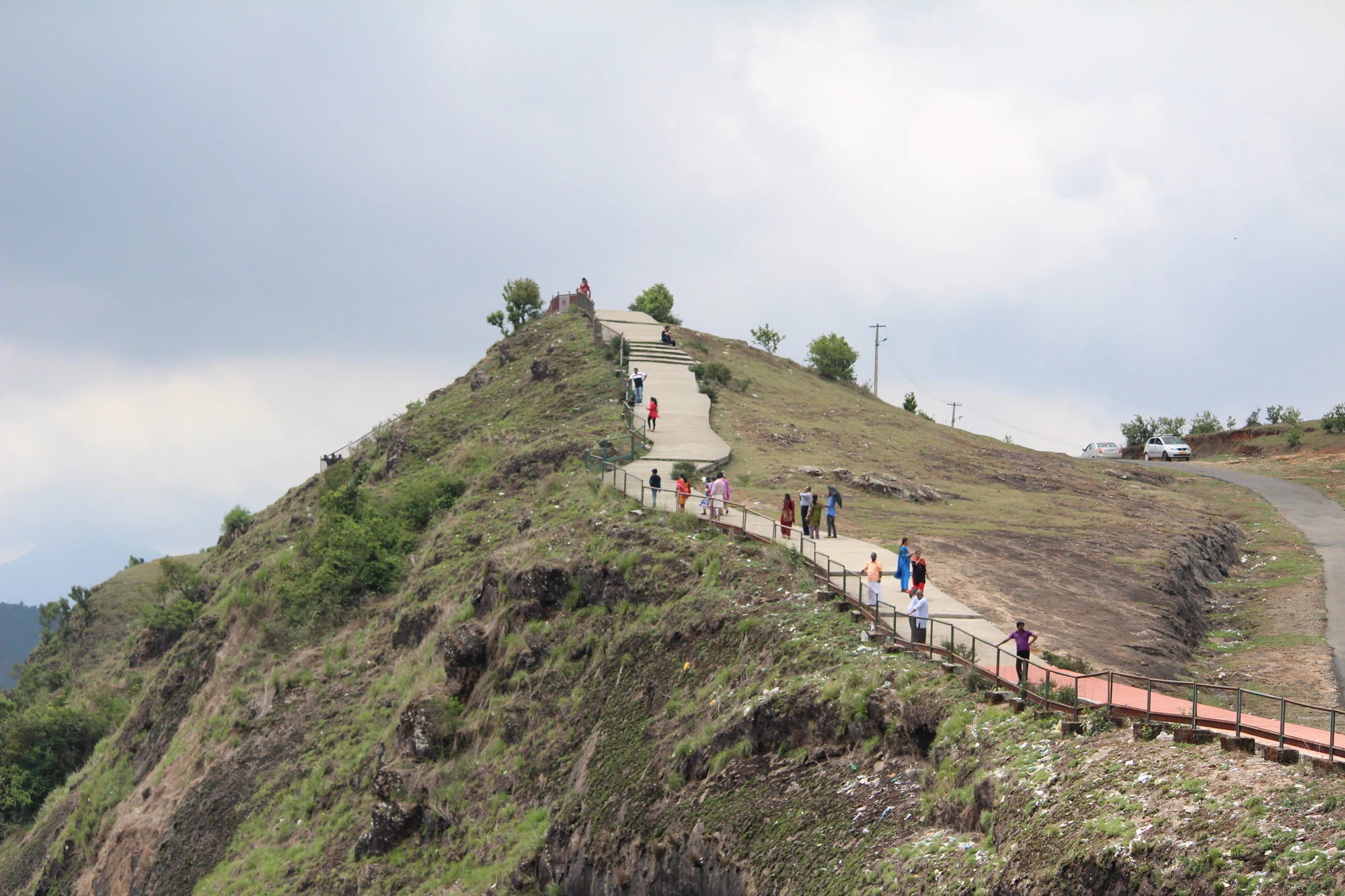
Parunthumpara can look like a single broad hilltop from a distant photograph. On the visitor side, it breaks into smaller changes of level: a road arrival, grassy ground, exposed rock and sections with steps or railings. Deciding how far to go is easier when those parts are treated separately.
Begin with the first admitted outlook
The road journey brings visitors into a highland setting near Peermade, with the Pambanar-side approach commonly used for the stop. From the arrival area, assess the visible path before choosing a farther viewpoint. The first usable outlook may already provide the layered hills and valley that brought you here.
The photograph shows people distributed along a route with steps and metal barriers. Those details provide more practical information than a general label such as easy viewpoint. Steps require a return climb, and the presence of railings in one section does not establish continuous protection across every grassy or rocky surface.
Rock and grass behave differently
Exposed rock interrupts the softer-looking slopes. A wet surface can reflect light and hide small changes in angle, while grass can conceal uneven ground. Keep to the established visitor route rather than making a straight line towards a rock that appears closer in the view.
The route should fit the least comfortable walker in the group. Anyone avoiding stairs or steep ground should assess the short arrival-side view and ask about the actual surface ahead. A panorama does not become more valuable simply because it was reached by the longest possible walk across the hill.
The return is part of the stop
At a viewpoint, the outward direction often feels easy because the eye is drawn towards the open valley. Turning back reveals the gradient that must be regained. Keep the roadhead and pickup arrangement in mind, particularly when mist changes how much of the route remains visible.
Allow time to pause on the return rather than treating the farthest point as the end of the visit. This is useful for families and for anyone who wants to photograph details along the way: the pale rock, the line of a railing or the different colours of nearby grass and distant forest.
Development proposals for Parunthumpara should not be confused with the current path. A tourism project document can discuss future amenities without proving that they have been built. The surface, barriers and facilities actually present on arrival are what determine the day’s usable walk.
There is no requirement to turn this stop into a trek. Parunthumpara’s strength is the relationship between accessible high ground and a much wider hill landscape. A short, well-chosen walk can give that relationship clearly, leaving time for the road journey through Peermade’s surroundings rather than stretching the outing beyond comfortable footing.
Use the Parunthumpara guide for destination context, then follow the admitted route and conditions at the site. A photograph records a layout; it cannot guarantee that every section is open or unchanged.
Plan the visit: Parunthumpara.