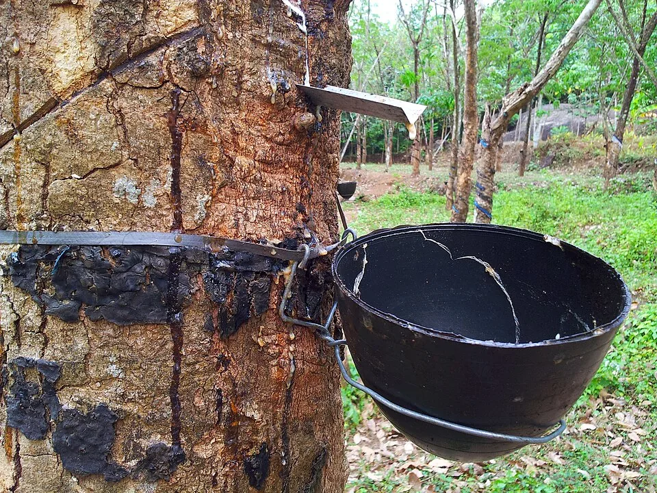
A green photograph can hide land use. Around Peechi, walking approaches pass banana plots, rubber rows, palms, streams and exposed rock before wooded sanctuary slopes dominate. This is not evidence that the protected forest is a plantation; it is evidence that its boundary meets lived and cultivated country.
Rubber trees carry readable marks
Diagonal cuts, metal spouts and black collection cups identify rubber tapping more reliably than a generic caption about dense forest. Ordered rows and repeated bands distinguish the grove from irregular woodland. Naming those visible details keeps a real agricultural edge from being marketed as wilderness.
The contrast becomes clearer on foot. A path may move past planted trunks and utility lines, cross a rocky stream and then face thicker layers of vegetation. The transition matters because protected areas do not float apart from people; they have boundaries, neighbours and working landscapes.
Streams cross both kinds of ground
Water threads between cultivation and forest without observing the categories on a map. Small channels below concrete crossings, palms and banana growth eventually contribute to the same catchment story as the reservoirs. Litter or disturbed banks at the edge are part of the visible truth, not details to crop out of every account.
The guide interprets a changing boundary
A managed walk explains when an approach becomes controlled forest and which route is authorised that day. The moment is not always a dramatic gate. It may be a change in path surface, vegetation or instruction—small cues that are easy to miss when every place is described only as lush.
This edge makes Peechi–Vazhani more specific, not less beautiful. Cultivated rows reveal human dependence on the foothills; woodland and reservoir catchments reveal the limits placed around water and habitat. Seeing both gives the trek a landscape history rather than a green backdrop.
- Tapping cuts and cups mean rubber cultivation.
- Banana plots and utility lines identify inhabited edges.
- A guide decides where authorised forest access begins.
Frequently asked questions
Is the whole approach untouched forest?
No. Photographs show cultivated and inhabited edges around Peechi before denser woodland.
Why does that matter?
It explains how farms, settlements, streams and a protected catchment meet rather than presenting every green view as the same habitat.
Can I enter wherever the vegetation looks forested?
No. Follow the confirmed reporting instruction and authorised guide.