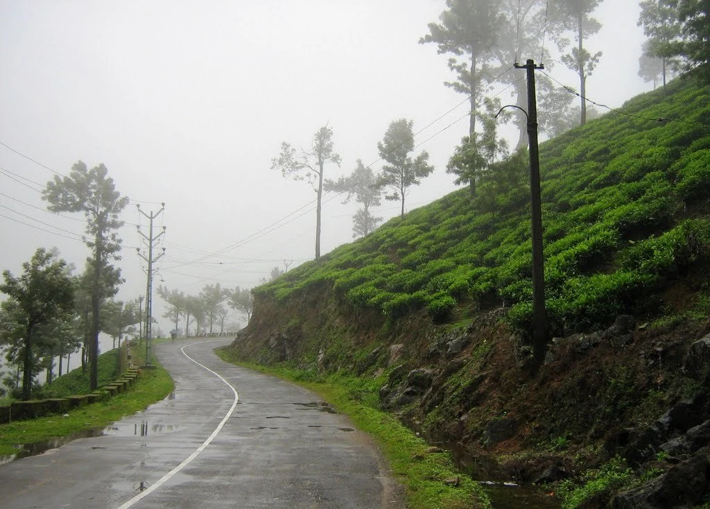
A wet road curving between tea slopes is one of Peermade’s characteristic views. It is also a clue to how the highland settlement works. Plantations need connections between fields, workers’ homes, processing and markets. The road belongs to that everyday movement before it becomes part of a visitor’s scenic drive.
Coffee before the familiar tea view
Kerala Tourism’s history of Peermede associates nineteenth-century plantation development with Henry Baker Junior and describes coffee cultivation preceding the growth of tea. It recounts disease affecting the coffee and later tea experiments using plants from the Nilgiris. This is the broad transition behind a landscape now widely recognised through clipped tea hedges.
The account also names other estate developers, including Daniel Munro. Those names help locate a period of commercial change, but they do not explain the landscape on their own. The same history acknowledges communities in the hills and labour brought from Tamil Nadu. Plantations were made and maintained through work, settlement and transport, not simply through the choices of a few estate owners.
Roads changed what could move
The tourism account dates a cart road to 1872 and describes later changes in goods transport. That gives a useful historical framework for the road-centred experience of Peermade today. A hill landscape that is easy to photograph from a vehicle once required a much harder movement of crops, supplies and people.
Do not assume that every current bend follows the exact 1872 alignment. Roads are widened, bypassed and rebuilt. The historical point is the growing importance of a dependable connection between the highlands and the lower country. A modern journey through Peermade still depends on that relationship between slope and transport.
Look at the estate lane as a working space
Within a tea landscape, the lane may be the strongest line in the view. It divides planted slopes, passes shade trees and disappears around a contour. Small vehicles or people on it reveal the scale better than a distant panorama alone. The road is not merely decorative foreground beneath the tea.
Its presence also does not establish public access. An estate lane can be private even when it is clearly visible from a public road. A visitor who wants a plantation walk should arrange a named activity with the estate or operator that controls the route. An attractive opening between hedges is not enough to identify a permitted trail.
Bridges reveal successive connections
Photographs from Peermade show older and newer crossings close together, including a metal-beam bridge on masonry supports beside a later concrete structure. Such a scene makes change visible without requiring a claim that one particular bridge carried the original plantation traffic. The structures demonstrate different phases of connection across the same difficult ground.
From a safe public position, notice how the road meets the stream valley and how the piers sit against rock. Avoid standing in the carriageway to align two bridges in a photograph. These remain transport spaces, and the most useful reading of them begins with their present function.
A plantation town, not one estate attraction
Peermade is a settlement and a wider highland landscape. Its shops, junctions, homes and administrative role are part of the destination alongside tea slopes. Staying in the area can give time to understand those relationships, whereas treating the name as a single attraction often leads to searching for a nonexistent universal entry gate.
Begin with the town as the arrival base, then choose a specific estate visit or public-road excursion. The history becomes clearer when a tea view is placed alongside the roads that serve it and the town that supports the surrounding country. Peermade’s interest lies in those connections as much as in the green pattern of a hillside.