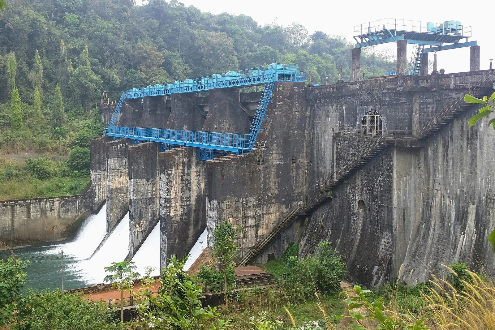
The structure everybody photographs at Peruvannamuzhi is a stone masonry gravity dam with four radial gates, a blue gantry crane riding the crest and an arched gallery doorway in the abutment. It is handsome, it is obviously the dam, and it is only one fourteenth of the answer.
The Kerala Irrigation Department’s asset register for the Kuttiyadi Irrigation Project lists the works in two lines. The first is the main dam, gravity, stone masonry. The second is thirteen earth dams.
Why thirteen
The reason is the shape of the ground. At full reservoir level the water covers 1,052 hectares, and the basin it fills is not a clean bowl. It is a lumpy laterite landscape of low ridges and dips, and the water finds every one of them. Wherever the rim drops below the full-supply line, the reservoir would simply spill out sideways into the next valley — so each of those saddles has to be plugged with its own embankment.
The result is a reservoir held in not by one wall but by fourteen, thirteen of which are unremarkable banks of earth that most visitors drive over without noticing. The viewpoint that maps label the Peruvannamuzhi Reservoir View Point, about 800 metres east of the main dam, stands on one of them. It is a genuine viewpoint over the water. It is not the dam, and the structure beneath it is roughly a hundred metres long rather than the main wall’s hundred and seventy.
The dam in its own numbers
From the register: top width 11.13 metres, bottom width 25.40, maximum height above lowest foundation 35.36 metres. The spillway is ogee type, 48.8 metres in total length, crest level 38.44 metres, with four radial shutters each 12.2 by 7.62 metres and a design capacity of 1,444 cubic metres a second.
A dam is really a set of levels, and these are the ones that matter: top bank +46.88 metres, full reservoir level 44.41, minimum draw-down +25.52, with 2.44 metres of freeboard. Gross storage 120.52 million cubic metres, live 113.44, dead 7.08. Catchment 108.78 square kilometres.
One entry gives away the drawing office. The probable maximum flood was calculated at 1,071.75 cubic metres a second using Ryve’s formula — an empirical nineteenth-century method developed in the Madras Presidency, still in routine use in south Indian practice long after. Nothing else on the sheet tells you as plainly which engineering tradition this dam belongs to.
And then the obelisk
Among the trees by the dam road stands a white pillar topped with the Ashoka lion capital and a chakra, chain-railed on a concrete apron. Set into it is a marble plaque headed SALIENT FEATURES. It is the closest thing Peruvannamuzhi has to an interpretive sign, and it is the only memorial here you can actually stand and read.
It gives: length at top 171 metres; height, maximum, 36.16 metres; full reservoir level 44.41 metres; catchment 109.5 square kilometres; storage, net, 113.4 million cubic metres; water spread 1,052 hectares; canals, left bank 37.2 kilometres and right bank 37.2 kilometres; ayacut 14,575 hectares.
Set that against the register and four of the eight figures do not match. The plaque rounds the height up by 80 centimetres, from 35.36 to 36.16. It inflates the catchment from 108.78 to 109.5 square kilometres. It adds about 72 hectares to the ayacut, 14,575 against 14,568.70. And most tellingly it gives the two main canals identical lengths — 37.2 kilometres each — when the register records 40.02 on the left bank and 34.27 on the right.
Two of those, the water spread and the full reservoir level, agree exactly. The rest drift. It is not a scandal; it is what happens when a commemorative plaque is cut from a design document rather than from an as-built survey. The obelisk is a monument to a dam as it was drawn, not to the dam as it stands.
The department cannot find it either
There is one further wrinkle, and it belongs to the register rather than the plaque. The Irrigation Department’s own asset record places the dam and spillway at 11°36′45″ north. The longitude it gives, 75°49′27″ east, is correct to within metres. The latitude is exactly one arc-minute too far north — about 1.8 kilometres, which puts the dam in open country up the valley. Read 11°35′45″ instead and it lands on the concrete.
A single digit, in a government table, copied onward ever since. It is the same class of error as the plaque’s canal lengths: not carelessness about the dam, but the ordinary drift that sets in when numbers are transcribed more often than they are checked.
What to do with all this
Walk the crest, look at the four gates and the gantry, then go and find the obelisk and read it properly. It takes three minutes and it is the most interesting object on the site — a state memorial, complete with lions and chakra, erected to commemorate a set of measurements, several of which are wrong.
Then look back at the water and count the ridgelines. Somewhere out along that rim, thirteen more dams are quietly doing as much work as the one you are standing on.
Frequently asked questions
How many dams are there at Peruvannamuzhi?
Fourteen. The Kerala Irrigation Department’s register lists the main stone masonry gravity dam plus thirteen earth dams, which plug the low saddles around the reservoir rim where the water would otherwise escape sideways.
How big is the Peruvannamuzhi reservoir?
It covers 1,052 hectares at full reservoir level, holding 120.52 million cubic metres gross and 113.44 million live, with a catchment of 108.78 square kilometres.
Why does the plaque at the dam disagree with official figures?
The SALIENT FEATURES plaque on the obelisk appears to have been cut from design figures rather than an as-built survey. Four of its eight headline numbers differ from the Irrigation Department register — including the two main canal lengths, which it gives as identical when they are not.
Where exactly is the dam?
At about 11.5965°N, 75.8233°E. OpenStreetMap’s mapped dam crest, the geotag on a Commons photograph of the structure and the Wikipedia coordinate all converge there. Note that the Irrigation Department’s own register prints a latitude one arc-minute too far north, roughly 1.8 km off.