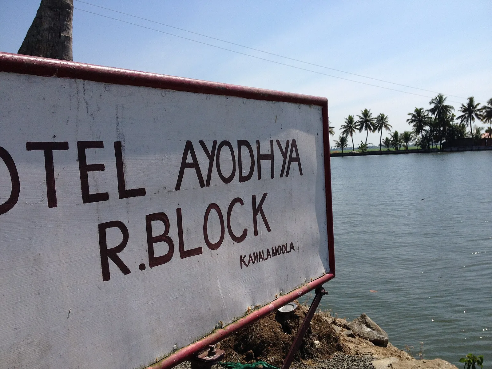
R Block is not named after anybody. It is a lot on a map.
The notification
The Madras government banned further reclamation of the Vembanad kayal in 1903, then approved a scheme in 1912 and lifted the ban in 1913. The scheme notified some 19,500 acres of lake for reclamation, divided into blocks — and each block was named with a letter of the English alphabet.
That is the entire origin of the name. R was a lot number in an administrative subdivision of a lake that did not yet have any land in it.
We do not know why R specifically, or whether the letters ran in any particular order, and no source we can find explains it. We are not going to invent an explanation, and we would gently suggest treating any page that offers you one with suspicion.
The eight families
The reclamation itself belongs to the third of the new-reclamation periods, running roughly 1914 to 1920. Wikipedia’s Kuttanad article, sourced to the FAO’s Globally Important Agricultural Heritage Systems proposal, records that R Block Kayal, covering 1,400 acres, was reclaimed by the joint efforts of eight families led by Pallithanam Luca Matthai, then a member of the Sree Moolam Popular Assembly — Travancore’s legislative body.
His partners are named: Vachaparampil Mathen, Pazhayaparmpil Chacko, Ettuparayil Xavier, Pattassery P. P. Mathai, Kaarikkuzhi Ponnada Vaakkaal Mathulla Mappila, Meledom, Paruthickal and Kandakudy. A secondary source dates the completed work to 1921, so about 1920–21 is the honest range.
The consortium structure is the interesting part. Reclaiming a lake bed is not a task that scales down: you need a continuous outer bund before you have a single acre of anything, and until that bund closes you have spent everything and own nothing. The capital cost was the kerosene engine and the earth; the risk was the monsoon, and the bunds of that era breached frequently. No single family carried that. Eight of them did, together, which is why the record is a list of surnames rather than a name.
Who it was not
R Block is very widely credited to Joseph Murickan, the Kayal Rajavu — the lake king. That is wrong, and it is worth being firm about.
Murickan reclaimed the neighbouring Q, S and T blocks, from 1940 — two decades after R, in a different economic era, under a wartime Grow More Food policy and with electric motors that the earlier consortium did not have. He named his blocks Chithira, Rani and Marthandam, after the Travancore royal house.
The confusion is not anyone’s fault in particular. Kerala Tourism markets the four blocks as a single destination — the Q, S, T and R Block Kayal — and once four things are sold as one place, the most famous name attached to any of them absorbs the rest. R Block is the block that gets absorbed.
The size, and the letter that outlived the empire
One caution on the acreage. The reclaimed extent is recorded as 1,400 acres; the block as mapped today encloses closer to 1,600. Those are not the same measurement — a mapped polygon and a historical reclamation figure rarely are — so we print 1,400 acres reclaimed and note that the mapped extent is larger.
And then there is the name itself, which has proved remarkably durable. The empire that issued the notification is gone. The families that raised the bund lost the land — agitation in 1954, acquisition in 1972, and in 1975 some 1,600 acres distributed among 1,580 farmers. The reclamation is more than a century old.
OpenStreetMap still records the place as name=R-Block, with name:ml as ആർ ബ്ലോക്ക് — the Latin letter transliterated into Malayalam script and read back as “aar block”. A hand-painted hotel sign at the landing says the same thing. A clerk’s lot reference from a colonial notification is now simply what the place is called, in two scripts, by everybody.
Frequently asked questions
What does the R in R Block stand for?
Nothing recorded. A 1912 Madras government scheme notified about 19,500 acres of the Vembanad kayal for reclamation in blocks, each named with a letter of the English alphabet. R was simply the lot reference. No source we can find explains the choice, and we have not invented one.
Who reclaimed R Block?
An eight-family consortium led by Pallithanam Luca Matthai, a member of the Sree Moolam Popular Assembly, in about 1920–21, covering 1,400 acres. His partners included Vachaparampil Mathen, Pazhayaparmpil Chacko, Ettuparayil Xavier, Pattassery P. P. Mathai, Kaarikkuzhi Ponnada Vaakkaal Mathulla Mappila, Meledom, Paruthickal and Kandakudy.
Was R Block reclaimed by Joseph Murickan?
No. Murickan reclaimed the neighbouring Q, S and T blocks from 1940 — two decades later — naming them Chithira, Rani and Marthandam. The two are constantly conflated because the four blocks are marketed as one destination.
Who owns the land now?
The reclaimers do not. Following an agitation in 1954 and acquisition in 1972, about 1,600 acres were distributed to 1,580 farmers in 1975.