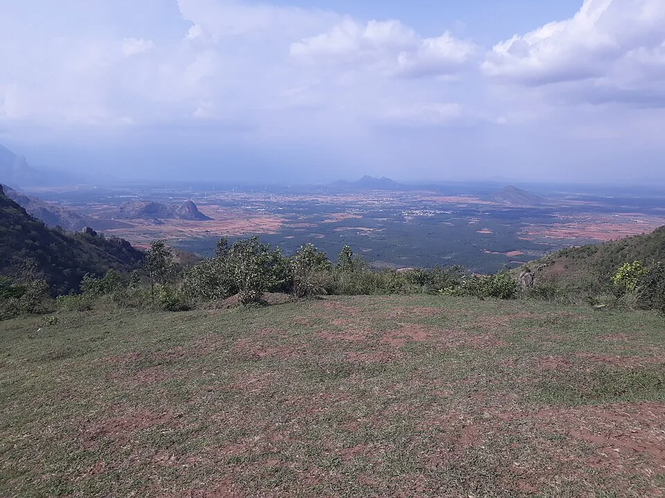
Between them, Kerala Tourism and English Wikipedia name eight places on the plain below Ramakkalmedu: Adivaram, Cumbum, Theni, Kombai, Thevaram, Uthamapalayam, Bodinayakanur and Vaiga. From the railing they are a grid of coloured fields with the Cumbum valley running away to the south-east, and the whole thing is close enough that on a clear morning you can pick out individual roads. The striking part is not how near they look. It is how far they are.
The arithmetic
Measured with OSRM from the viewpoint's own pin on 26 August 2026, against straight-line distances from the same point: Cumbum is 8.8 km away in a straight line and 24.2 km by road, about twenty-six minutes. Uthamapalayam — the Tamil Nadu taluk that OpenStreetMap's boundaries believe this viewpoint physically stands in — is 8.9 km away and 33.3 km by road, about thirty-seven minutes. Theni is 33.6 km and 64.0 km. Bodinayakanur, the nearest railway station to Ramakkalmedu as the crow flies, is 25.2 km away and 59.2 km by road, a little over an hour. In every case the road is between two and four times the straight line.
Why
Nothing crosses this crest. The Kerala–Tamil Nadu border runs along the top of this escarpment, and the escarpment is the reason: the ground drops about a thousand metres from the grass you are standing on to the fields you are looking at. Traffic between the two states goes round, not over. The same fact shapes everything else on the ridge — it is why the jeep road to Aamai Para is 5.8 km for a rock 1.6 km away, and why the Centre for Wind Energy Technology, surveying this ridge for the Kerala government, wrote that “the Kerala–Tamilnadu border line divides the ridge equally and it confines the utilization of lands for wind power projects”.
What to take with you
Binoculars, if you have them. Picking Cumbum, Theni and Bodinayakanur out of the grid is the actual activity at this viewpoint and the naked eye flattens it into one green sheet. Come in the first two hours after the 08:30 opening, before haze builds over the valley. And use all three vantage points inside the ticket rather than just the famous one: the viewpoint itself, mapped with a bearing of 22 degrees, the hornbill-shaped watchtower 131 metres away, and the mound the Kuravan and Kurathi statue stands on 137 metres away, each of which gives a slightly different angle on the same plain.
The thing you cannot photograph
The towns light up after dark, and English Wikipedia singles that out as the best of it. The DTPC gate shuts at 18:00 and the sun does not set here until between 18:06 and 18:44, depending on the month. Nobody who has stayed to watch the plain light up did it from inside this compound.