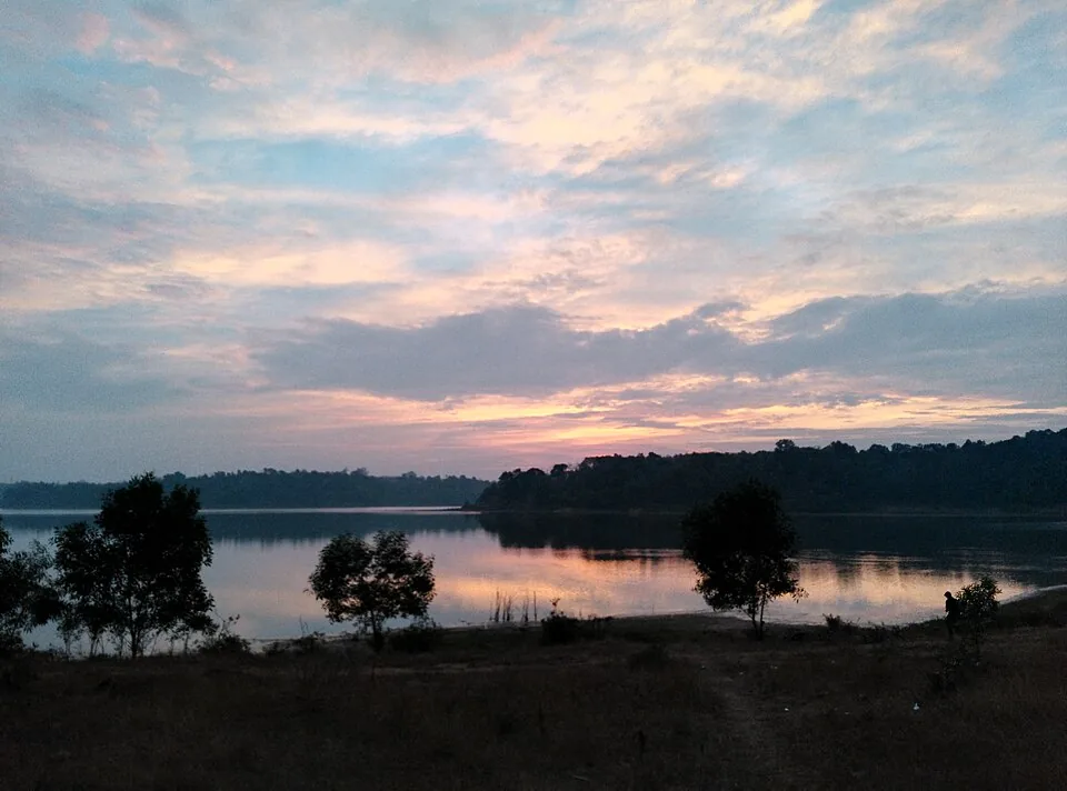
Kerala’s water is riverine and tidal. Forty-four rivers come off the Ghats, meet the sea in a chain of brackish lagoons, and the whole famous landscape of the backwaters is the result. Sasthamcotta Lake is the exception on every count. It is fresh, not brackish. It is deep, not shallow. And it has no river flowing into it and none flowing out. Understanding that one fact explains almost everything about the place — why the water is sweet enough to have supplied a city, why it looks so still, and why it has been draining away for thirty years for reasons no visitor standing on the bank can see.
How it fills
The lake sits in a bowl of low laterite hillocks, closed on the south by an earthen bund that holds it back from the paddy flats. Water arrives three ways. First, directly as rain: the area averages roughly 2,350 to 2,400 mm a year, most of it in the two monsoons. Second, as surface run-off off the slopes of a catchment of about 12.7 sq km. Third, and this is the part that matters, as subsurface recharge — groundwater moving in from the hillocks, from the sedimentary beds beyond the catchment, and from the floodplain that lies to the south and east near the Kallada river. Groundwater accounts for something close to half the annual inflow.
The hillocks are not scenery. They are the lake’s storage system. They soak up monsoon rain and release it slowly downhill through the season, which is why a lake with no feeder stream still holds water in March. The management studies describe them, correctly, as a groundwater reservoir.
How it empties
There are four exits and only one of them is visible. Evaporation from the surface takes something around a fifth of the annual budget. Groundwater seeps out again through the bed and margins. Occasional spillage over the bund is possible but in practice the lake has no spillway. And the Kerala Water Authority pumps, for the district drinking-water scheme. A water-balance study of the lake under normal rainfall found an annual deficit of about 0.438 million cubic metres — that is, in an ordinary year, more leaves than arrives, and the level falls. There is no flush, no spate, no reset. A lake fed by seepage and emptied by seepage is exquisitely sensitive to anything that changes the ground around it.
What changed the ground
Two things, and both were profitable. The laterite hillocks were quarried for construction material, which removed the storage. And the low ground beside the Kallada — sand from the riverbed and floodplain, clay from the paddy — was mined on an industrial scale for decades. In Kallada village alone, local reporting and the panchayat’s own agricultural office put 820 acres of paddy field converted to clay mining, against 400 acres of farmland left.
The hydrology of what followed is not disputed. Digging out the low ground lowered the bed levels beside the lake out of proportion to anything else, which steepened the hydraulic gradient across the lake’s margin. Recharge became drainage. Subsurface water that used to sit in the floodplain and feed the lake began seeping the other way, into the pits. The lake started leaking into the holes dug next to it. A letter from the district collector of Kollam to the district police chief flagged a further risk: that mining in critical stretches of the Kallada could open a path for saline water to reach the lake, and with it the drinking-water supply.
The same river, at the other end
This is the second time the Kallada appears in Kollam district’s environmental story, and it is worth putting the two side by side. At its mouth, the river’s islets at Munroe Island are sinking, because the Kallada Irrigation Project and the Thenmala reservoir cut off the flood-borne sediment that used to rebuild them each year. Upstream of that, beside Sasthamcotta, the same river’s floodplain has been mined out from under a Ramsar wetland. One river, two very different failures, both caused by treating a working watercourse as a supply of material. If you are making a day of it, the connection is the most interesting thing in the district.
What has actually been lost
Figures vary because measurement here is patchy, and that is itself part of the story. What is documented: around 46 acres of lakebed dried out, attributed to sand mining and pumping, and recorded in the research literature by 2015. An expert committee convened in 2010 catalogued soil erosion running at 50 tonnes per hectare per year as far back as 1996, hillock mining, tapioca and plantation encroachment on the slopes, sewage and household waste, filling of the shallows, and weed infestation. In December 2016 the press reported the lake drying. By May 2018 it was reported that nearly half of the lake’s 3.73 sq km had become dry, cracked ground, with the level falling at roughly 50 cm a year, and that the Water Authority had stopped drawing from it after discolouration attributed to iron bacteria.
Meanwhile the number printed on tourism pages is still 373 hectares, or 375, which is the area entered on the Ramsar sheet in 2002. It has not been revised in the copy that reaches visitors.
Listed, but not escalated
Sasthamcotta was designated a Ramsar Wetland of International Importance on 19 August 2002, site number 1212, in the same round as Ashtamudi and the Vembanad-Kol system. It is worth being precise about what that does and does not mean. Ramsar also maintains the Montreux Record, a register of listed sites where ecological character has changed or is likely to — and India has exactly two entries on it, Keoladeo National Park since 1990 and Loktak Lake since 1993. Sasthamcotta is not one of them. Everything above is on the public record, and none of it has triggered the formal escalation.
What is happening now
More than before, and more seriously. The site’s approved management plan is being revised under a GEF-funded wetland biodiversity project, with Wetlands International South Asia working alongside the State Wetland Authority Kerala and the state environment department. A final stakeholder consultation was held at the Sasthamkotta panchayat conference hall on 21 June 2025. The revised plan is built around restoring the hydrological regime, standing up a dedicated Sasthamkotta Wetland Management Unit, community monitoring through the Wetland Mitra network, and waste-management infrastructure — with encroachment, water quality, solid waste and rainfall variability named as the live threats. Separately, the Fisheries Department launched a 2024 plan to restock the endemic manjakoori, Horabagrus brachysoma, one of the species the lake was listed for.
None of that changes what a visitor should do, which is simply this: look at the waterline, and know what you are looking at. The interpretation board at the landing has stood in the lake in some years and on dry ground in others. That, not the boat ride, is what makes Sasthamcotta worth the trip out from Kollam.
Frequently asked questions
Does any river flow into Sasthamcotta Lake?
No. It is filled by direct rainfall of roughly 2,350 to 2,400 mm a year, by surface run-off from a catchment of about 12.7 sq km, and by subsurface groundwater recharge from the hillocks around it and the floodplain to the south — with groundwater making up close to half the annual inflow. It loses water to evaporation, seepage and pumping, and has no spillway.
Why has the lake been shrinking?
Quarrying of the laterite hillocks removed the catchment’s natural storage, and large-scale sand and clay mining in the adjoining low ground and Kallada floodplain lowered bed levels beside the lake, steepening the hydraulic gradient so that subsurface water flows out rather than in. Erosion, encroachment on the slopes and sewage compounded it.
Is Sasthamcotta on the Ramsar Montreux Record?
No. The Montreux Record is Ramsar’s register of listed wetlands where ecological character has changed or is likely to, and India has exactly two entries on it — Keoladeo National Park, added in 1990, and Loktak Lake, added in 1993. Sasthamcotta’s decline is well documented in the scientific and news record but has never triggered the formal listing.