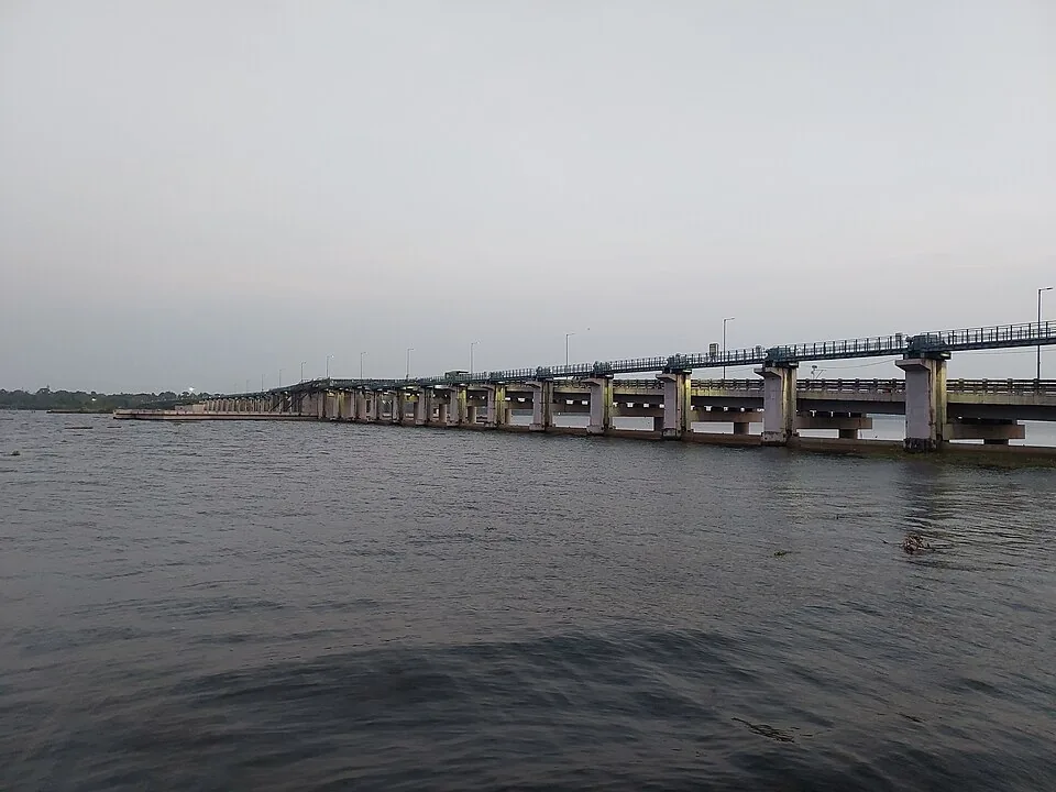
There is a particular kind of public work that never quite arrives: funded, begun, partly built, and then left in a condition that works well enough that nobody has to finish it. The Thanneermukkom barrage is the largest example of the type in Kerala, and for most of its life it had a hole in the middle.
Built from both ends
The Irrigation Department gives the proposed length as 1,402 metres, running between Thanneermukkom on the Alappuzha shore and Vechoor on the Kottayam side. It was approached from both banks. The Vechoor half — thirty-one shutters and two navigation locks — was completed in 1965. The Thanneermukkom half, another thirty-one shutters and one lock, was completed in 1975.
That left the middle: four hundred and twenty-eight metres, designed for twenty-eight shutters and a fourth lock, in the deepest and most awkward part of the crossing. In the department’s own phrasing, it could not be accomplished at that time.
The solution was an earthen cofferdam — a bank of compacted mud thrown across the gap to join the two finished arms. A cofferdam is, by definition, temporary. This one lasted forty-three years.
What that actually meant
It meant that the salt barrier worked, because a mud bank blocks water perfectly well. It also meant that the middle of the structure had no shutters and no lock in it, so the flow regime and the boat routes were shaped by an improvisation rather than by the design. And it meant that the road across the top — the reason most people encounter the barrage at all — ran over packed earth in the middle of the longest lake in India.
Very few of the people who used it knew. From a car window a causeway is a causeway. The remarkable thing about the Thanneermukkom cofferdam is not that it existed but that it became invisible: a temporary measure so long-lived that it stopped registering as temporary at all.
The paperwork that closed the gap
What finally moved it was not a transport argument but an ecological one. In 2010 the M. S. Swaminathan Research Foundation submitted a report on the biodiversity of Kuttanad to the State Government, and among its recommendations was the completion of the barrage’s third stage.
The money followed three years after that. Government Order (Rt) No. 1141/2013/WRD, dated 22 October 2013, sanctioned Rs 255.335 crore. The estimated probable amount of contract was a little over Rs 180 crore and the agreed figure came in at about Rs 174 crore, some 3.75 per cent below estimate. The work went to the Mary Matha–Tomar–Reid consortium of Muvattupuzha. The site was handed over on 1 July 2014, with a contract period of nine hundred and twenty days giving a completion date of 5 January 2017, subsequently extended to 31 December 2018.
The bridge over the central stage opened to traffic on 31 July 2018. We give the order number and the dates deliberately, because this is the part of the story that is never told: the difference between a structure being begun and a structure being finished is usually not engineering but procurement, and here you can read it off the file.
Still not done
And even now it is not quite complete. The Irrigation Department’s own status describes the project as around ninety-five per cent finished, with link islands, beautification works and — appropriately enough — the removal of the old cofferdam still outstanding. A structure started in the early 1960s was, on its owner’s own account, still unfinished sixty years later.
Two numbers you will see elsewhere are worth ignoring. The barrage is very widely described as 1,252 metres long and commissioned in 1976, which does not match the Irrigation Department’s published account of its own structure; that figure does not survive checking. It is also frequently called the largest mud regulator in India, a claim that appears on English Wikipedia without a source and has been copied ever since. It is a reinforced-concrete barrage designed for ninety shutters and four locks, not a mud regulator, and no national inventory we can find supports the superlative.
Frequently asked questions
When was the Thanneermukkom bund actually finished?
The central bridge opened to traffic on 31 July 2018, fifty-three years after the first half was completed in 1965. The Irrigation Department still describes the project as around 95% complete, with link islands, beautification and removal of the old cofferdam outstanding.
What was there before the central stage was built?
An earthen cofferdam — a bank of packed mud joining the two completed arms across the 428-metre gap. It was in place from the mid-1970s until the central stage opened in 2018, and traffic crossed it.
Why is the bund often said to be 1,252 m long and from 1976?
That figure circulates widely in English-language sources but does not match the Kerala Irrigation Department’s own account, which gives a proposed length of 1,402 m and the staged dates of 1965, 1975 and 2018. Where the department and the encyclopedias disagree about the department’s own structure, we follow the department.