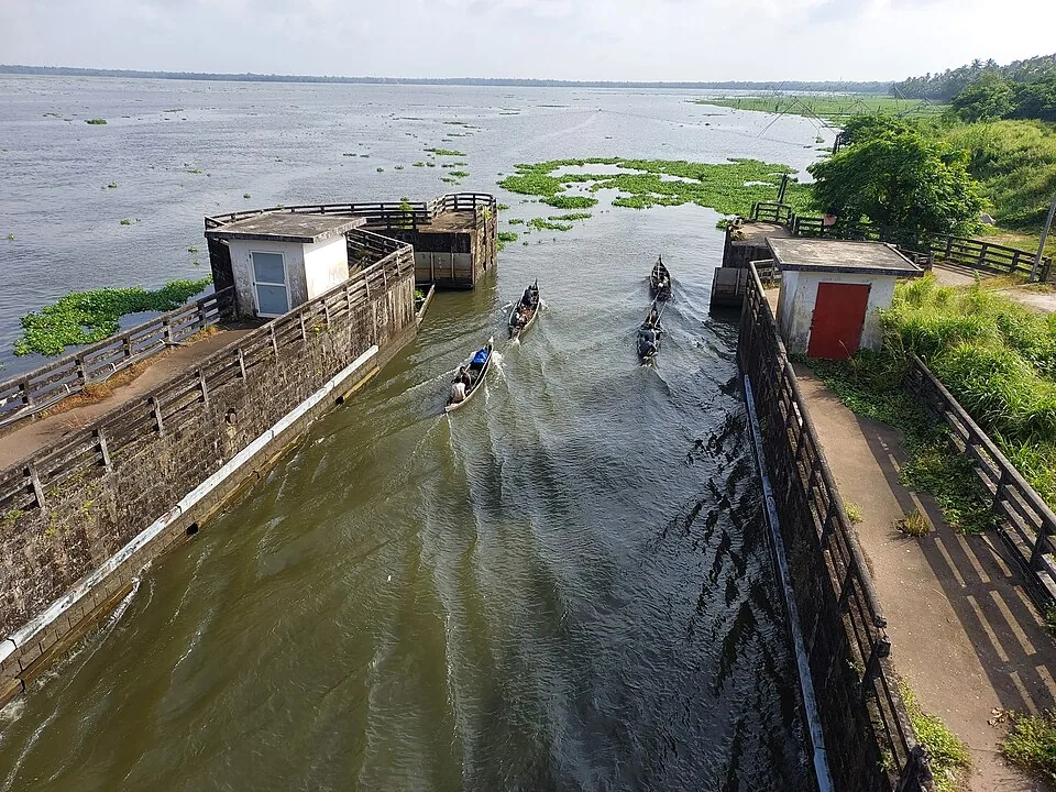
Thanneermukkom is known for a piece of irrigation engineering, which is a slightly unfair fate for a village with a Portuguese garrison, a war, and one of the oldest Christian sites in India within walking distance of a bus stop.
A name about water
Start with what the place is called, because Malayalam sources offer two explanations and they point in different directions. The plainer one is topographic: this is a mukham, a mouth or face, of the kayal — a promontory almost surrounded by water at the point where the backwater opens out. The name simply describes the shape of the ground.
The other is the one people prefer to tell. Namboodiris travelling to the temples along this coast are said to have stopped here to take on drinking water, and the water was good — thanneer is drinking water — so the place became known for it. A rest stop remembered for the sweetness of its wells.
Neither can be proved, and both are old. What gives the second one its edge is what has happened since. The village profile today records serious scarcity of drinking water in this panchayat, and the single largest structure in the parish is a wall built across the lake to keep salt out of the water. A settlement named for abundant fresh water now sits beside a barrage whose entire purpose is to defend fresh water. The name reads less like a label than like a receipt.
Karappuram, the Portuguese, and a war
This coast was not always Travancore, and Thanneermukkom sat in a contested pocket of it. In 1528 a Portuguese military garrison was established here with the support of the local ruler, the Karappuram raja — an arrangement that soured after the raja’s death and brought the village into conflict with the Portuguese commander Dom Cristóvão da Gama.
For more than a century afterwards Karappuram remained semi-autonomous, held by a body of local chiefs and only nominally under the Cochin kingdom. That ended in 1753, when Karappuram and Alangad — tributary territories of Cochin — passed to Travancore under Marthanda Varma. (The Treaty of Mavelikkara, signed the same year, is a different agreement and is often confused with this one: it was made with the Dutch, and it bound them to stay out of Travancore’s expansion rather than settling Karappuram itself.) It is an unusually eventful history for a place most people now experience as a stretch of road between Alappuzha and Kumarakom.
The oldest thing here is not the bund
About 2.9 kilometres from the barrage, on a road named for the two places it joins — the Cherthala–Thanneermukkom road — stands the church at Kokkamangalam. It is counted among the Ezharappallikal: the seven and a half churches that Saint Thomas Christians hold were founded by the apostle Thomas himself in the first century, after he landed on this coast around the year 52.
The other churches on that list are at Kodungallur, Kollam, Niranam, Nilackal, Kottakavu, Palayoor and Thiruvithamcode. Kokkamangalam’s tradition holds that Thomas preached here for about a year and that sixteen hundred people were baptised — and the striking thing is where that account is preserved. It comes down through the Rampan Pattu, a form of old Malayalam Christian folk verse. The community’s founding story survives as a song.
Whatever one concludes about first-century history, the survival of a specific number inside a sung tradition for a very long time is remarkable in itself, and it is the kind of thing that gets lost when a place is described only by its infrastructure.
The ordinary religious geography
Alongside it the village keeps the usual dense mixture of this coast: the Varanattu Bhagavati temple, the Kandankulangara and Ilanjamkulangara temples, the Chali Narayanapuram temple, and further churches at Kannankara and Chali. Nineteen square kilometres of clayey-sandy ground under coconut, with coir societies, shell processing and silica-sand extraction, and Vembanad along the north-eastern edge.
It is worth ten minutes off the road. Most people cross the bund at speed on their way somewhere else, which means they pass within three kilometres of a church that claims the first century and never know it was there.
Frequently asked questions
What does Thanneermukkom mean?
Malayalam sources give two explanations. One is geographic — a promontory at the mukham, the mouth or face, of the backwater. The other is that travelling Namboodiris stopped here for drinking water, thanneer, because it was sweet. Neither is verifiable, and the second has an irony to it, since the panchayat now records serious drinking-water scarcity.
What are the seven and a half churches?
The Ezharappallikal are the churches that Saint Thomas Christians hold were founded by the apostle Thomas in the first century, traditionally listed as Kodungallur, Kollam, Niranam, Nilackal, Kokkamangalam, Kottakavu, Palayoor and Thiruvithamcode. Kokkamangalam, about 2.9 km from the Thanneermukkom bund, is one of them.
Was Thanneermukkom really held by the Portuguese?
A Portuguese garrison was established here in 1528 with the support of the Karappuram raja, and relations broke down after his death. The wider region stayed semi-autonomous under local chiefs until 1753, when Karappuram and Alangad passed from Cochin to Travancore under Marthanda Varma.