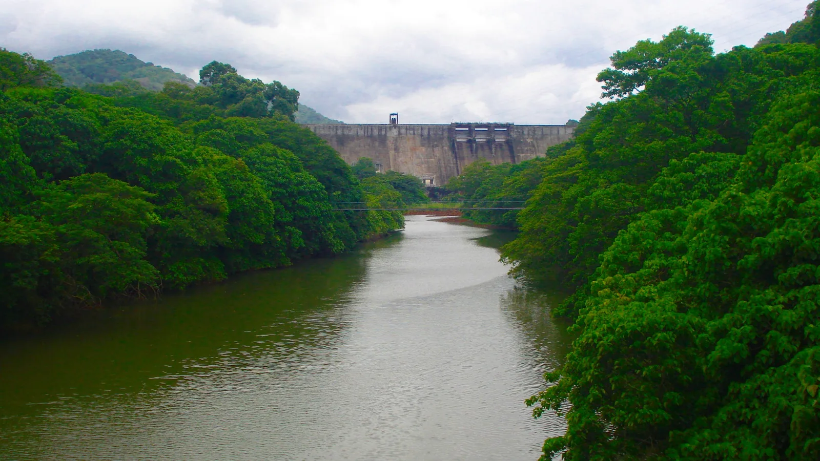
One of the genuinely good things about the view from this dam is that there is nothing on the far shore. No resorts, no houses, no lights at night. We have said before that this is a legal fact rather than an accident, and it is — but the legal fact is odder and more specific than we knew.
The sanctuary on the far shore was drawn around the reservoir. Not near it, not overlapping it: the water’s edge is written into the boundary description as a line.
The notification
Shendurney Wildlife Sanctuary was declared by the Government of Kerala on 25 August 1984, under section 18(1) of the Wildlife (Protection) Act 1972, over 10,032 hectares of the Kulathupuzha Reserve. The schedule gives the district as Quilon and the taluk as Pathanapuram.
Its four boundaries read, in the notification’s own words. North: the boundary starts from Thenmala, passes through a ridge behind the Divisional Forest Office towards east up to Periyamaruthimalai. East: the state boundary, between Periyamaruthimalai and Karimala. South: from Karimalai along the southern boundary of the division up to 5 km, then along the boundary between natural forests and plantation till it reaches the Kallada Reservoir, and then along the southern boundary of Kallada reservoir up to Dam site. West: the limits of the reserve forests between Kallada Dam and Thenmala Forest Office.
Read the last two again. The southern limit of one of Kerala’s strictest protected areas runs along a reservoir shore to a dam. The western limit runs between that dam and a forest office. Two of the four boundaries of this sanctuary are a 1970s irrigation project.
The dates, which are the surprise
The sanctuary was notified in August 1984. The dam was commissioned in May 1986.
So when the boundary was written, the reservoir was already a mappable feature on the ground — impounding had begun — nearly two years before the dam it was made by was formally commissioned. The protected area is younger than the lake it wraps around, and it is drawn to it.
That inverts the usual mental picture, in which a wilderness exists and infrastructure is later pushed into it. Here the engineering came first and the conservation was fitted around the shape it left.
How much of the sanctuary is the lake
This is where it gets arithmetically uncomfortable, and we have to give you a range rather than a number, because the official water-spread figures for this reservoir disagree badly.
The sanctuary is 100.32 square kilometres. KSEB gives the reservoir’s water spread as 13.72 square kilometres. The Central Water Commission gives 23. The Forest Department’s own sanctuary literature gives 26.
So somewhere between about one seventh and one quarter of Shendurney Wildlife Sanctuary is the surface of an irrigation reservoir. Even at the low end that is a striking fraction of a protected area to be man-made water; at the high end it is more than a quarter. We give the range because giving a single number would be pretending the sources agree.
And the river is not the river yet
One more thing that this reframing fixes, and it corrects our own phrasing as much as anyone’s.
It is not really a dam across the Kallada. Three rivers rise in this sanctuary — the Shendurney, the Kulathupuzha and the Kazhuthurutty — and they meet inside the impoundment. The Forest Department describes the artificial lake as formed by the dam built across the Shenduruney, Kulathupuzha and Kazhuthurutty rivers.
Which means the Kallada, as a named river, effectively begins at this wall. The 121 kilometres of river that run west from here to Ashtamudi, past Munroe Island, start at a confluence that is underwater. It is one of the better facts in this district, and it is on the notification.
What it means standing there
The far shore stays empty because the far shore is a sanctuary, and the sanctuary’s edge is the waterline. The sanctuary is named for the chenkurinji tree and sits within the Agasthyamalai landscape; the whole catchment of this irrigation project lies inside it, which is also why the water arriving in the canals is as clean as the 1982 survey found it.
Access beyond the reservoir is controlled for the same reason, and that is not an inconvenience to be worked around. It is the arrangement that keeps the view you came for.
Frequently asked questions
Is the reservoir inside Shendurney Wildlife Sanctuary?
Effectively yes. The sanctuary’s 1984 notification draws its southern boundary "along the southern boundary of Kallada reservoir upto Dam site" and its western boundary between the dam and the Thenmala forest office — so two of the four legal boundaries are the reservoir and the dam.
When was the sanctuary declared?
On 25 August 1984, under section 18(1) of the Wildlife (Protection) Act 1972, over 10,032 hectares of the Kulathupuzha Reserve in what the notification calls Quilon district, Pathanapuram taluk.
Which came first, the sanctuary or the dam?
The reservoir. The sanctuary was notified in August 1984 and the dam commissioned in May 1986, but impounding had already begun and the boundary was written to the water. The protected area is younger than the lake it wraps around.
How much of the sanctuary is water?
Between about a seventh and a quarter of it. The sanctuary is 100.32 sq km; official water-spread figures for the reservoir are 13.72 sq km (KSEB), 23 sq km (Central Water Commission) and 26 sq km (Forest Department literature). We give the range because the sources genuinely disagree.
Is the dam really across the Kallada?
Not simply. The Shendurney, Kulathupuzha and Kazhuthurutty rivers meet inside the impoundment, and the Forest Department describes the lake as formed by a dam built across all three. The Kallada as a named river effectively begins at this wall.
Why is nothing built on the far shore?
Because it is inside the sanctuary, whose boundary is the waterline. The entire catchment of the irrigation project lies within the protected area, which is why the far shore has no buildings and why access beyond the reservoir is controlled.