Eastern Ernakulam has one great legend and it is told everywhere except at the place it is about. Demons — bhoothams — set out to dam the river in a single night, in order to flood the country upstream and submerge a Shiva temple. Shiva beat them with a trick rather than a fight: he counterfeited the dawn, a cock crowed, and they dropped everything and fled the light. The boulders they abandoned are still lying in the riverbed.
You will hear that at Bhoothathankettu, whose name means the demons’ dam. You will hear it at Paniyeli Poru, standing on the boulders in question. You will hear it from boatmen and guides along the whole rock-strewn reach of the Periyar.
You will very rarely hear it at Thrikkariyoor, which is the temple in the story. Without this building the legend has no stakes, no target and no plot — and the building sits quietly a few kilometres away with no interpretation panel and nobody stopping.
Then look at a map
Bhoothathankettu is on the Periyar. Thrikkariyoor Mahadeva Temple stands on the northern bank of the Kothayar, a tributary of the Muvattupuzha — a separate river system, about eight kilometres away across the divide.
Damming the Periyar at Bhoothathankettu does not, on any straightforward reading of the ground, put water over Thrikkariyoor. The state has in fact dammed the Periyar at that exact spot, with a barrage completed in 1964 and fourteen shutters on it, and the temple is entirely dry. If the bhoothams had finished the job they would have flooded the Periyar valley, drowned a great deal of forest — which is, as it happens, precisely what the barrage did — and left the temple untouched.
Which makes the story better, not worse
A legend that fails a hydrology check is not a legend that has been caught lying. It is a legend showing you its working.
What survives in these stories is rarely a plan. It is an event and a feeling: water came, the temple was in danger, and afterwards people needed an account of why. The most arresting feature in the landscape is a field of enormous boulders sitting in a riverbed as if placed there — which does not look like something a river did, and looks very much like something abandoned. Put the two together and you have a night’s work interrupted before dawn.
The documented candidate for the water is the great Periyar flood dated to 1341, the most consequential event in this river’s recorded past — the one that choked the ancient port at Kodungallur with silt, opened a new mouth to the sea, deposited the land that became Vypin island, and in doing so handed Kochi its harbour. There is no eyewitness account of it. What survives instead is a dating system: the Puthuvype Era, the Era of the New Deposit, counted from 1341. People did not write the flood down. They started counting from it, and inland they told a story about demons.
A temple that was emptied
Thrikkariyoor has a second gap between its reputation and its fabric, and it has the same explanation shape. Devotional tradition counts it as the last of the 108 Shivalayas consecrated by Parasurama — the closing consecration, not an entry in the middle. Local historical tradition, supported by scholars including Prof. Joseph Mundassery and V. Kanakasabhai, holds that this was Karuvoor, a headquarters of the early Cheras. Both are large claims.
What stands is a modest working village temple. The reason is on the record: accounts of the Pandyan attack hold that the population fled and that Kothamangalam and its surroundings were left uninhabited for two centuries across the eighth and ninth centuries. The institution is very old. The building is what came back afterwards. Kerala conflates those two things constantly, and almost never says which one a date refers to.
What to look at, since you are stopping
The compound runs to about four acres and faces east, with towers on the eastern and western sides. The sreekovil is a large rectangle — worth registering, because square and circular sanctums dominate in Kerala — and rises in two floors under copper. On the balikkal mandapam, look up for wooden carvings of the Ashtadikpalakas, the guardians of the eight directions, together with Brahma. The flagmast is teak sheathed in copper, there is a large pond in front, and the sanctum’s mural paintings were restored in 2013. Photography is not permitted inside the sanctum.
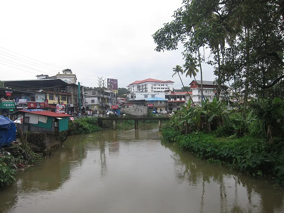
Then walk down to the water, which is the five minutes most visitors skip. The river is why the temple is here — the arattu, the concluding procession of the Meenam festival, ends at it — and it is also the quiet correction to everything else you will be told on this road. Everybody driving east from Kochi treats this as one landscape with one river running through it. It is two.
Frequently asked questions
Which temple were the demons trying to drown?
Thrikkariyoor Mahadeva Temple at Kothamangalam. The bhootham legend told at Bhoothathankettu and along the Periyar rock fields has this building as its target — it is the reason the story has any stakes — and it is almost never told at the temple itself.
Is Thrikkariyoor on the Periyar?
No. It stands on the northern bank of the Kothayar, a tributary of the Muvattupuzha, about eight kilometres from Bhoothathankettu across the divide. The other sites on the same day out — Bhoothathankettu, Paniyeli Poru, the Thattekkad sanctuary — are all Periyar sites.
Does that mean the legend is wrong?
It means the legend is not a plan. Stories of this kind preserve an event and an explanation assembled afterwards, not a survey. The boulders in the Periyar look placed rather than deposited, the temple was remembered as having been in danger from water, and the two got joined. The documented candidate for the water is the great Periyar flood dated to 1341.
What is the 1341 flood?
The most consequential recorded event on the Periyar. Silt it carried down choked the ancient port at Kodungallur, the river cut a new mouth to the sea, and the material deposited along the coast built new land including Vypin island — creating the sheltered harbour that made Kochi. No eyewitness account survives; the evidence is the Puthuvype Era, a dating system that counts its years from 1341.
Why does such an important temple look so ordinary?
Because the place was emptied. Accounts of the Pandyan attack hold that the population fled and the area stood uninhabited for two centuries across the eighth and ninth centuries. Thrikkariyoor is old as an institution — counted in tradition as the last of Parasurama’s 108 Shivalayas, and argued by some historians to be the early Chera seat of Karuvoor — but the fabric standing today is what returned afterwards.
What should I look for inside?
A roughly four-acre east-facing compound with towers on the east and west; a rectangular sreekovil in two copper-covered floors; wooden carvings of the Ashtadikpalakas and Brahma on the balikkal mandapam; a copper-sheathed teak flagmast; a large frontal pond; and sanctum murals restored in 2013. Then walk down to the river, which is where the festival ends.