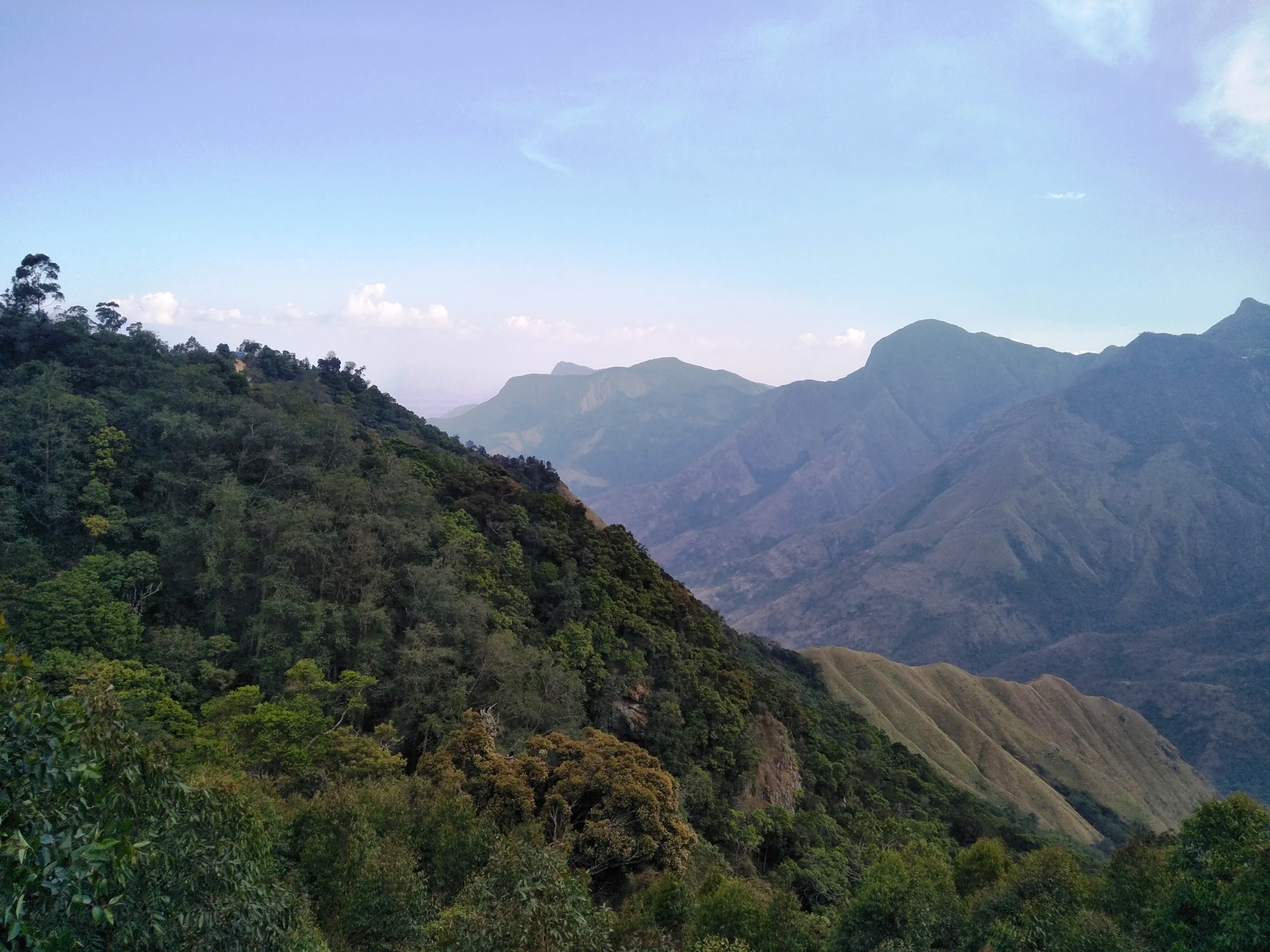
A wide photograph of Top Station can flatten the very thing that makes the view memorable: distance. Hills overlap until they resemble a single wall of green. On site, a slower look separates the near ridge, the folds beneath it and the high ground across the valley. That sequence is the beginning of understanding the outlook, especially when cloud changes what is visible.
Start with the nearest ridge
Use a tree or the edge of a wooded slope in the foreground as a reference. The nearest leaves remain sharply defined while more distant ridges soften. This difference gives the valley depth even without a named peak in the frame. A useful photograph can preserve that foreground instead of cropping it away in pursuit of an uninterrupted panorama.
Below the viewpoint, the land folds repeatedly. Some hollows carry dense tree cover; other slopes show more open vegetation or exposed rock. Their textures tell different parts of the landscape apart. It is enough to observe those contrasts without assigning a forest type or a species name that cannot be recognised at such a distance.
Cloud changes the composition
A cloud bank can hide the far crest while leaving the lower valley visible. At another moment, the distant ridge may clear while a nearer fold disappears. The view is therefore a succession of arrangements rather than one permanent postcard. Waiting at a safe viewing position can reveal more than moving repeatedly between exposed edges in search of a completely clear horizon.
Haze has a different effect from a solid cloud bank. It reduces contrast gradually, turning the farthest slopes pale while the near vegetation stays dark. In a photograph, that can make the outline of a ridge more important than its surface detail. The best frame may contain only a few layers, each visibly separate, rather than the widest possible angle.
The approach belongs to the picture too
Before the roadhead, tea fields give the hills a more ordered texture. Rows, field boundaries and estate buildings show a worked landscape. The final valley view shifts attention towards steeper terrain, where the regular pattern of cultivation gives way to less uniform slopes. Remembering both parts of the journey makes the change at Top Station more striking.
That change also connects the scenery with the place’s former transport role. Goods leaving the tea country had to cross a sharp difference in level. The view makes the challenge imaginable, although the engineering history belongs to the railway and ropeway story rather than to guesses about every line on the hillside.
A border view reached through Munnar
Top Station’s usual visitor itinerary begins in Kerala, but its viewpoint entrance lies in Theni district, Tamil Nadu. The state boundary and the road journey describe different things: one fixes the physical location, the other explains how many visitors arrive. Neither changes the shape of the valley, but keeping them clear prevents confusion when arranging a pickup or considering a separate Kurangani trek.
Let the visit end with a view you can actually read. A near tree, a wooded fold, an open ridge and a moving edge of cloud are enough to convey the place. There is no need to promise a distant landmark, a flowering event or a perfectly clear sunrise for the landscape to hold a visitor’s attention.
Location: Theni district. Historical landscape context: Kerala Tourism.
Plan the visit: Top Station.