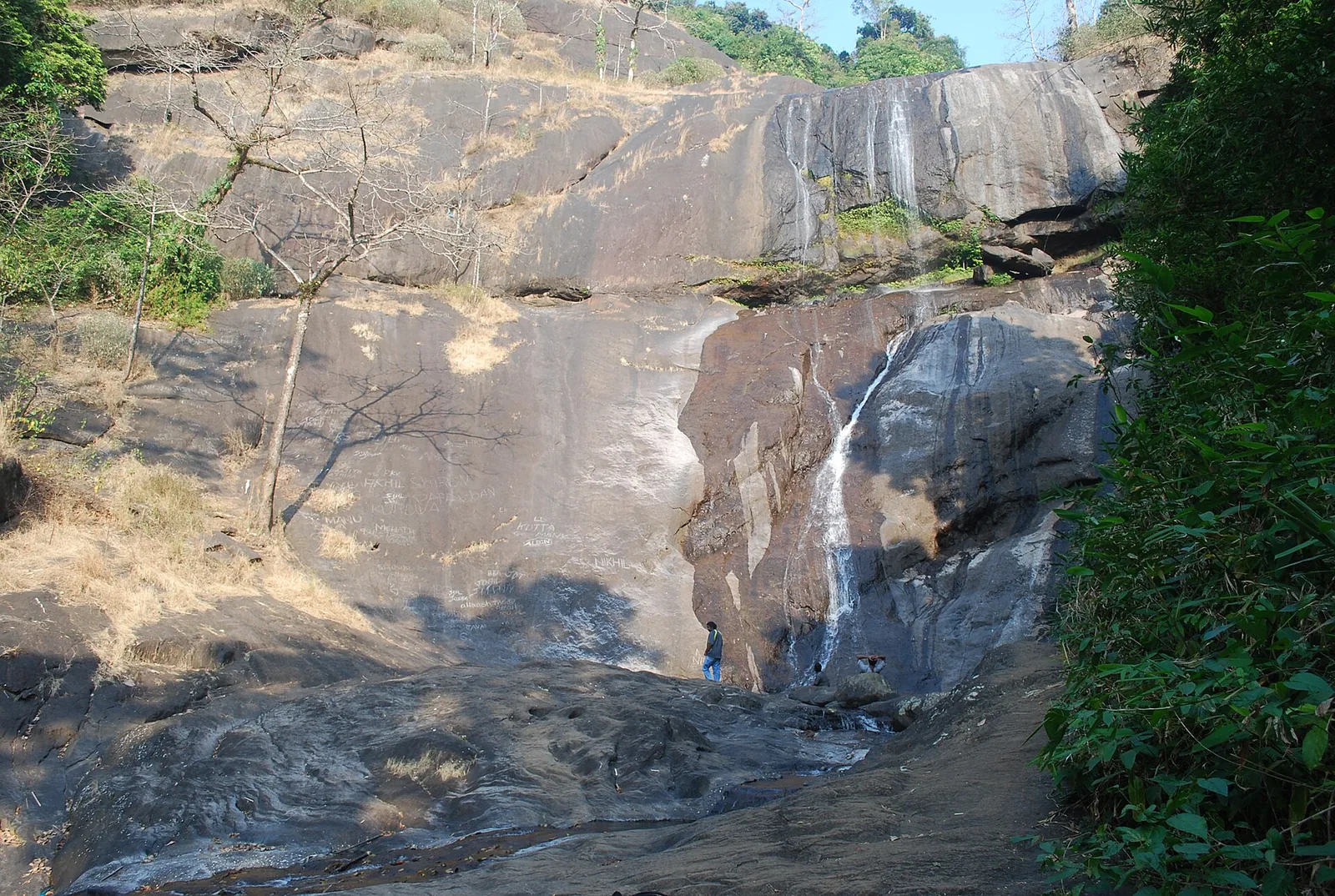
Stand at the foot of the first fall at Tusharagiri on a good day in October and it is easy to read the scene as pure nature: a river coming off the Western Ghats, a long grey apron of rock, spray standing in the gorge. It is a fair reading, but it is incomplete. The Chalippuzha at this point is a working river as well as a scenic one, and has been for over twenty years. A few kilometres of its course below the falls carries a small hydroelectric diversion, and the flow you are watching is the flow that is left.
A weir with no reservoir
The structure is the Chembukkadavu weir, commissioned in 2003 and operated by the Kerala State Electricity Board. It is a trench-type diversion weir with no spillway and no reservoir — which is to say it does not impound the river into a lake, it takes water off it and sends it through a tunnel to a powerhouse. Three turbines produce about 2.7 megawatts, and the scheme is credited with roughly 6.59 gigawatt-hours a year. Water that has passed through that station does not simply return to the landscape either; it is used again downstream at a second stage, Chembukadavu II.
The scheme sits within the Kuttiady Augmentation Scheme, a set of works intended to add water and generation to the older Kuttiady hydroelectric project to the north. One secondary source describes Chembukadavu as the first of several small hydroelectric schemes developed by KSEB with an overseas partner; treat that partnership detail as uncorroborated. The commissioning date, capacity and run-of-river design are better documented.
None of this makes the falls fake. Run-of-river schemes on Kerala’s hill streams are small, and the volume that comes down the Chalippuzha in a normal monsoon is far more than a 2.7 MW station could take. But it does mean that the phrase you will read on almost every travel page about Tusharagiri — that the falls never dry up, that they can be visited in any month — is a claim about a river whose flow is partly a management decision, in a catchment that is getting hotter.
May 2024: the claim failed publicly
Kerala’s press reported the Thusharagiri falls dry after a record-hot summer, the rock bare, and the eco-tourism centre’s arrivals down by roughly two thousand on the same month a year earlier — about 15,000 visitors in April 2024 against about 17,000 in April 2023. The Forest Department, which had by then been running the site for nineteen years, could do nothing but advise people to come back after the monsoon. A destination whose entire proposition is falling water had, for a season, no falling water.
May 2025: the opposite failure
On the afternoon of 13 May 2025 an unexpected flash flood came down the Chalippuzha at Chembukadavu. What made it notable was not its size — no significant damage or casualties were reported — but its origin. There had been little rain in the lower Chembukadavu area. The water came from the hills above, arriving in a valley where the sky looked unthreatening. That is the specific hazard of a short, steep Ghats catchment, and it is the reason the safest habit at Tusharagiri is to watch the ridge rather than the weather over your own head.
The same report carried a second detail that says a good deal about the place. A newly built bridge across the river at Chembukadavu was standing closed, because its approach road had been under slow construction for months; the previous year’s monsoon had breached the water at the old crossing repeatedly, and residents were pressing for the approach to be finished before the rains came again. A valley with a hydroelectric station, a ticketed eco-tourism gate and a tall concrete arch bridge over the gorge was, that month, still waiting on a road.
Where the water goes
The Chalippuzha is formed just above the falls where two hill streams meet, runs down past Chembukadavu, and joins the Iruvanjipuzha — also written Iruvazhinjipuzha — about three kilometres north of Thiruvambady. The Iruvanji collects other tributaries on the way, Muthappanpuzha at Anakkampoyil among them, and joins the Chaliyar at Koolimadu near Cheruvadi. The Chaliyar carries the lot past Mukkam and out to the Arabian Sea at Beypore, where the wooden uru dhows are built. The water you photograph on the rock leaves Kerala through one of the oldest working ports on the coast.
That chain matters for a practical reason as well as a poetic one. Because the Chalippuzha is a headwater of a much larger system, its flow at Tusharagiri responds to rain that fell somewhere you cannot see, hours before it reaches you. It is not like a coastal river with a long, slow, forgiving catchment. It is short, steep and fast, and the interval between a downpour on the ridge and a surge across the rock at the falls can be startlingly brief.
How to plan around a working river
Come between September and December, when the post-monsoon river genuinely fills the rock face and the trails are passable. Accept that in a hot April the falls may be a trickle, or nothing, and that no website can promise you otherwise. Treat any red or orange weather alert as a closure — Kerala Tourism closes tourist spots district-wide during them, and prohibitory orders are now issued under Section 163 of the BNSS, which carries prosecution rather than a fine. And when you are standing on the rock, remember that the river is not performing for you. It has other commitments.
There is something clarifying, rather than disappointing, in knowing this. Tusharagiri is often sold as untouched wilderness, and it is not: it is a managed river in a settled valley, with a power station on it, a ticket gate at its entrance and a tunnel being bored through the hills a few kilometres to the south. Seeing it accurately does not make the rock smaller or the spray less cold. It just makes the place legible — a working Western Ghats valley, doing several jobs at once, one of which happens to be beautiful. The rest of the district is on the Kozhikode hub.
Frequently asked questions
Do the Tusharagiri falls ever dry up?
Yes, despite the common claim that they run year-round. In May 2024 Kerala’s press reported the falls dry after a record-hot summer, with visitor numbers at the eco-tourism centre down by roughly two thousand on the same month the previous year. September to December, after the monsoon, is when the fall is reliably a fall.
Is there a dam on the river?
Not a dam, but a weir. The Chembukkadavu scheme, commissioned in 2003 and run by the KSEB, is a trench-type run-of-river diversion with no spillway and no reservoir: it takes water off the Chalippuzha and passes it through three turbines for about 2.7 MW, then uses it again downstream at Chembukadavu II.
What is the flash-flood risk?
Real, and it arrives from weather you cannot see. On 13 May 2025 a flash flood came down the Chalippuzha at Chembukadavu with almost no rain falling locally — the water came off the hills above. Watch the sky over the ridge rather than over your own head, and stay out of the water entirely during any red or orange alert, when tourist spots are closed district-wide.