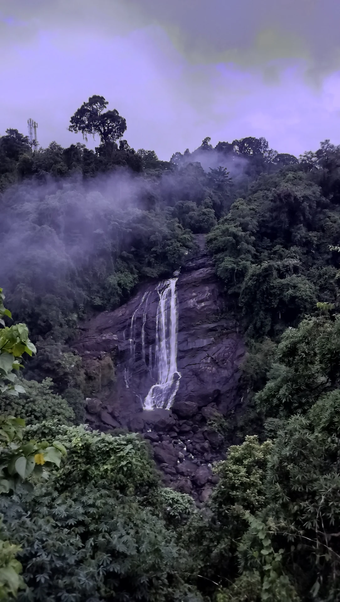
The journey from Neriamangalam towards Adimali brings road travellers into a landscape of wooded slopes and steep watercourses. Valara is one of the places where that descent of water becomes plainly visible. The road gives a view into the river landscape, but it follows its own engineered alignment rather than providing a continuous path along the stream.
A local river name matters
Kerala Tourism’s current combined destination account identifies Valara with the Deviyar. OpenStreetMap also maps the named Deviyar through the waterfall location. Older tourism wording sometimes uses the broader Periyar name. The useful geographical distinction is between the local watercourse carrying the cascade and the larger Periyar basin to which it belongs.
Keeping those scales separate avoids turning a general basin label into a claim that the visitor is looking at the main Periyar channel. It also gives Valara a more precise identity than a generic “waterfall near Munnar”. The cascade belongs to a particular drainage line on the Neriamangalam–Adimali approach.
The road crosses a different kind of landscape from central Munnar
Valara is encountered before reaching Munnar’s town and high tea-estate scenery from the western approach. Its immediate visual character is forest and exposed waterfall rock. A tea-plantation photograph may represent a later part of the journey, but it does not explain the waterfall’s own setting.
That distinction helps with timing and expectations. Valara works as a stop on the road corridor when conditions permit. It should not be described as an attraction within Munnar town, nor should its proximity on a tourist itinerary be converted into a fixed driving time. Traffic and conditions on the approach determine the actual journey.
Watch how the drop uses the rock
The visible water narrows and broadens as it crosses the rock face. Projections divide the flow; ledges interrupt it; the lower cascade meets a field of larger boulders. Vegetation frames the scene and partly conceals what happens above and below the view. A roadside photograph shows a reach of the river, not the whole watercourse.
This is why following the stream in imagination is different from following it on foot. A forested gap beside the road does not establish an accessible riverside trail. The sensible viewing position remains the authorised roadside area, with no assumption that the waterfall lip or base can be reached safely.
Seasonal flow belongs to the catchment
Rainfall over the contributing slopes affects what reaches the cascade. Kerala Tourism describes the monsoon and post-monsoon period as visually stronger and the drier season as less forceful. The flow on a particular day depends on conditions beyond the small patch of sky visible above the roadside.
A sunny interval at the viewpoint therefore does not prove that water upstream is low or stable. Equally, a modest cascade in one photograph is not a promise that the waterfall is always slight. Treat the water as a changing part of the catchment, and use current local conditions for the visiting decision.
The route is part of the experience
The broader journey includes towns and road junctions that provide services more reliably than an assumed facility at the waterfall edge. Arrange food, a longer rest or a transport change at an actual settlement. Let Valara remain a focused viewing stop rather than expecting the roadside to provide every part of a day visit.
Seen this way, the cascade marks a transition in the western approach to the high ranges. It reveals the force and direction of a local watercourse within the Periyar basin, while the road carries travellers onward towards Adimali and Munnar. The two journeys meet in the view without becoming the same route.
Sources and further reading
Kerala Tourism: current Deviyar identification