This article exists because of two hours on a Sunday afternoon.
On 13 April 2025, between roughly 15:51 and 16:42, a group from the Wikimedians of Kerala user group walked down the laterite track at Kalladathanni, crossed the footbridge, came out onto the rock, and photographed it. They uploaded forty-one images under a CC BY-SA 4.0 licence, credited to SijiR and Manojk. Every photograph on our pages for this waterfall comes from that afternoon. There is no other usable set.
What the internet had before that
Not much. A short blog write-up of a visit in January 2016. A DTPC Kollam listing of a couple of hundred words. A scatter of aggregator pages recycling the same paragraph, several of them with the distances wrong and at least one with the district wrong. A Facebook page. That was more or less it, for a river site with a hundred metres of open rock in a district that receives a great many visitors.
It is easy to assume that everything is photographed now. For the headline places, it is. For the ordinary countryside of a state as visited as Kerala, it very much is not, and Vattathil is a clean demonstration: a place perfectly pleasant, entirely accessible, six and a half kilometres from a bus stand on a major road — and effectively invisible until eight people with cameras decided otherwise.
What the two records show when you line them up
Because we have an account from 2016 and a photographic record from 2025, a few things about this place can be dated rather than guessed. That is rare for a site with no management and no paperwork.
The most useful is the crossing. The 2016 writer describes reaching the falls over a wooden bridge made from two coconut trunks, and warns about it. The 2025 photographs show a narrow concrete footbridge with steel-pipe railings running through the rubber estate. Somewhere in those nine years, somebody built a bridge.
That matters practically, because the coconut-trunk warning is still circulating in copied travel write-ups and it will put people off a walk that is now unremarkable. If you have read that this site involves a hair-raising log crossing, that information is at least a year out of date and probably several.
The second change is navigation. In 2016 visitors found the falls by asking for Kalladathanni bridge. Today the falls, a second cascade and the approach road appear on current maps, and the site has both a Wikimedia Commons category and a DTPC listing. It remains obscure, but the public footbridge and named approach make arrival much clearer.
And what the photographs show that the write-ups do not
This is the argument for looking at pictures rather than reading about places, and it worked three times here.
The first is the falls themselves. Every text description has to reach for the word waterfall, which sets an expectation of height that the site does not meet. One frame settles it instantly: a broad rock apron, water sliding across it in braided chutes a half-metre high, and a wide flat pool below. DTPC’s odd little sentence about a waterfall that does not particularly fall turns out to be exact.
The second is the far bank. In one frame there is an unfinished concrete building on the rock across the river — pillars, a slab, a black water tank, no roof. No write-up mentions it. We do not know what it is and we are not going to speculate, but a reader arriving expecting untouched forest ought to know that the opposite bank is being built on. That sits uneasily beside the reported attempts to quarry an adjoining eleven acres, and the local action council formed to oppose them, though the two are not necessarily connected and we are not connecting them.
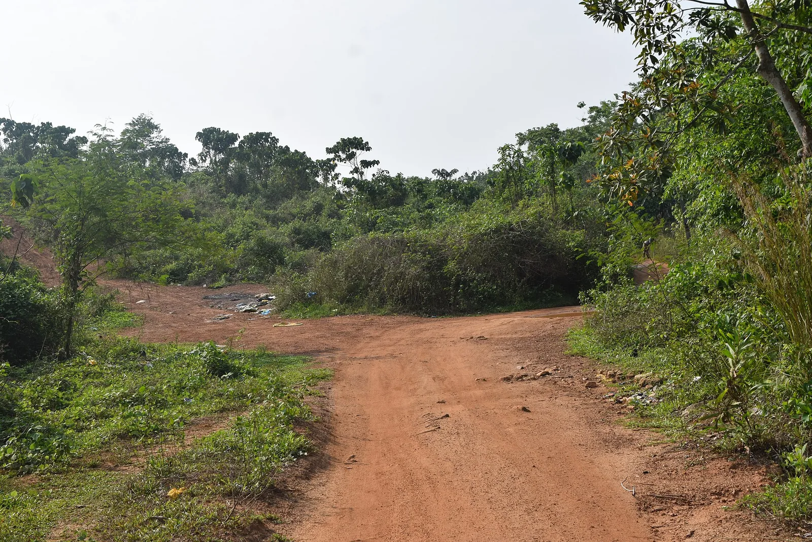
The third is the litter, which is at the top of this page. The approach track has fly-tipping on the verge. It is not the photograph anyone would choose to sell a destination with, which is exactly why it is here: this is what an unstaffed site with no bins and no warden looks like, and the only person who is going to carry your rubbish out of Vattathil is you.
A note on one photograph we did not use
Among the forty-one is a group selfie of the photowalk party — nine people including two children, faces clear, at the water’s edge. It is a nice picture and it is properly licensed, and it appears on none of our pages.
Two reasons. It is not a photograph of the place, and its filename gives no hint that it is anything other than a shot of the falls, which is a decent argument for opening every image before publishing it. And a licence that permits reuse is not the same thing as a reason to put identifiable strangers, and particularly identifiable children, on a commercial travel page. We are grateful to them for the other forty.
Frequently asked questions
Why does every photograph credit the same two people?
Because they are the only usable photographs that exist. All 41 images of Vattathil on Wikimedia Commons come from one Wikimedians of Kerala user group photowalk on the afternoon of 13 April 2025, credited to SijiR and Manojk under CC BY-SA 4.0.
Is the log-bridge crossing still there?
No, and this is the most useful out-of-date warning to correct. A 2016 account describes crossing on two coconut trunks; the April 2025 photographs show a narrow concrete footbridge with steel railings through the rubber estate. The scary-crossing descriptions still circulating are stale.
Is the site under threat?
Reported, not established. One Malayalam account describes attempts to quarry rock from an adjoining property of about eleven acres and a local action council formed to oppose it. We could not corroborate the acreage or the applications from a second source. What is not in doubt from the photographs is that construction has already reached the far bank.