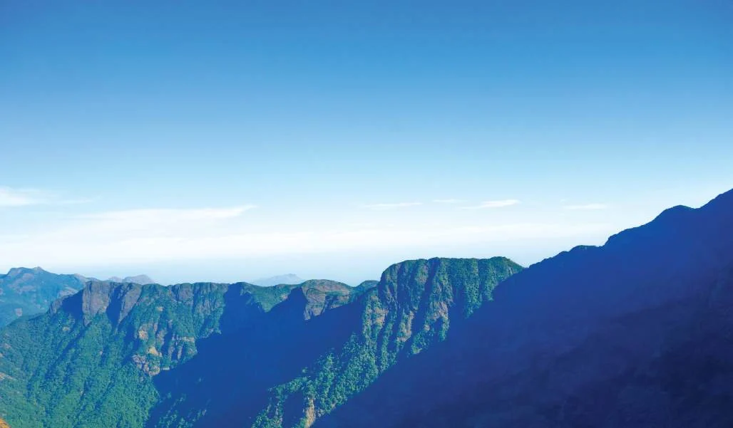
Vellarimala has two faces, and almost every account of trekking it conflates them. From the west, in Kozhikode district, the massif is a wall — the ground climbs from near sea level at the coast to 2,339 metres at Vavul Mala in a distance that leaves the mountain no room to be gentle. From the east, on the Wayanad plateau, the same crest is only a few hundred metres above the tea gardens, because the plateau itself sits at around 700 to 900 metres. The result is that the Kozhikode approach is a mountaineering-grade slog and the Wayanad approach was, historically, a walk. They are not two versions of one trek. They are two different undertakings that happen to share a summit.
The Kozhikode route
This is the classic one, and the one Kerala Tourism’s ecotourism listing is named for: Vellarimala — trek to Vavul Mala. Its starting point is Muthappanpuzha, about three kilometres beyond Anakkampoyil and roughly fifty kilometres from Kozhikode city, reached by bus from Thiruvambadi or by road via Thamarassery. Jeeps run from Muthappanpuzha to a higher base. From there the standard description is about nine kilometres on foot through dense forest and rocky ground, with sustained pitches at inclines of thirty-five degrees and more.
It is commonly called one of the toughest treks in South India, and the published route notes support that. It is a two-day undertaking: a full day to reach the summit area, a night out, and the return the following day. There is no infrastructure — no shelter, no water points, no signage, and no reliable mobile coverage. Elephants use the forest, and leeches use everybody. The Olichuchattam waterfall, about six kilometres up, is the one recognisable landmark on the way. Every serious description says the same two things: get permission from forest officials first, and take a guide.
The Wayanad route, and why it is gone
The eastern approach was different in kind. From Meppadi the road ran up through the tea belt to Chooralmala and on to Mundakkai, and from those estate villages the walk onto the high ground was, in the words of one widely-copied route description, a moderate climb. That is why the internet still offers it as the easier alternative. It is also why the internet is now dangerously out of date, because Chooralmala and Mundakkai were destroyed on 30 July 2024 and their people have been rehoused in a township at Elstone Estate near Kalpetta. The gentler route onto Vellarimala ran through settlements that no longer exist.
It is worth being precise about why that matters beyond the obvious. A trekker following pre-2024 notes would not merely find the road different. They would arrive, unbriefed, in a landscape of debris and recovery works, in a panchayat where a very large number of people died, and would be asking directions of a community that has spent two years being asked about it. The polite thing and the safe thing coincide: do not use the eastern approach, and do not treat the affected villages as a waypoint, a viewpoint or a photograph.
The western approach has changed too
Few route descriptions register this. Anakkampoyil is now the western portal of the Anakkampoyil–Kalladi–Meppadi tunnel road — 8.73 kilometres of alignment, 8.1 of it twin-tube, four lanes, ₹2,134.5 crore, implemented by Konkan Railway Corporation. The foundation was laid on 31 August 2025, Stage-II forest clearance for 17.263 hectares came on 24 February 2026, and rock blasting began in March 2026. The trek base sits beside a major civil-engineering site, and the approach roads carry construction traffic.
Then came Kalladi. On 7 July 2026 a landslide at Kalladi near Meppadi — the eastern end of that same tunnel alignment, about five kilometres from the 2024 crown zone — killed three people and left five missing. Officials attributed it to large volumes of excavated spoil stored near the exit portal and mobilised by monsoon rain. The geoscientist C. P. Rajendran observed that tunnelling alters stress distribution within hill slopes and creates fractures that can fail under intense rainfall; the ecologist C. K. Vishnudas called it an engineering failure imposed on an inherently fragile mountain, noting that 200 millimetres of daily rain had been enough. Whatever a reader concludes about the tunnel’s merits, the practical point stands: both ends of this massif are active ground.
Permission is not a formality
Casual listings get this wrong. DTPC Kozhikode’s Vellarimala page lists no entry fee and hours of 8:00 am to 4:00 pm, which reads like a gate you can turn up at. It is not. The terrain on the Kozhikode flank falls under the Kerala Forest Department’s Thamarassery and Thiruvambadi side of the division; on the Wayanad flank it falls under the South Wayanad Forest Division. Permission is granted case by case, and it is granted for a party with a guide, not for an individual with a map.
Blanket closures are frequent and have nothing to do with your fitness. On 17 February 2024 the Kerala High Court ordered a string of Wayanad ecotourism centres shut over human–animal conflict — Soochipara, the Chembra Peak trekking trail, Kuruva, Meenmutty, Muthanga, Tholpetty, Brahmagiri and others — and they stayed shut for months, reopening only in late September 2024. Red-alert rainfall has since brought bans on entry to all tourist spots across Kozhikode, Idukki and Wayanad, with trekking and adventure tourism suspended and a complete ban on ecotourism centres and water bodies. A trek page that quotes fixed opening hours is describing a fiction.
Who should not attempt this
Anyone without a permit. Anyone without an experienced local guide who has been on the mountain recently — not in 2019. Anyone who is not equipped to spend an unplanned night out at altitude in cold rain, because the weather here turns without negotiation. Anyone travelling in or near the south-west monsoon, roughly June to September, when the slopes are saturated and the whole massif is under active landslide watch. Anyone who has read a nine-kilometre figure and assumed it means a day walk. And anyone whose reason for coming is that they read about what happened here in 2024.
What is left, honestly, is a short list: a small number of experienced, permitted, guided parties in the dry months, and everybody else looking at the Camel’s Hump from below. From the Thusharagiri and Anakkampoyil foothills, or from the Meppadi tea belt on a clear morning between about December and March, the crest stands clear before the cloud builds. That is a real thing to have seen, and it costs nobody anything (indicative — confirm current access and conditions with the forest range office and district administration before travelling).
Frequently asked questions
Can I still approach Vellarimala from Chooralmala?
No. Chooralmala and Mundakkai were destroyed on 30 July 2024 and their surviving residents rehoused at Elstone Estate near Kalpetta. Route descriptions still offering Chooralmala as the easier approach were written before the disaster and never updated. It is a rehabilitation and recovery landscape, not a trailhead.
What does the Kozhikode-side route involve?
It starts from Muthappanpuzha, about 3 km beyond Anakkampoyil and roughly 50 km from Kozhikode city, with around nine kilometres of steep forest walking from the vehicle base and a night out on the mountain — commonly called one of the toughest treks in South India. There is no shelter, no water point, no signage and no reliable mobile coverage, and it requires forest permission and a guide.
Do I need permission, and from whom?
Yes. On the Kozhikode flank, from the Kerala Forest Department range office covering the Thamarassery and Thiruvambadi area; on the Wayanad flank, from the South Wayanad Forest Division. DTPC Kozhikode’s listing of no entry fee and 8am–4pm hours does not substitute for range-office permission, and district administrations impose blanket closures during red-alert rainfall.
