Sitheri Hills

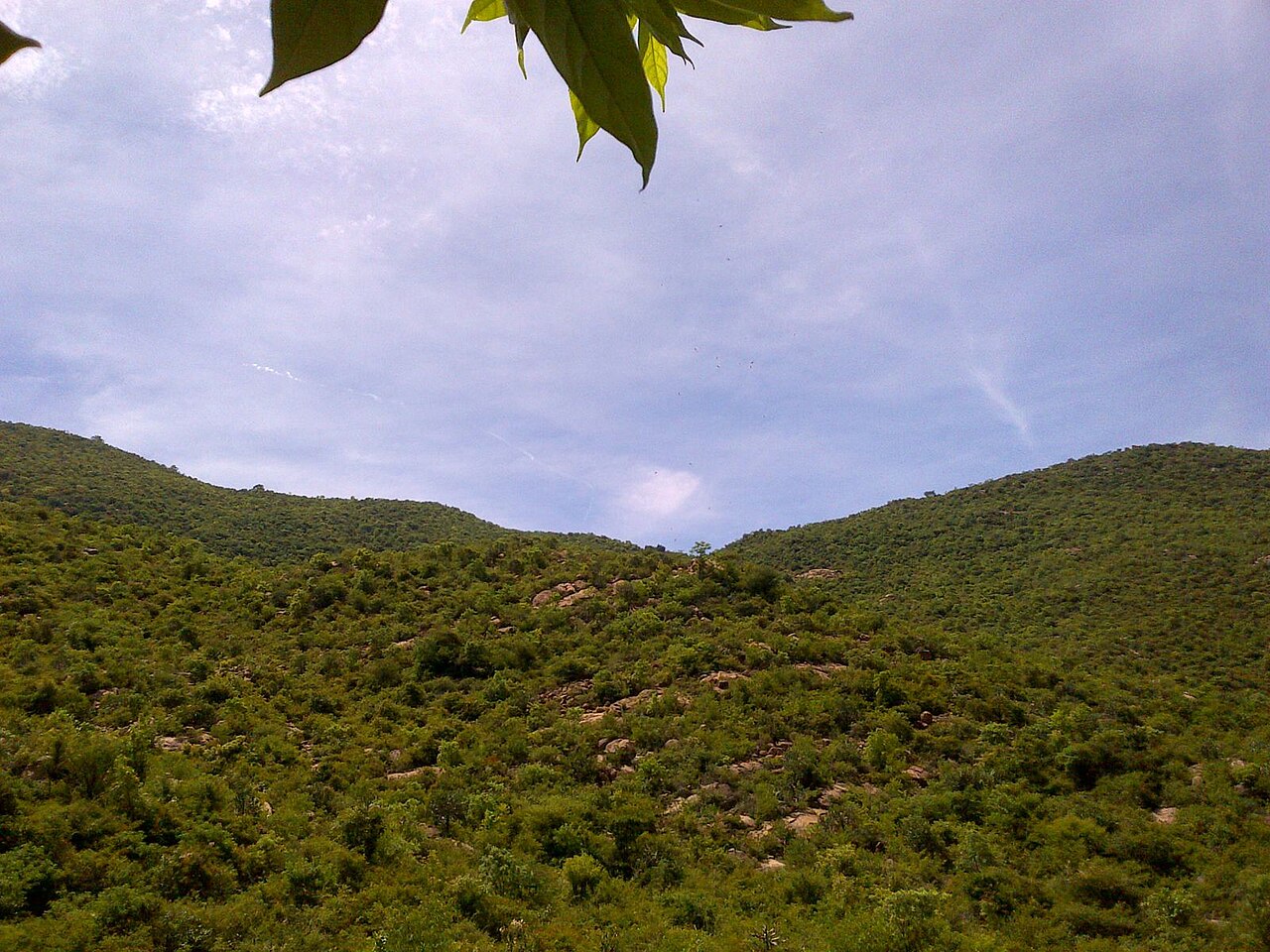
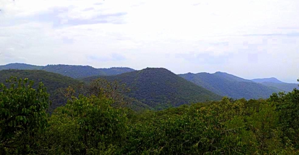
A small reserve-forest hill settlement reached by a hairpin ghat road, with cooler climate, viewpoints and tribal hamlets growing coffee and pepper.

Sitheri Hills, Pappireddipatti
Practical guide

Plan Sitheri Hills

Who's going?Tailor Sitheri Hills to your trip
Typehill station
Nearest basePappireddipatti
DistrictDharmapuri
Best timeOctober to March is the cooler, drier…
Time neededAbout an hour
EntryFree
Places to visit3

Sitheri Hills is planned from Pappireddipatti, one of the travel bases in Dharmapuri district. Use Pappireddipatti for stays, food and local transport, then plan this place as a focused stop.

The story

Sitheri Hills is worth visiting for a forested Eastern Ghats plateau of villages and difficult roads.

The story of Sitheri Hills

Follow the authorised approach and spend time reading the defining architecture, landscape, collection or living practice of Sitheri Hills.

The plateau’s settlements, forests and agriculture long predate its limited development as an excursion landscape.

Sitheri Hills deserves time for the details identified above rather than a rushed photograph. At Sitheri Hills, use the named visitor approach, check the current public boundary on arrival and concentrate on the feature that makes this place distinct within its town. For Sitheri Hills, any closure, worship restriction or safety barrier takes precedence over an older itinerary.

Legend & myth

Community knowledge of springs, paths and seasonal change is living heritage, while access requires current local advice.

Read the full history of Sitheri Hills 30 more words

History

The plateau’s settlements, forests and agriculture long predate its limited development as an excursion landscape.

Why visit

Experience a forested Eastern Ghats plateau of villages and difficult roads in its real setting.

What to expect

Highlights

Getting there

How to visit

  • Base yourself in Pappireddipatti or nearby in Dharmapuri, then confirm the last-mile route locally before travel.
  • If access depends on temple, museum or seasonal rules, check on the day before you go.
Timing

Best time

October to March is the cooler, drier season in the Cauvery delta.

Weather in Sitheri HillsSeasonal guide

Live forecast loads in your browser.

Today at Sitheri Hills
Sunrise6:05 am
Sunset5:57 pm
Golden hour best light4:57 pm–5:57 pm
Blue hour after sunset5:57 pm–6:22 pm
Sun sets toward compass bearingW · 261°
Moon tonight🌒 Waxing crescent · 24%
Retreating monsoon. October and November still see spells of rain from the retreating monsoon, though it is usually lighter than mid-year. Conditions are generally good but worth checking.

Sun and moon are calculated for this location and shown in IST. Photography windows are the hour around sunrise and sunset; the sunset bearing is degrees clockwise from true north. Moon phase is accurate to about half a day.

Stay · eat · do · rent · see · shop

Stays, food & things to do near Sitheri Hills

Verified hotels, homestays, restaurants, experiences, sights, shops and rentals around Sitheri Hills — commission-free, with direct contact. Filter by what you need.

Verified inventory is being added here.

Verified places are being added. The category filters will fill in as approved stays, restaurants, experiences, sights, shops and nature listings go live.

List your place
Ranked guides

Top experiences around Pappireddipatti

2 more places around Pappireddipatti. Open a guide to plan the visit and onward journey.

townPappireddipatti

15.9 km · ~26 min by cab

An agrarian taluk town in the hilly southeast of the district near the Salem border, close to the Sitheri hill approaches.

damVaniyar Dam

19.7 km · ~33 min by cab

Vaniyar Dam is one of Dharmapuri's larger reservoirs, built across the Vaniyar River, a tributary of the Ponnaiyar (South Pennar), in the foothills of the Shevaroy Hills. It holds about 418 million cubic feet of water to a depth of roughly 65 feet and feeds a network of irrigation tanks in surrounding villages. The reservoir and its hill backdrop make it a quiet local picnic spot.

Roampedia is commission-free — own or know a stay, eatery, guide or shop near Sitheri Hills? List it and it appears here once verified.

Add a nearby business
Before you go

Sitheri Hills — at a glance

TimingsDaylight travel only; the ghat road is not advised after dark
Best timeSeptember to February; misty and green after the monsoon

Entry: Free; a forest-checkpost sign-in may apply

Getting here

How to reach Sitheri Hills

About 30 km from Harur or Pappireddipatti by a hairpin ghat road; nearest railhead Dharmapuri or Salem Jn; nearest airport Salem SXV ~80 km

Getting around Sitheri Hills

If you need step-free access, contact the site before travelling. Ask about a level entrance, steps along the route, the nearest drop-off point, seating and accessible toilets.

If you need help at Sitheri Hills
112All emergencies (police · fire · medical)The single number to call in any emergency (ERSS).

Emergency numbers are verified against official government and state tourism sources. 112 works anywhere in India.

Nearby

What’s near Sitheri Hills

townPappireddipatti

An agrarian taluk town in the hilly southeast of the district near the Salem border, close to the Sitheri hill approaches.

15.9 km · ~26 min by cab · straight line
townHarur

A taluk town in the southern part of the district and the gateway to the Sitheri Hills and Theerthamalai temple.

18.2 km · ~30 min by cab · straight line
damVaniyar Dam

Vaniyar Dam is one of Dharmapuri's larger reservoirs, built across the Vaniyar River, a tributary of the Ponnaiyar (South Pennar), in the foothills of the Shevaroy Hills. It holds about 418 million cubic feet of water to a depth of roughly 65 feet and feeds a network of irrigation tanks in surrounding villages. The reservoir and its hill backdrop make it a quiet local picnic spot.

19.7 km · ~33 min by cab · straight line
templeTheerthamalai Temple

Hilltop shrine to Theerthagiriswarar (Shiva) reached by roughly 990 steps. Legend holds that Rama created a sacred spring (theertham) here, giving the hill its name.

24.7 km · ~41 min by cab · straight line
heritageVathalmalai (Vytla Hills)

Vathalmalai is a small hill hamlet on the Shevaroy hill range at roughly 1,400 m, reached by a winding ghat road with about 26 hairpin bends. Its cool climate supports coffee, pepper and jackfruit, earning it the nickname 'Mini Ooty of Dharmapuri'. A hilltop Murugan temple and seasonal waterfalls draw trekkers.

27.3 km · ~45 min by cab · straight line
K
Kottai Kovil (Mallikarjuneswarar Temple)
Place
templeKottai Kovil (Mallikarjuneswarar Temple)

This 8th-9th-century Shiva temple, dedicated to Lord Mallikarjuneswarar and Goddess Kamatchi Ambal, is locally called Kottai Kovil, the Fort Temple. Its best-known feature is a hanging stone pillar in the ardha mandapam that leaves a small gap above the floor, a display of ancient sculptural skill. Local tradition holds that King Adhiyaman worshipped here and that a secret passage once linked the temple to Adhiyamankottai.

46.3 km · ~77 min by cab · straight line
townDharmapuri Town

District headquarters and a market and administrative centre, and a leading mango-growing belt of Tamil Nadu. It is the main road base for trips to Hogenakkal.

46.5 km · ~77 min by cab · straight line
S
Sir Thomas Munro Pillar
Place
heritageSir Thomas Munro Pillar

This memorial pillar was erected by the Madras government to mark Dharmapuri's association with Sir Thomas Munro, who lived here from April 1792 to March 1799 as Assistant to the Superintendent of Revenue in the Baramahal. Munro later became Governor of Madras and is remembered for the ryotwari land-revenue system. The pillar is a colonial-era heritage marker in the town.

46.6 km · ~78 min by cab · straight line
H
Hero Stones Site Museum
Place
museumHero Stones Site Museum

Set up by the Tamil Nadu State Department of Archaeology, this open-air site museum displays more than 25 hero stones commemorating warriors, collected from around the Dharmapuri region. Alongside them it holds megalithic-era artifacts, neolithic stone tools, terracotta figurines, coins and iron objects. It offers a compact overview of the district's Iron Age and Sangam-era heritage.

46.6 km · ~78 min by cab · straight line
G
Government Museum, Dharmapuri
Place
museumGovernment Museum, Dharmapuri

The Government Museum in Dharmapuri displays sculptures, stone carvings and antiquities gathered from across the district. Its collection reflects the region's long temple-building and Adhiyaman-era history. It is a small district museum useful for understanding local archaeology and art history.

46.9 km · ~78 min by cab · straight line
T
Thoppur Ghat
Place
heritageThoppur Ghat

Thoppur Ghat is a scenic mountain-pass stretch of the Dharmapuri-Salem highway (NH-44) that winds through forested hills and valleys. It is popular with travellers for its long views over wooded slopes, and the surrounding hills hold megalithic-era remains. The pass serves as a well-known scenic gateway between the Dharmapuri plains and the Salem region.

49.5 km · ~83 min by cab · straight line
A
Adhiyamankottai Fort
Place
heritageAdhiyamankottai Fort

Adhiyamankottai was the capital of the Adhiyaman chieftains who ruled the ancient Thagadur (Dharmapuri) country in the Sangam era. The oval fort ruins are linked to King Adhiyaman Neduman Anji, one of the 'Kadai Ezhu Vallal' whose court the poetess Avvaiyar visited. It is regarded as one of South India's oldest forts and is a state-protected heritage site.

50.4 km · ~84 min by cab · straight line

All 3 places to visit in Pappireddipatti →

On the map

Where Sitheri Hills is

Good to know

Sitheri Hills — frequently asked

How long should I allow?

Allow about two hours for Sitheri Hills, adding time for queues, worship, birding, weather or closures.

Where do the directions lead?

The Directions link leads to the practical visitor entrance for Sitheri Hills; follow current signs for parking, tickets and permitted entry.

When is the best time to visit Sitheri Hills?

October to March is the cooler, drier season in the Cauvery delta.

What are the entry fee and timings at Sitheri Hills?

Entry: Free; a forest-checkpost sign-in may apply. Timings: Daylight travel only; the ghat road is not advised after dark.

How do I reach Sitheri Hills?

Base yourself in Pappireddipatti or nearby in Dharmapuri, then confirm the last-mile route locally before travel. If access depends on temple, museum or seasonal rules, check on the day before you go.

How much time do I need for Sitheri Hills?

About an hour.

What else is near Sitheri Hills?

Nearby you can pair Pappireddipatti (15.9 km), Harur (18.2 km), Vaniyar Dam (19.7 km), Theerthamalai Temple (24.7 km).

Image credits

Photographs: Vinoth88 (CC BY-SA 3.0). Wikimedia Commons.