What to expect
Periyar Falls (Vellimalai)
A waterfall in the Periya Kalrayan section near Vellimalai village, roughly 15 km from the Gomukhi Dam. The flow is strongest from September to December after the northeast monsoon.

Practical guide
Plan Periyar Falls (Vellimalai)
Who's going?Tailor Periyar Falls (Vellimalai) to your trip
Typewaterfall
Nearest baseKalrayanHills
DistrictKallakurichi
Best timeOctober to March is the cooler, drier…
Time neededAbout an hour
EntryFree
Places to visit3→Periyar Falls (Vellimalai) is planned from KalrayanHills, one of the travel bases in Kallakurichi district. Use KalrayanHills for stays, food and local transport, then plan this place as a focused stop.
Getting there
How to visit
- Base yourself in KalrayanHills or nearby in Kallakurichi, then confirm the last-mile route locally before travel.
- If access depends on temple, museum or seasonal rules, check on the day before you go.
Timing
Best time
October to March is the cooler, drier season in the Cauvery delta.
Weather in Periyar Falls (Vellimalai)Seasonal guide
Live forecast loads in your browser.
Today at Periyar Falls (Vellimalai)
Sunrise6:04 am
Sunset5:56 pm
Golden hour best light4:56 pm–5:56 pm
Blue hour after sunset5:56 pm–6:21 pm
Sun sets toward compass bearingW · 261°
Moon tonight🌒 Waxing crescent · 24%
Retreating monsoon. October and November still see spells of rain from the retreating monsoon, though it is usually lighter than mid-year. Conditions are generally good but worth checking.
Sun and moon are calculated for this location and shown in IST. Photography windows are the hour around sunrise and sunset; the sunset bearing is degrees clockwise from true north. Moon phase is accurate to about half a day.
Stay · eat · do · rent · see · shop
Stays, food & things to do near Periyar Falls (Vellimalai)
Verified hotels, homestays, restaurants, experiences, sights, shops and rentals around Periyar Falls (Vellimalai) — commission-free, with direct contact. Filter by what you need.
Verified inventory is being added here.
Verified places are being added. The category filters will fill in as approved stays, restaurants, experiences, sights, shops and nature listings go live.
List your placeRanked guides
Top experiences around KalrayanHills
2 more places around KalrayanHills. Open a guide to plan the visit and onward journey.

hill stationKalvarayan Hills (Kalrayan Hills)
3.1 km · ~8 min by auto
An Eastern Ghats hill range on the Kallakurichi-Salem border, split into the northern Chinna (little) and southern Periya (big) Kalrayans, dotted with tribal villages, forests and a temperate climate. It is the district's main hill destination, offering trekking, valley viewpoints, a botanical garden and seasonal waterfalls, reached mainly via Kallakurichi (about 56 km).

waterfallMegam Falls
1.1 km · 13 min walk
A tall seasonal waterfall in the Kalvarayan Hills about 5 km from Kachirapalayam, whose roar carries a long way when in full flow. It is one of the most visited spots in the hills during the monsoon and post-monsoon months.
Roampedia is commission-free — own or know a stay, eatery, guide or shop near Periyar Falls (Vellimalai)? List it and it appears here once verified.
Add a nearby businessBefore you go
Periyar Falls (Vellimalai) — at a glance
TimingsDaylight hours only
Best timeSep-Dec after the monsoon
Entry: Free
Getting here
How to reach Periyar Falls (Vellimalai)
Nearest railway: Kallakurichi ~35 km or Vriddhachalam Jn ~70 km; nearest airport: Salem (SXV) ~95 km or Tiruchirappalli (TRZ) ~125 km
Getting around Periyar Falls (Vellimalai)
If you need step-free access, contact the site before travelling. Ask about a level entrance, steps along the route, the nearest drop-off point, seating and accessible toilets.
If you need help at Periyar Falls (Vellimalai)
112All emergencies (police · fire · medical)The single number to call in any emergency (ERSS).100Police101Fire108Ambulance (emergency / EMS)1091Women’s helpline (distress)1098Child helpline1363Tourist helpline (India, 24×7, multilingual)
Emergency numbers are verified against official government and state tourism sources. 112 works anywhere in India.
Nearby
What’s near Periyar Falls (Vellimalai)
waterfallMegam Falls
A tall seasonal waterfall in the Kalvarayan Hills about 5 km from Kachirapalayam, whose roar carries a long way when in full flow. It is one of the most visited spots in the hills during the monsoon and post-monsoon months.
1.1 km · 13 min walk · straight linehill stationKalvarayan Hills (Kalrayan Hills)
An Eastern Ghats hill range on the Kallakurichi-Salem border, split into the northern Chinna (little) and southern Periya (big) Kalrayans, dotted with tribal villages, forests and a temperate climate. It is the district's main hill destination, offering trekking, valley viewpoints, a botanical garden and seasonal waterfalls, reached mainly via Kallakurichi (about 56 km).
3.1 km · ~8 min by auto · straight lineP
Pappanayakkanpatti Dam
Place
damPappanayakkanpatti Dam
Pappanayakkanpatti Dam is described as the largest dam in the Kalvarayan (Kalrayan) Hills area, with a height of about 52 feet. It holds monsoon runoff from the hills and is one of several dams and reservoirs that make the range a water source for the surrounding plains.
4.2 km · ~11 min by auto · straight lineK
Kaviyam Falls
Place
waterfallKaviyam Falls
Kaviyam Falls is one of the noted waterfalls of the Kalvarayan Hills, alongside Megam and Periyar falls, located near Thoradipattu panchayat. The cascade is surrounded by the dense greenery of the Eastern Ghats and is a refreshing spot for visitors and trekkers exploring the hills.
8.3 km · ~14 min by cab · straight line
damGomukhi Dam
A reservoir in the Kalrayan foothills near Kachirapalayam, about 15 km from Kallakurichi, with a landscaped garden and a hilltop view point that draw crowds in summer and on holidays. The lake spreads across a wide area in the monsoon and supplies water to dozens of surrounding villages.
8.5 km · ~14 min by cab · straight line
townKallakurichi town
The headquarters of Kallakurichi district, carved out of Viluppuram district in 2019. It is the main commercial and transport hub and the gateway to the Kalvarayan Hills.
22.8 km · ~38 min by cab · straight lineA
Ardhanareeswarar Temple, Veeracholapuram
Place
templeArdhanareeswarar Temple, Veeracholapuram
This Shiva temple near Kallakurichi town enshrines Ardhanareeswarar with the goddess called Anubhambikai and is attributed to Chola construction, variously dated to around the 12th century and associated with Rajendra Chola. Inscriptions record that the village was once named Mallikarjunapuram and preserve a legend of a Chola king immersing his father's ashes at the nearby Manimutharu river. The historic structure has long stood in a state of disrepair.
27.2 km · ~45 min by cab · straight lineA
Arulmigu Meenakshi Amman Temple, Kallakurichi
Place
templeArulmigu Meenakshi Amman Temple, Kallakurichi
This town temple is dedicated to the goddess Meenakshi and is noted for its intricate carvings and vibrant sculptures. Its principal annual celebration is the Meenakshi Thirukalyanam festival, marking the divine wedding of Meenakshi and Sundareswarar.
28.6 km · ~48 min by cab · straight line
heritageThiyagadurgam Fort
The ruinous fort occupies the rocky hill above Thiyagadurgam. It changed hands during eighteenth-century French, Mysorean and Company conflict; climb only in cool daylight with current local guidance.
33.4 km · ~56 min by cab · straight line
templeUlagalantha Perumal Temple (Trivikrama), Thirukovilur
A Divya Desam dedicated to Vishnu in his Vamana-Trivikrama (world-measuring) form, praised by the Alvar saints and referenced in Sangam-era Tamil literature. Its eleven-tiered rajagopuram rises about 192 ft (59 m), the third tallest temple tower in Tamil Nadu after Srirangam and Thiruvannamalai.
48.7 km · ~81 min by cab · straight line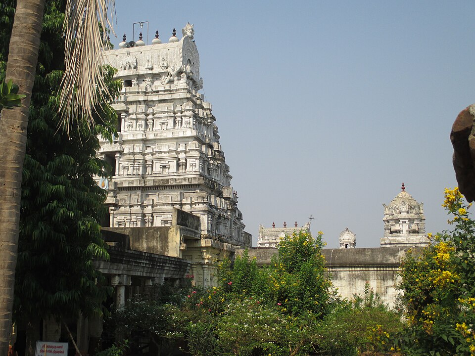
templeAdhirangam Ranganathaswamy Temple
This Vishnu temple is counted among the 108 Abhimana Kshetrams of Sri Vaishnavism and is popularly called Adhi (original) Thiruvarangam. The presiding deity Ranganatha reclines on Adisesha in a sleeping posture measuring about 29 feet in length. The goddess is Rangavalli (Ranganayaki) Thayar, and the temple's sacred waters include the Chandra Pushkarani and the Thenpennai river.
49.7 km · ~83 min by cab · straight line
heritageKabilar Hillock (Kabilar Kundru), Thirukovilur
A rocky hillock and mandapam in the middle of the Thenpennai river at Thirukovilur, associated with the Sangam-era Tamil poet Kapilar, who is said to have fasted to death here after the death of his patron Vel Pari. An ASI-protected heritage landmark tied to the town's classical literary history.
50.3 km · ~84 min by cab · straight lineOn the map
Where Periyar Falls (Vellimalai) is
Good to know
Periyar Falls (Vellimalai) — frequently asked
When is the best time to visit Periyar Falls (Vellimalai)?
October to March is the cooler, drier season in the Cauvery delta.
What are the entry fee and timings at Periyar Falls (Vellimalai)?
Entry: Free. Timings: Daylight hours only.
How do I reach Periyar Falls (Vellimalai)?
Base yourself in KalrayanHills or nearby in Kallakurichi, then confirm the last-mile route locally before travel. If access depends on temple, museum or seasonal rules, check on the day before you go.
How much time do I need for Periyar Falls (Vellimalai)?
About an hour.
What else is near Periyar Falls (Vellimalai)?
Nearby you can pair Megam Falls (1.1 km), Kalvarayan Hills (Kalrayan Hills) (3.1 km), Pappanayakkanpatti Dam (4.2 km), Kaviyam Falls (8.3 km).
Read before you go
Periyar Falls (Vellimalai) guides, stories & itineraries
We have not published a story about Periyar Falls (Vellimalai) itself yet. These cover KalrayanHills and the wider district, with separate journeys between stops.
Tamil Nadu-wide guides & itineraries
Route-level itineraries and practical guides for the rest of Tamil Nadu.
Ardhanareeswarar Temple, Veeracholapuram: story and tradition
Story & tradition
Ardhanareeswarar Temple, Veeracholapuram: story and tradition
4 min read · Read →
The story of Adhirangam Ranganathaswamy Temple
Place story
The story of Adhirangam Ranganathaswamy Temple
4 min read · Read →
The story of Thiyagadurgam Fort
Place story
The story of Thiyagadurgam Fort
4 min read · Read →
Thiyagadurgam Fort: history and local significance
History & significance
Thiyagadurgam Fort: history and local significance
4 min read · Read →
The story of Gomukhi Dam
Place story
The story of Gomukhi Dam
4 min read · Read →
Gomukhi Dam: history and local significance
History & significance
Gomukhi Dam: history and local significance
4 min read · Read →
Image credits
Photographs: PJeganathan (CC BY-SA 4.0). Wikimedia Commons.