What to expect
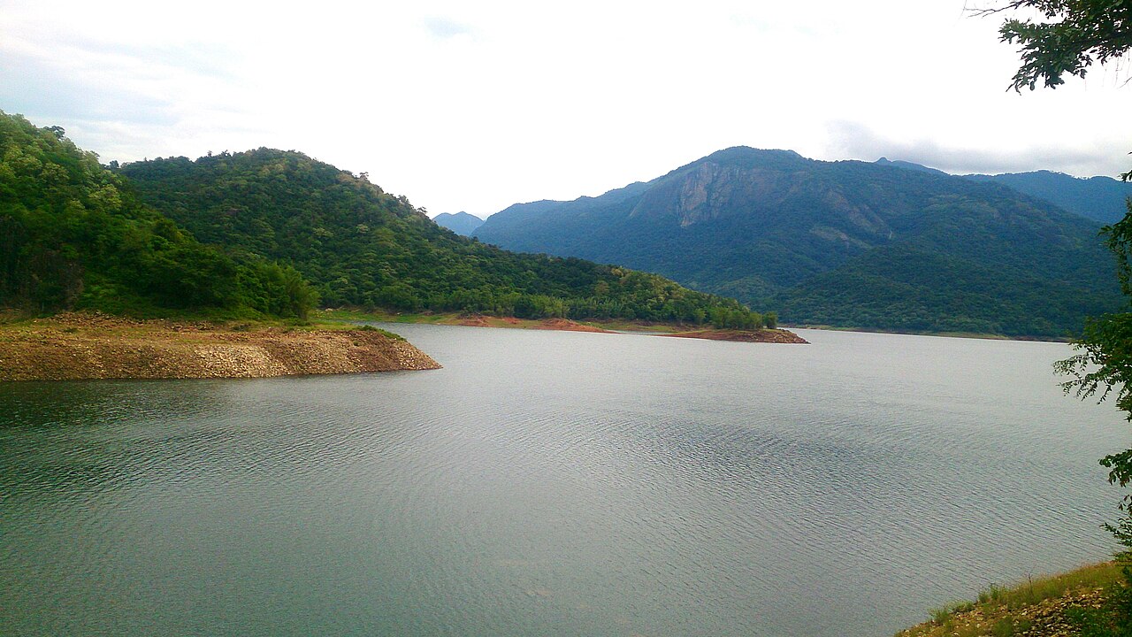
Karaiyar Dam
A 1959 reservoir on the upper Thamirabarani inside KMTR whose backwaters are the seasonal boat gateway to Banatheertham Falls.

Practical guide
Plan Karaiyar Dam
Who's going?Tailor Karaiyar Dam to your trip
Typedam
Nearest baseAmbasamudram
DistrictTirunelveli
Best timeOctober to March is the cooler, drier…
Time neededAbout an hour
Entry₹20
Places to visit14→Karaiyar Dam is planned from Ambasamudram, one of the travel bases in Tirunelveli district. Use Ambasamudram for stays, food and local transport, then plan this place as a focused stop.
Getting there
How to visit
- Base yourself in Ambasamudram or nearby in Tirunelveli, then confirm the last-mile route locally before travel.
- If access depends on temple, museum or seasonal rules, check on the day before you go.
Timing
Best time
October to March is the cooler, drier season in the Cauvery delta.
Weather in Karaiyar DamSeasonal guide
Live forecast loads in your browser.
Today at Karaiyar Dam
Sunrise6:08 am
Sunset6:04 pm
Golden hour best light5:04 pm–6:04 pm
Blue hour after sunset6:04 pm–6:29 pm
Sun sets toward compass bearingW · 261°
Moon tonight🌒 Waxing crescent · 24%
Retreating monsoon. October and November still see spells of rain from the retreating monsoon, though it is usually lighter than mid-year. Conditions are generally good but worth checking.
Sun and moon are calculated for this location and shown in IST. Photography windows are the hour around sunrise and sunset; the sunset bearing is degrees clockwise from true north. Moon phase is accurate to about half a day.
Photos
Karaiyar Dam in pictures
Stay · eat · do · rent · see · shop
Stays, food & things to do near Karaiyar Dam
Verified hotels, homestays, restaurants, experiences, sights, shops and rentals around Karaiyar Dam — commission-free, with direct contact. Filter by what you need.
Verified inventory is being added here.
Verified places are being added. The category filters will fill in as approved stays, restaurants, experiences, sights, shops and nature listings go live.
List your placeRanked guides
Top experiences around Ambasamudram
13 more places around Ambasamudram. Open a guide to plan the visit and onward journey.
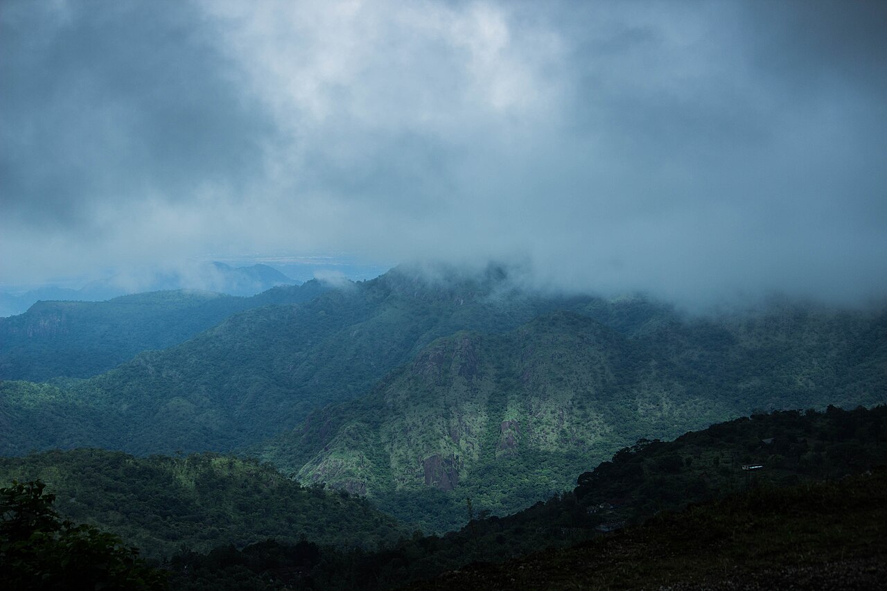
wildlifeKalakkad Mundanthurai Tiger Reserve
A large protected Western Ghats landscape with multiple controlled entry points. The page withholds a centre pin and requires the exact gate supplied for an authorised activity.
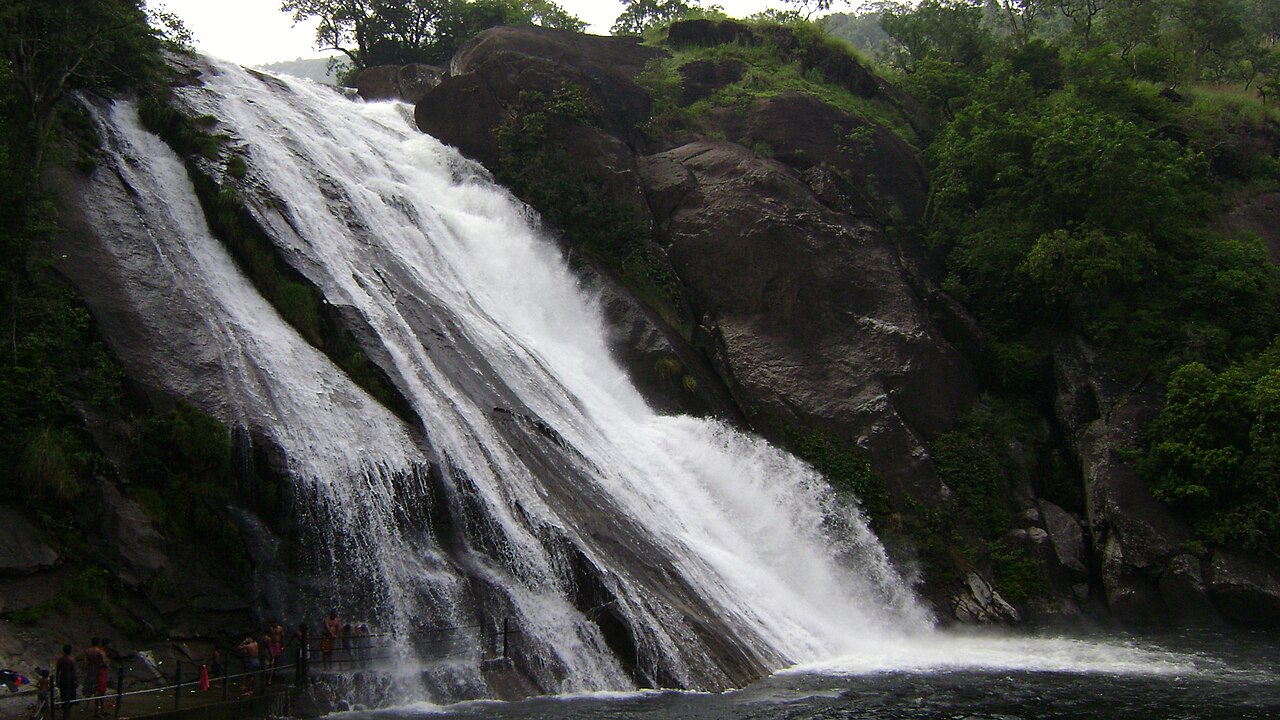
waterfallAgasthiyar Falls (Papanasam Falls)
6.4 km · ~16 min by auto
A sacred cascade near Papanasam where bathing and visitor access depend on current flow and Forest Department controls.
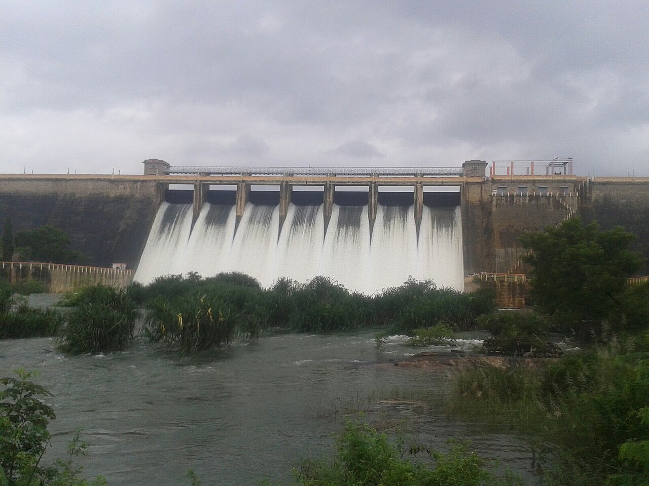
damManimuthar Dam and Falls
10.2 km · ~17 min by cab
A working dam and a separate seasonal falls in the same foothill landscape. This pin records the named dam object; waterfall access must be checked independently.

templePapanasanathar Temple, Papanasam
9.6 km · ~16 min by cab
An ancient Shiva temple ('Papanasam' means absolution of sins) on the Thamirabarani, the pilgrimage anchor of the Papanasam falls-and-dam cluster in Ambasamudram taluk.

templeSivasailam Temple
12.9 km · ~22 min by cab
A 1,000-year-old Pandya-era Shiva temple (Sivasailanathar / Paramakalyani) ringed by Western Ghats hills, a Vaippu Sthalam praised in the 7th-century Thevaram, noted for its huge Nandi.
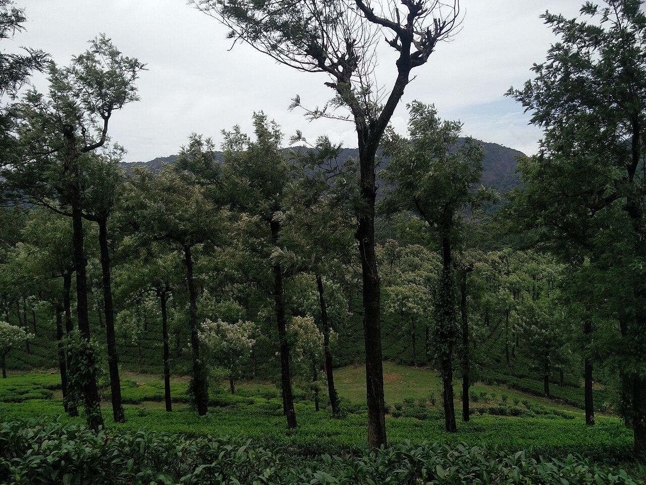
viewpointManjolai Hills
A dispersed tea-estate and protected-forest hill landscape inside KMTR. No public visitor entrance was verified, so this page withholds point directions.

waterfallBanatheertham Falls
2.7 km · ~7 min by auto
A perennial falls inside the Karaiyar Dam backwaters in KMTR, reached by boat and short trek, made famous by the song 'Chinna Chinna Aasai' from the film Roja.
damPapanasam Dam
2.0 km · 25 min walk
A working dam on the Thamirabarani catchment ringed by protected Western Ghats forest; public access is limited to authorised areas.

damServalar Dam
8.7 km · ~14 min by cab
A hill reservoir on the Servalar tributary within KMTR, part of the Papanasam hydro and irrigation network.

viewpointKuthiravetti Viewpoint
6.8 km · ~17 min by auto
A windy ridge viewpoint in the Manjolai hills overlooking KMTR forests, Papanasam Dam and Manimuthar Dam.

heritageAmbasamudram (Thamirabarani ghats)
15.7 km · ~26 min by cab
A historic taluk town on the Thamirabarani, the road-and-rail gateway to Papanasam, Manimuthar and the Ghats, with riverside temples and bathing ghats.

templeKodaganallur Kailasanathar Temple
15.6 km · ~26 min by cab
A Shiva temple on the Thamirabarani near Tirunelveli, counted among the nine Nava Kailasam shrines of the river.

viewpointAgastyarkoodam (Agasthyamalai Peak)
9.4 km · ~16 min by cab
A 1,868 m peak of the Agasthyamalai range on the Tirunelveli-Thiruvananthapuram border, the district's highest point and a source region of the Thamirabarani. Revered as the abode of sage Agastya, whose stone image stands at the summit, it lies within the UNESCO-listed Agasthyamala Biosphere Reserve, and the pilgrim trek is opened for only a short season each year.
Roampedia is commission-free — own or know a stay, eatery, guide or shop near Karaiyar Dam? List it and it appears here once verified.
Add a nearby businessBefore you go
Karaiyar Dam — at a glance
Timings9 AM–5 PM (indicative)
Best timeOct–Feb
Entry price
- Indian adult
- ₹20
Fees change without notice. Check the current rate at the counter.
Entry: ₹10–20 indicative
Getting here
How to reach Karaiyar Dam
Ambasamudram ~18 km; Tirunelveli Jn (TEN) ~45 km
Getting around Karaiyar Dam
If you need step-free access, contact the site before travelling. Ask about a level entrance, steps along the route, the nearest drop-off point, seating and accessible toilets.
If you need help at Karaiyar Dam
112All emergencies (police · fire · medical)The single number to call in any emergency (ERSS).100Police101Fire108Ambulance (emergency / EMS)1091Women’s helpline (distress)1098Child helpline1363Tourist helpline (India, 24×7, multilingual)
Emergency numbers are verified against official government and state tourism sources. 112 works anywhere in India.
Nearby
What’s near Karaiyar Dam
damPapanasam Dam
A working dam on the Thamirabarani catchment ringed by protected Western Ghats forest; public access is limited to authorised areas.
2.0 km · 25 min walk · straight linewaterfallBanatheertham Falls
A perennial falls inside the Karaiyar Dam backwaters in KMTR, reached by boat and short trek, made famous by the song 'Chinna Chinna Aasai' from the film Roja.
2.7 km · ~7 min by auto · straight linewaterfallAgasthiyar Falls (Papanasam Falls)
A sacred cascade near Papanasam where bathing and visitor access depend on current flow and Forest Department controls.
6.4 km · ~16 min by auto · straight lineviewpointKuthiravetti Viewpoint
A windy ridge viewpoint in the Manjolai hills overlooking KMTR forests, Papanasam Dam and Manimuthar Dam.
6.8 km · ~17 min by auto · straight linedamServalar Dam
A hill reservoir on the Servalar tributary within KMTR, part of the Papanasam hydro and irrigation network.
8.7 km · ~14 min by cab · straight lineviewpointAgastyarkoodam (Agasthyamalai Peak)
A 1,868 m peak of the Agasthyamalai range on the Tirunelveli-Thiruvananthapuram border, the district's highest point and a source region of the Thamirabarani. Revered as the abode of sage Agastya, whose stone image stands at the summit, it lies within the UNESCO-listed Agasthyamala Biosphere Reserve, and the pilgrim trek is opened for only a short season each year.
9.4 km · ~16 min by cab · straight linetemplePapanasanathar Temple, Papanasam
An ancient Shiva temple ('Papanasam' means absolution of sins) on the Thamirabarani, the pilgrimage anchor of the Papanasam falls-and-dam cluster in Ambasamudram taluk.
9.6 km · ~16 min by cab · straight linedamManimuthar Dam and Falls
A working dam and a separate seasonal falls in the same foothill landscape. This pin records the named dam object; waterfall access must be checked independently.
10.2 km · ~17 min by cab · straight linetempleSivasailam Temple
A 1,000-year-old Pandya-era Shiva temple (Sivasailanathar / Paramakalyani) ringed by Western Ghats hills, a Vaippu Sthalam praised in the 7th-century Thevaram, noted for its huge Nandi.
12.9 km · ~22 min by cab · straight lineK
Kasi Viswanathar Temple, Ambasamudram
Place
templeKasi Viswanathar Temple, Ambasamudram
One of the oldest temples of Ambasamudram, a Shiva shrine on the Thamirabarani said to have a history stretching back around 2,000 years. It belongs to the cluster of ancient riverside temples that make Ambasamudram and Kallidaikurichi a temple-heritage belt.
14.1 km · ~24 min by cab · straight linetempleKodaganallur Kailasanathar Temple
A Shiva temple on the Thamirabarani near Tirunelveli, counted among the nine Nava Kailasam shrines of the river.
15.6 km · ~26 min by cab · straight lineheritageAmbasamudram (Thamirabarani ghats)
A historic taluk town on the Thamirabarani, the road-and-rail gateway to Papanasam, Manimuthar and the Ghats, with riverside temples and bathing ghats.
15.7 km · ~26 min by cab · straight lineOn the map
Where Karaiyar Dam is
Good to know
Karaiyar Dam — frequently asked
When is the best time to visit Karaiyar Dam?
October to March is the cooler, drier season in the Cauvery delta.
What are the entry fee and timings at Karaiyar Dam?
Entry: ₹10–20 indicative. Timings: 9 AM–5 PM (indicative). The rupee figure quoted is the Indian adult rate.
How do I reach Karaiyar Dam?
Base yourself in Ambasamudram or nearby in Tirunelveli, then confirm the last-mile route locally before travel. If access depends on temple, museum or seasonal rules, check on the day before you go.
How much time do I need for Karaiyar Dam?
About an hour.
What else is near Karaiyar Dam?
Nearby you can pair Papanasam Dam (2.0 km), Banatheertham Falls (2.7 km), Agasthiyar Falls (Papanasam Falls) (6.4 km), Kuthiravetti Viewpoint (6.8 km).
Read before you go
Karaiyar Dam guides, stories & itineraries
We have not published a story about Karaiyar Dam itself yet. These cover Ambasamudram and the wider district, with separate journeys between stops.
Tamil Nadu-wide guides & itineraries
Route-level itineraries and practical guides for the rest of Tamil Nadu.
The story of Thirupudaimarudur Narumbunathar Temple and Bird Sanctuary
Place story
The story of Thirupudaimarudur Narumbunathar Temple and Bird Sanctuary
4 min read · Read →
The story of Uchishta Ganapathy Temple, Manimoortheeswaram
Place story
The story of Uchishta Ganapathy Temple, Manimoortheeswaram
4 min read · Read →
Uchishta Ganapathy Temple, Manimoortheeswaram: history, architecture and significance
History & significance
Uchishta Ganapathy Temple, Manimoortheeswaram: history, architecture and significance
4 min read · Read →
The story of Cheranmahadevi Kailasanathar (Ammainathar) Temple
Place story
The story of Cheranmahadevi Kailasanathar (Ammainathar) Temple
4 min read · Read →
Cheranmahadevi Kailasanathar (Ammainathar) Temple: history, architecture and significance
History & significance
Cheranmahadevi Kailasanathar (Ammainathar) Temple: history, architecture and significance
4 min read · Read →
The story of Bhaktavatsala Perumal Temple, Cheranmahadevi
Place story
The story of Bhaktavatsala Perumal Temple, Cheranmahadevi
4 min read · Read →
Image credits
Photographs: VasuVR (CC BY 4.0), Soundharya (CC BY-SA 4.0), TNSE THIRESE ANTONY TNV (CC BY-SA 4.0), Sunciti _ Sundaram's Images + Messages (CC BY-SA 2.0). Wikimedia Commons.