Jalagamparai Falls

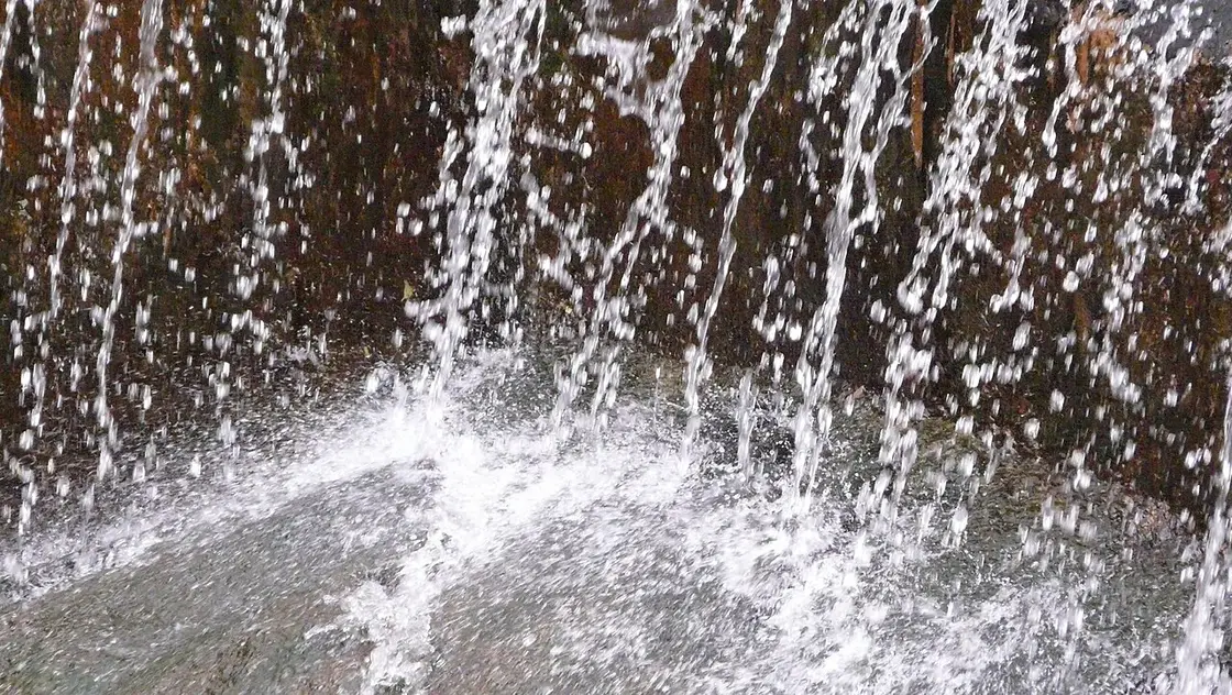
Seasonal waterfall where the Attaru river drops over rocky ledges on the eastern flank of the Yelagiri hills, reached by a short downhill trek; strongest during and just after the monsoon.

Jalagamparai Falls, Yelagiri
Practical guide

Plan Jalagamparai Falls

Who's going?Tailor Jalagamparai Falls to your trip
Typewaterfall
Nearest baseYelagiri
DistrictTirupathur
Best timeOctober to March is the cooler, drier…
Time neededAbout an hour
EntryFree
Places to visit8Listed businesses1

Jalagamparai Falls is planned from Yelagiri, one of the travel bases in Tirupathur district. Use Yelagiri for stays, food and local transport, then plan this place as a focused stop.

The story

Jalagamparai is a seasonal cascade below the Yelagiri plateau. Its flow, road access and walking conditions depend on recent rain, so it should never be promised as a year-round waterfall.

The story of Jalagamparai Falls

Water from the hills gathers into the Attaru and drops across a rocky channel. In a good season the setting can justify the journey; after a dry spell the same place may hold little water, and that is a natural condition rather than a failed attraction.

Ask locally about the current road approach and final walk before leaving Yelagiri. Online accounts describe different routes, some involving a longer descent, so do not follow an old track blindly or assume mobile signal will guide the return.

Wet rock, sudden runoff and isolated paths are the main risks. Wear footwear with grip, leave before dusk, avoid entering the plunge area and turn back during heavy rain or thunderstorms.
What to expect

Highlights

Getting there

How to visit

  • Base yourself in Yelagiri or nearby in Tirupathur, then confirm the last-mile route locally before travel.
  • If access depends on temple, museum or seasonal rules, check on the day before you go.
Timing

Best time

October to March is the cooler, drier season in the Cauvery delta.

Weather in Jalagamparai FallsSeasonal guide

Live forecast loads in your browser.

Today at Jalagamparai Falls
Sunrise6:05 am
Sunset5:56 pm
Golden hour best light4:56 pm–5:56 pm
Blue hour after sunset5:56 pm–6:21 pm
Sun sets toward compass bearingW · 261°
Moon tonight🌒 Waxing crescent · 24%
Retreating monsoon. October and November still see spells of rain from the retreating monsoon, though it is usually lighter than mid-year. Conditions are generally good but worth checking.

Sun and moon are calculated for this location and shown in IST. Photography windows are the hour around sunrise and sunset; the sunset bearing is degrees clockwise from true north. Moon phase is accurate to about half a day.

Stay · eat · do · rent · see · shop

Stays, food & things to do near Jalagamparai Falls

Verified hotels, homestays, restaurants, experiences, sights, shops and rentals around Jalagamparai Falls — commission-free, with direct contact. Filter by what you need.

Top pick
Hotel
Hotel Land Mark
5.9 km · ~15 min by auto

A hotel on Boat House Road at Athanavur, opposite the Murugan temple, in Yelagiri Hills. It lists four mobile numbers for booking rather than a landline.

Directions Commission-freeView details

Book with the place itself. India’s cyber-crime coordination centre warned in April 2025 that convincing copies of hotel and pilgrimage booking sites are being pushed through sponsored search and social ads, taking payment for rooms the property never hears about. Every listing here links to the business’s own contact details and its own Google or Bing profile — we take no commission and sit in nobody’s payment path. If a booking page reached you through an ad, check the address bar against the property’s own site before you pay. Fraud can be reported on cybercrime.gov.in or on 1930.

Ranked guides

Top experiences around Yelagiri

7 more places around Yelagiri. Open a guide to plan the visit and onward journey.

hill stationYelagiri Hills

4.9 km · ~12 min by auto

Tirupathur's signature hill station on a ~1,110 m Eastern Ghats plateau, reached by a road of 14 hairpin bends and known for its cool climate, orchards, rose gardens, boating and paragliding.

activityPunganur Lake

5.1 km · ~13 min by auto

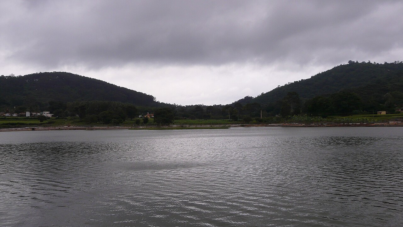
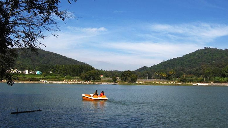
Man-made lake at the heart of Yelagiri, the hill station's most-visited spot, ringed by hills with a central fountain; pedal and row boating are the main draw.

parkYelagiri Nature Park

6.5 km · ~16 min by auto

Landscaped ~12-acre park near Punganur Lake with an artificial cascade, musical fountain, aquarium, children's play area and themed gardens; a standard family stop on the Yelagiri circuit.

templeVelavan Temple, Yelagiri

5.8 km · ~15 min by auto

Hillside temple dedicated to Lord Murugan (Velavan), one of the main devotional stops within the Yelagiri hill station, visited both for worship and for the valley views.

S
Swamimalai Hills, Yelagiri
Place
heritageSwamimalai Hills, Yelagiri

5.9 km · ~15 min by auto

The highest point of the Yelagiri hill station, reached by a trek of roughly 3 km from Punganur Lake. The summit offers a panorama over the whole hill station and surrounding valleys, making it Yelagiri's best-known trekking route.

N
Nilavoor Lake, Yelagiri
Place
heritageNilavoor Lake, Yelagiri

7.8 km · ~19 min by auto

An artificial lake in Nilavoor village on the Yelagiri hills, flanked by a garden on its banks. It is a popular boating spot offering pedal and motorboat rides amid the hill scenery, and is quieter than the more central Punganur Lake.

G
Government Herbal Farm, Yelagiri
Place
heritageGovernment Herbal Farm, Yelagiri

5.9 km · ~15 min by auto

A forest-department herbal park close to Punganur Lake growing medicinal herbs and plants used in Siddha and Ayurvedic preparations. It is a small educational nature stop showcasing the hill's rare medicinal flora.

Roampedia is commission-free — own or know a stay, eatery, guide or shop near Jalagamparai Falls? List it and it appears here once verified.

Add a nearby business
Before you go

Jalagamparai Falls — at a glance

TimingsDaylight hours (best before noon)
Best timeJuly to December (post-monsoon)

Entry: Free

Getting here

How to reach Jalagamparai Falls

Nearest railway Jolarpettai Jn (~30 km); nearest airport Bengaluru International (BLR), ~125 km; Salem ~95 km

Getting around Jalagamparai Falls

If you need step-free access, contact the site before travelling. Ask about a level entrance, steps along the route, the nearest drop-off point, seating and accessible toilets.

If you need help at Jalagamparai Falls
112All emergencies (police · fire · medical)The single number to call in any emergency (ERSS).

Emergency numbers are verified against official government and state tourism sources. 112 works anywhere in India.

Nearby

What’s near Jalagamparai Falls

hill stationYelagiri Hills

Tirupathur's signature hill station on a ~1,110 m Eastern Ghats plateau, reached by a road of 14 hairpin bends and known for its cool climate, orchards, rose gardens, boating and paragliding.

4.9 km · ~12 min by auto · straight line
activityPunganur Lake

Man-made lake at the heart of Yelagiri, the hill station's most-visited spot, ringed by hills with a central fountain; pedal and row boating are the main draw.

5.1 km · ~13 min by auto · straight line
S
Sri Vekkaliamman Temple, Kandili
Place
heritageSri Vekkaliamman Temple, Kandili

An Amman temple at Kandili, about 13 km from Tirupathur town, noted for its towering gopuram reported at around 142 feet. It is one of the more prominent temple destinations in the district and a focus of local festival worship.

5.4 km · ~13 min by auto · straight line
templeVelavan Temple, Yelagiri

Hillside temple dedicated to Lord Murugan (Velavan), one of the main devotional stops within the Yelagiri hill station, visited both for worship and for the valley views.

5.8 km · ~15 min by auto · straight line
S
Swamimalai Hills, Yelagiri
Place
heritageSwamimalai Hills, Yelagiri

The highest point of the Yelagiri hill station, reached by a trek of roughly 3 km from Punganur Lake. The summit offers a panorama over the whole hill station and surrounding valleys, making it Yelagiri's best-known trekking route.

5.9 km · ~15 min by auto · straight line
G
Government Herbal Farm, Yelagiri
Place
heritageGovernment Herbal Farm, Yelagiri

A forest-department herbal park close to Punganur Lake growing medicinal herbs and plants used in Siddha and Ayurvedic preparations. It is a small educational nature stop showcasing the hill's rare medicinal flora.

5.9 km · ~15 min by auto · straight line
parkYelagiri Nature Park

Landscaped ~12-acre park near Punganur Lake with an artificial cascade, musical fountain, aquarium, children's play area and themed gardens; a standard family stop on the Yelagiri circuit.

6.5 km · ~16 min by auto · straight line
N
Nilavoor Lake, Yelagiri
Place
heritageNilavoor Lake, Yelagiri

An artificial lake in Nilavoor village on the Yelagiri hills, flanked by a garden on its banks. It is a popular boating spot offering pedal and motorboat rides amid the hill scenery, and is quieter than the more central Punganur Lake.

7.8 km · ~19 min by auto · straight line
P
Paiyampalli
Place
heritagePaiyampalli

A village in Tirupathur taluk that is one of Tamil Nadu's important prehistoric sites, excavated by the Archaeological Survey of India under S. R. Rao in 1964-65 and 1967-68. The digs revealed a Neolithic habitation level dated around 1390 BCE overlaid by a Megalithic period, with charred horse gram and green gram and black-and-red ware pottery. It documents one of the earliest farming settlements in northern Tamil Nadu.

9.1 km · ~15 min by cab · straight line
townJolarpettai

Town built around one of South India's major railway junctions, where the Chennai-Bangalore and Chennai-Salem-Kerala lines diverge; a long-standing strategic rail hub and the rail gateway for Yelagiri.

9.9 km · ~17 min by cab · straight line
A
Alangayam Dam
Place
heritageAlangayam Dam

A reservoir at Alangayam, a town panchayat in the western part of Tirupathur district near the Yelagiri and Javadi hill ranges. It is commonly listed among the district's scenic water-body attractions, set in an area known for sandalwood and agriculture.

12.4 km · ~21 min by cab · straight line
townTirupathur town

Headquarters of Tirupathur district, carved out of Vellore in 2019; a trading centre for the surrounding agricultural belt and the gateway town for Yelagiri.

12.4 km · ~21 min by cab · straight line

All 8 places to visit in Yelagiri →

On the map

Where Jalagamparai Falls is

Good to know

Jalagamparai Falls — frequently asked

Does Jalagamparai Falls flow all year?

No. It is rain-dependent; verify recent conditions locally before making the trip.

Can I swim at the falls?

No safe-swimming claim is made. Rock and runoff conditions change, so remain in permitted areas and follow local restrictions.

When is the best time to visit Jalagamparai Falls?

October to March is the cooler, drier season in the Cauvery delta.

What are the entry fee and timings at Jalagamparai Falls?

Entry: Free. Timings: Daylight hours (best before noon).

How do I reach Jalagamparai Falls?

Base yourself in Yelagiri or nearby in Tirupathur, then confirm the last-mile route locally before travel. If access depends on temple, museum or seasonal rules, check on the day before you go.

How much time do I need for Jalagamparai Falls?

About an hour.

What else is near Jalagamparai Falls?

Nearby you can pair Yelagiri Hills (4.9 km), Punganur Lake (5.1 km), Sri Vekkaliamman Temple, Kandili (5.4 km), Velavan Temple, Yelagiri (5.8 km).

Read before you go

Jalagamparai Falls guides, stories & itineraries

We have not published a story about Jalagamparai Falls itself yet. These cover Yelagiri and the wider district, with separate journeys between stops.

Around Yelagiri

These guides explore Yelagiri and the surrounding area. Choose a visit that fits your interests, allowing separately for travel between stops.

Tamil Nadu-wide guides & itineraries

Route-level itineraries and practical guides for the rest of Tamil Nadu.

See all 16 Tirupathur guides & stories →

Image credits

Photographs: Ashwin Kumar from Bangalore, India, CC BY-SA 2.0, via Wikimedia Commons (CC BY-SA 2.0), Ashwin Kumar from Bangalore, India (CC BY-SA 2.0). Wikimedia Commons.