Places to Visit in Gudibande

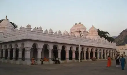
The northern hill country — the Byraweshwara rock fort of Gudibande and the hanging-rock viewpoint of Avalabetta.

Gudibande Fort, Gudibande
Practical guide

Plan Gudibande

Who's going?Tailor Gudibande to your trip
DistrictChikkaballapur
RoleFort-and-viewpoint base
Places to visit2
What to expect

Highlights

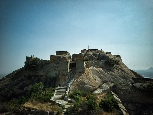
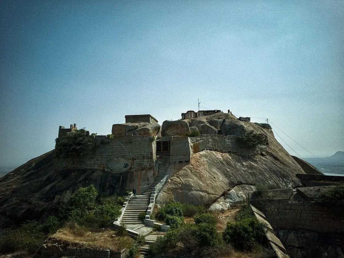
  • Gudibande Fort — A circular rock hill fort — the Gummanayaka or Byraweshwara fort — founded around 1350 by the chieftain Gummanayaka, with tiered stepped ponds (kalyanis) up the hill and a Byraweshwara temple at the top.
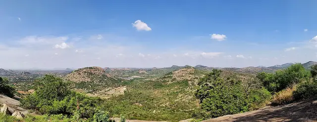
  • Avalabetta — A hill viewpoint famous for its overhanging "hanging rock" ledge above a sheer drop, with a Narasimha Swamy hilltop temple and a Lakshminarayana cave shrine, overlooking the Nandi range.
Getting there

How to visit

  • Nearest airport: Kempegowda International, Bengaluru (BLR) ~40 km from Chikkaballapur
  • Rail gateway: Chikkaballapur (CBP) on the Bengaluru–Kolar line, with trains from Bengaluru and Kolar; Gauribidanur and Sidlaghatta are also on the line
  • NH-44 (the Bengaluru–Hyderabad highway) runs through the district; KSRTC hubs at Chikkaballapur, Chintamani and Gauribidanur with frequent buses from Bengaluru. A car is best for Nandi Hills, Gudibande, Avalabetta and Kaivara.

Distance by road

  • Bengaluru98 km
  • Hassan222 km
  • Ballari228 km
  • Mysuru239 km
  • Davanagere249 km
  • Shivamogga289 km

Road distances measured on real routed roads to Gudibande itself, not to the district headquarters, on 24 August 2026. Driving time is deliberately not published: free-flow routing badly understates a Deccan single-carriageway highway, so allow more than the distance suggests.

Timing

Best time to visit Gudibande

Weather in GudibandeSeasonal guide

Live forecast loads in your browser.

Today at Gudibande
Sunrise6:08 am
Sunset6:29 pm
Golden hour best light5:29 pm–6:29 pm
Blue hour after sunset6:29 pm–6:54 pm
Sun sets toward compass bearingW · 278°
Moon tonight🌗 Last quarter · 49%

Sunset is in about 3 hours.

South-west monsoon. June to September is the south-west monsoon in Karnataka. Expect heavy showers, mostly in bursts rather than all day — carry rain cover, allow extra time for getting around, and note that ferries and open-air sites are the first things affected.

Sun and moon are calculated for this location and shown in IST. Photography windows are the hour around sunrise and sunset; the sunset bearing is degrees clockwise from true north. Moon phase is accurate to about half a day.

In the district

Where Gudibande sits in Chikkaballapur district

Nearest airportKempegowda International, Bengaluru (BLR) ~40 km from Chikkaballapur
Rail gatewayChikkaballapur (CBP) on the Bengaluru–Kolar line, with trains from Bengaluru and Kolar; Gauribidanur and Sidlaghatta are also on the line
Bus / road accessNH-44 (the Bengaluru–Hyderabad highway) runs through the district; KSRTC hubs at Chikkaballapur, Chintamani and Gauribidanur with frequent buses from Bengaluru. A car is best for Nandi Hills, Gudibande, Avalabetta and Kaivara.
District HQChikkaballapur
LandscapeA hill-and-temple district of the eastern plateau north-east of Bengaluru, carved out of Kolar in 2007, on the granite Nandi range and the Andhra Pradesh frontier — the source hills of the Pinakini, Palar and Arkavathi rivers

Chikkaballapur district is known for: The Nandi Hills sunrise hill station, the Bhoga Nandeeshwara temple, the Skandagiri night trek, the Gudibande fort and Avalabetta viewpoint, the Visvesvaraya birthplace of Muddenahalli, the Vidurashwatha memorial, the Kaivara temples and the Sidlaghatta silk town.

Nandi HillsBhoga Nandeeshwara TempleSkandagiri
Stay · eat · do · rent · see · shop

Places in Gudibande

Every verified place in Gudibande — filter by what you’re after.

Verified inventory is being added here.

Verified places are being added. The category filters will fill in as approved stays, restaurants, experiences, sights, shops and nature listings go live.

List your place
For hotels, homestays and local businesses

Get listed in Gudibande for free

Roampedia is commission-free. Travellers discover your business, book directly and contact you through official details. Basic listings are free, while Gold and Platinum package upgrades can be requested from the owner dashboard after approval.

List your business — free
Read before you go

Gudibande guides, stories & itineraries

Stories & history of Gudibande

Written about Gudibande itself — its history, its legends and the arguments about them.

Nearby in Chikkaballapur

Wider reading from Chikkaballapur. The stories about Gudibande itself are above.

More from Chikkaballapur

Wider guides to Chikkaballapur — its coast, its culture and the routes through it.

See all 14 Chikkaballapur guides & stories →

Map

Where things are in Gudibande

FAQ

Gudibande travel FAQs

What are the best places to visit in Gudibande?

Top places to visit in Gudibande include Gudibande Fort, Avalabetta — each has a full guide with how to reach it and what to see nearby on this page.

How do I reach Gudibande?

The nearest airport to Gudibande is Kempegowda International, Bengaluru (BLR) ~40 km from Chikkaballapur. The rail gateway is Chikkaballapur (CBP) on the Bengaluru–Kolar line, with trains from Bengaluru and Kolar; Gauribidanur and Sidlaghatta are also on the line. NH-44 (the Bengaluru–Hyderabad highway) runs through the district; KSRTC hubs at Chikkaballapur, Chintamani and Gauribidanur with frequent buses from Bengaluru. A car is best for Nandi Hills, Gudibande, Avalabetta and Kaivara.

What is the best time to visit Gudibande?

October to February is the coolest, most comfortable season to visit Gudibande and the rest of Karnataka. March to May is hot on the plains, and the June–September southwest monsoon brings the main rains, heaviest along the coast and Western Ghats.

Image credits