What to expect
Highlights
- The horse-face peak and grassland ridge trek.
- Shola forest, streams and sweeping Ghats views.
- The wider Kudremukh National Park setting.
Kudremukh, at about 1,894 m, is the second-highest peak in Karnataka and the centrepiece of the Kudremukh National Park. Its name — "horse-face" — comes from a distinctive profile of the mountain.

The peak is reached by a permit-controlled day trek from Mullodi/Balagal that crosses rolling shola grassland, streams and forest patches, one of the classic Western Ghats treks.
Road km to Chikkamagaluru; ghat roads and traffic vary — allow extra.
October to February (post-monsoon greenery, clearer skies); the park may restrict access in the monsoon.
Live forecast loads in your browser.
Sun and moon are calculated for this location and shown in IST. Photography windows are the hour around sunrise and sunset; the sunset bearing is degrees clockwise from true north. Moon phase is accurate to about half a day.
Verified hotels, homestays, restaurants, experiences, sights, shops and rentals around Kudremukh Peak — commission-free, with direct contact. Filter by what you need.
Verified places are being added. The category filters will fill in as approved stays, restaurants, experiences, sights, shops and nature listings go live.
List your place2 more places around Kudremukh. Open a guide to plan the visit and onward journey.

42.2 km · 68 min drive
A waterfall inside the Kudremukh National Park, reached down a long flight of steps, dropping around 30 m into a rocky pool amid rainforest; also known as Soojipara.

31.4 km · 58 min drive
A riverside temple to Adi Shakthyathmaka Annapoorneshwari, goddess of food and nourishment, at Horanadu on the Bhadra, where every pilgrim is offered a free meal; a key stop on the Sringeri–Kalasa temple circuit.
Roampedia is commission-free — own or know a stay, eatery, guide or shop near Kudremukh Peak? List it and it appears here once verified.
Add a nearby businessEntry: Forest permit (and guide) required
Trek base near Kalasa/Kudremukh, ~95–100 km from Chikkamagaluru
If you are travelling by bus or ferry, check the return service with the operator before setting out. Leave time to reach the stop or jetty after your visit.
Ask at the bus stand for the time of the last service back, not the next one. If you miss it, an auto or app cab is the fallback — agree the fare before you get in.
If you need step-free access, contact the site before travelling. Ask about a level entrance, steps along the route, the nearest drop-off point, seating and accessible toilets.
Emergency numbers are verified against official government and state tourism sources. 112 works anywhere in India.
A riverside temple to Adi Shakthyathmaka Annapoorneshwari, goddess of food and nourishment, at Horanadu on the Bhadra, where every pilgrim is offered a free meal; a key stop on the Sringeri–Kalasa temple circuit.
31.4 km · 58 min driveA waterfall inside the Kudremukh National Park, reached down a long flight of steps, dropping around 30 m into a rocky pool amid rainforest; also known as Soojipara.
42.2 km · 68 min drive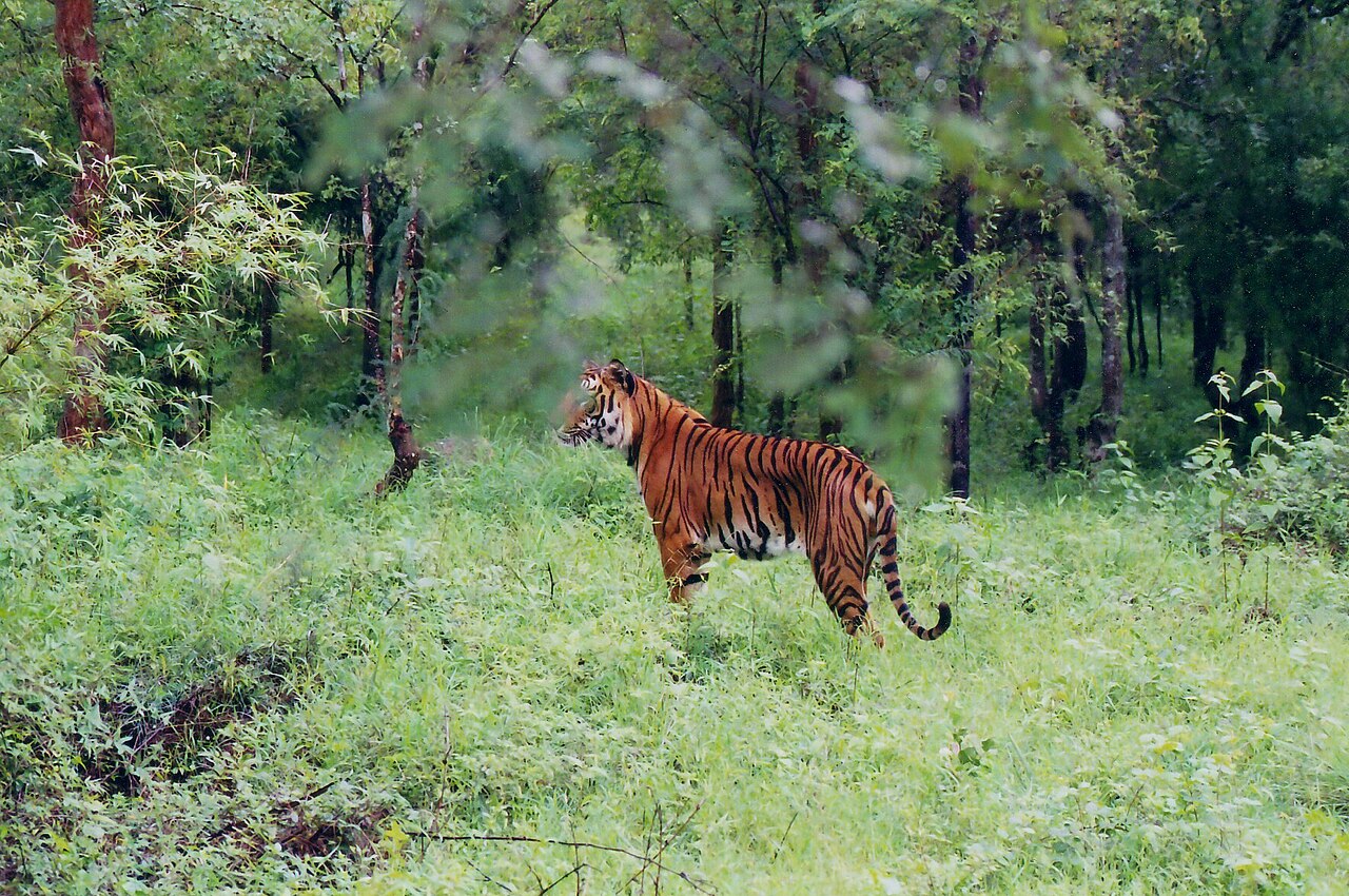
A tiger reserve on the Bhadra river around Muthodi, its dry and moist deciduous forest sheltering tigers, elephants, gaur, sambar and rich birdlife; jeep safaris run from the Muthodi range.
62.2 km · ~104 min by cab · straight line
The temple of goddess Sharadamba at Sringeri, seat of the Sharada Peetham — the first of the four mathas founded by Adi Shankaracharya — on the bank of the Tunga river; a major centre of learning and pilgrimage.
75.1 km · 93 min drive
A 14th-century temple in the Sringeri math complex blending Hoysala and Vijayanagara styles, famous for its twelve zodiac pillars set so that sunlight falls on the pillar of the solar month, and for its finely carved outer walls.
75.1 km · 93 min drive
A broad tiered waterfall of about 40 feet in forest above Kigga, 15.6 km by road from Sringeri, reached by around fifty laid steps from a car park. People bathe at the base in moderate flow, but it is loose boulders and slick rock — not a paddling pool.
80.2 km · 102 min drive
A calm irrigation lake ringed by coffee hills a few kilometres from Chikkamagaluru town, a popular spot for sunset views over the water with the Baba Budan range behind.
100.7 km · 132 min drive
At about 1,930 m the highest peak in Karnataka, a grassy summit of the Baba Budan range near Chikkamagaluru topped by a small Shiva shrine (Mullappa Swamy); a motorable road climbs to a saddle, from where a short stepped path leads to the top and sweeping Western Ghats views.
132.6 km · 153 min drive
A sacred mountain range north of Chikkamagaluru named after the Sufi saint Baba Budan, credited with first bringing coffee to India; its cave shrine (the Dattatreya Peetha) is revered by Hindus and Muslims alike, and the ridge has grassy trails and viewpoints.
202.7 km · 231 min drive
A thin, sacred cascade on the Baba Budangiri slopes where pilgrims stand in the spray, believed to have healing powers; reached by a short walk down steps from the road near the Dattatreya shrine.
203.1 km · 231 min driveWalking and driving times are real routed distances, except the few marked “straight line”, which are direct-line estimates and will read short.Routing: © openrouteservice.org by HeiGIT | Map data © OpenStreetMap contributors
October to February (post-monsoon greenery, clearer skies); the park may restrict access in the monsoon.
Entry: Forest permit (and guide) required. Timings: Full-day trek; start early.
The trek base is near Kalasa/Kudremukh, ~95–100 km from Chikkamagaluru; the trek needs a forest-department permit and usually a guide. Numbers and timings are regulated — arrange the permit and guide in advance, start early, and carry water, food and rain cover; the full trek is long and strenuous.
A full day for the trek.
Nearby you can pair Annapoorneshwari Temple, Horanadu (31.4 km), Hanuman Gundi Falls (42.2 km), Bhadra Wildlife Sanctuary (62.2 km), Sharadamba Temple, Sringeri (75.1 km).
We have not published a story about Kudremukh Peak itself yet. These cover Kudremukh and the wider district, with separate journeys between stops.
These guides explore Kudremukh and the surrounding area. Choose a visit that fits your interests, allowing separately for travel between stops.
Route-level itineraries and practical guides for the rest of Karnataka.
Photographs: solarisgirl, CC BY-SA 2.0, via Wikimedia Commons (CC BY-SA 2.0), Ramesh Desai (CC BY-SA 4.0), Prashanthmuthyalanaidu (CC BY-SA 4.0), iMahesh (CC BY-SA 4.0). Wikimedia Commons.


