What to expect
Highlights
- The Tagore beach and Rabindranath Tagore association.
- The INS Chapal warship museum on the seafront.
- Island views and a calm harbour beach.
Karwar, the district headquarters, is a port town at the mouth of the Kali river with a long, calm beach and a naval presence. Rabindranath Tagore stayed here as a young man and wrote of its beauty.

The seafront has the Tagore beach and Rabindranath Tagore museum, a decommissioned-warship museum (INS Chapal), and views out to islands like Kurumgad; the sea here is gentler than the open Kanara coast.
Road km to Uttara Kannada; ghat roads and traffic vary — allow extra.
October to February; sunsets over the harbour and islands are lovely.
Live forecast loads in your browser.
Sun and moon are calculated for this location and shown in IST. Photography windows are the hour around sunrise and sunset; the sunset bearing is degrees clockwise from true north. Moon phase is accurate to about half a day.
Verified hotels, homestays, restaurants, experiences, sights, shops and rentals around Karwar Beach — commission-free, with direct contact. Filter by what you need.
A three-star resort operated by Sterling Holidays on the coast about 5 km south of the town centre, and the largest branded hotel in Karwar. It is a package resort rather than a town hotel: expect to be driven in and out for everything in Karwar itself.
Homestay on Ocean Deck Road at Sadashivgad, north of the river and roughly 8 km round from the town centre, near the estuary rather than the town beach.
Guest house on the Sadashivgad side of the Kali, named for the view it is built to face — the river mouth where the Kali meets the Arabian Sea, with the islands beyond it. About 6 km round by road from the town centre, which puts it away from the town beach and beside the estuary instead.
A Mahamaya temple about 7 km round from the town centre, on the north side of the river. Mahamaya is the goddess in her form as the great illusion, and temples to her are a Konkan-coast pattern rather than an inland Karnataka one. A neighbourhood temple in use, not a monument, and it shares its name with a hotel on the Link Road nearby.
A Shiva temple roughly 4. It is a working local temple with no published history, no timings and no ticket — the ordinary religious furniture of a Konkan town rather than a visitor attraction, and worth a look only if you are passing.
A temple to Mahaladeva and the Mahasati goddess, out at about 9 km round from the town centre and the furthest of the town's recorded shrines. Mahalasa and the sati goddesses belong to the same Goan-Konkan religious world as the Shantadurga temple on the fort hill. Nothing about its history or its hours is published anywhere we could check.
A small eating house near the Kali River Garden at Kodibag, at the north end of the town about forty minutes' walk from the centre. "Hotel" here means what it means all over coastal Karnataka — a plate-meals restaurant, not a place to sleep. Named for Annapurneshwari, the goddess of food, which on this coast usually signals a vegetarian kitchen; it publishes nothing, so check before you count on it.
A roadside restaurant on the Panvel–Kochi–Kanyakumari highway — NH-66 — at Kodibag, on the northern edge of town about half an hour's walk from the centre. A highway kitchen rather than a destination, and a straightforward stop if you are driving in from Goa. Nothing about its hours or menu is published.
A restaurant at Kodibag, beside the Indian Bank and near the Radha Krishna temple, and one of the closest eating houses to the town centre — about thirteen minutes on foot.
A meat restaurant on KEB Road opposite the Sagar Complex, a quarter of an hour's walk from the town centre, and one of the handful of non-vegetarian kitchens in the middle of town. Karwar's cooking is Konkan and Goan more than Kannadiga — coconut, cashew and ginger in the gravy — and the everyday version of it is eaten in rooms like this rather than in hotels.
An eating house on INP Road at Baithkol, by the fishing harbour about fifty minutes' walk south of the town centre. Baithkol is where the catch actually lands — mackerel, sardine, seer, prawns, clams and crab — and the kitchens around the harbour road are the reason to be down there at all. Nothing about it is published; go and look.
5 km out. Useful if you are already on that road; not somewhere to walk to from the beach.
A meat kitchen at Arga, on the coast road well south of the town — the same Arga whose beach went into naval property when the base at Binaga was built. About 9 km round from the town centre, so a drive rather than a walk.
That is not decoration: Christianity came to this coast with the Portuguese in Goa in the sixteenth and seventeenth centuries, and Karwar's Catholic families descend from those congregations. A working parish; visit outside Mass.
A Shantadurga temple on the Sadashivgad hill, about 6 km round from the town centre and on the way up to the fort. Shantadurga is one of the great Goan goddesses — the peacemaker form of Parvati — and her presence here is a plain marker of how far the Konkan cultural world reaches south of the state border. A living temple: shoes off, and it is used, not exhibited.
The tomb of Sayed Shamsuddin, called Shah Karamuddin Auliya, on the Sadashivgad side of the river — and the single oldest thing in the Karwar story that you can still stand in front of. When the Portuguese captured and burned the fort at this river mouth in 1510, they named the place Forte de Piro after the dargah of a Sufi saint they found there, and this is that saint. Nearly five centuries later it is still a working shrine.
The government inspection bungalow in the town centre, eleven minutes' walk from the seafront — the old Public Works rest house of the kind every district headquarters in India has, built for touring officials and let to the public only when it is free and only through the department. Worth knowing about, not worth planning around.
A public park about fifteen minutes' walk from the town centre — a neighbourhood green rather than a destination, with the ordinary benches, paths and evening walkers of a small district town. Free and open; nothing is published about its hours.
A statue of Swami Vivekananda about 3. It is a civic monument of the kind found in most Indian district towns rather than a historic one — a five-minute stop if you are already going past, and no more than that.
The closest of the town's parks to the centre, eleven minutes on foot — a children's playground rather than a garden, and the obvious release valve if you are travelling with small children and the beach is too hot in the middle of the day.
A riverside public garden at Kodibag, at the north end of the town where the Kali comes down to the sea, about 3.5 km round from the centre. It is named in the district's own list of places of interest in Karwar. What it is for is an evening hour by the water with the bridge and the estuary in front of you — free, unticketed, and busiest at sunset.
Book with the place itself. India’s cyber-crime coordination centre warned in April 2025 that convincing copies of hotel and pilgrimage booking sites are being pushed through sponsored search and social ads, taking payment for rooms the property never hears about. Every listing here links to the business’s own contact details and its own Google or Bing profile — we take no commission and sit in nobody’s payment path. If a booking page reached you through an ad, check the address bar against the property’s own site before you pay. Fraud can be reported on cybercrime.gov.in or on 1930.
3 more places around Karwar. Open a guide to plan the visit and onward journey.

3.4 km · ~8 min by auto
A Sonda-era hill fort of 1715 above the mouth of the Kali river, about 5 km from Karwar, with the Shantadurga temple and a 17th-century dargah on the way up and the Arabian Sea and its islands below.
4.1 km · ~10 min by auto
A tortoise-shaped island ~4 km off Karwar with a hilltop Narasimha temple, snorkelling and an annual jatra; reached by boat.

370 m · 5 min walk
Karwar’s main promenade beach, named for Rabindranath Tagore, who stayed here in 1882 and wrote a chapter of his memoirs about it — with the decommissioned missile boat INS Chapal preserved on the sand as a walk-through warship museum and a retired Tu-142 patrol aircraft beside it.
Roampedia is commission-free — own or know a stay, eatery, guide or shop near Karwar Beach? List it and it appears here once verified.
Add a nearby businessEntry: Free (warship museum ticketed)
Karwar town, ~60 km north of Gokarna; Konkan railway/NH-66
If you are travelling by bus or ferry, check the return service with the operator before setting out. Leave time to reach the stop or jetty after your visit.
Ask at the bus stand for the time of the last service back, not the next one. If you miss it, an auto or app cab is the fallback — agree the fare before you get in.
If you need step-free access, contact the site before travelling. Ask about a level entrance, steps along the route, the nearest drop-off point, seating and accessible toilets.
Emergency numbers are verified against official government and state tourism sources. 112 works anywhere in India.
Karwar’s main promenade beach, named for Rabindranath Tagore, who stayed here in 1882 and wrote a chapter of his memoirs about it — with the decommissioned missile boat INS Chapal preserved on the sand as a walk-through warship museum and a retired Tu-142 patrol aircraft beside it.
370 m · 5 min walk · straight lineA Sonda-era hill fort of 1715 above the mouth of the Kali river, about 5 km from Karwar, with the Shantadurga temple and a 17th-century dargah on the way up and the Arabian Sea and its islands below.
3.4 km · ~8 min by auto · straight lineA tortoise-shaped island ~4 km off Karwar with a hilltop Narasimha temple, snorkelling and an annual jatra; reached by boat.
4.1 km · ~10 min by auto · straight line
The long town beach in front of Gokarna, used by pilgrims for ritual bathing and by visitors for a relaxed shore walk; the starting point of the cliff trail to the quieter southern beaches.
35.6 km · ~59 min by cab · straight line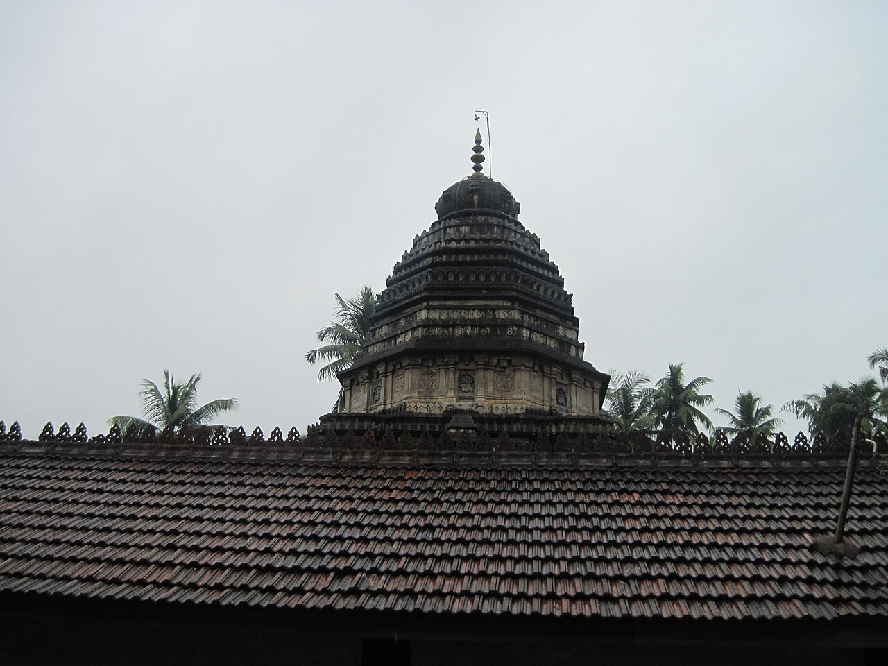
An ancient Shiva temple at Gokarna enshrining the Atmalinga, one of the most sacred lingas in South India (a "Dakshina Kashi") — a classic Dravidian temple by the sea and the centre of the Maha Shivaratri car festival.
36.7 km · ~61 min by cab · straight line
A crescent of sand between Gokarna town and Om Beach, reached by a short cliff walk — a mellow backpacker favourite for sunsets and yoga.
38.1 km · ~63 min by cab · straight line
A beach curved into the shape of the Om (ॐ) symbol south of Gokarna — the most popular of the town’s beaches, with shacks, water sports and a laid-back scene.
39.5 km · ~66 min by cab · straight line
A small half-moon cove reached by a cliff trek or boat beyond Om Beach — quiet and secluded, with just a few shacks.
39.9 km · ~67 min by cab · straight line
The most remote of the Gokarna beaches (also called Full Moon), reached by boat or a long cliff trek — an isolated stretch popular for camping where permitted.
40.3 km · ~67 min by cab · straight line
The Ramsar-listed mangrove estuary where the un-dammed Aghanashini river meets the sea — rich in bivalve fisheries, birdlife and boat backwaters.
41.8 km · ~70 min by cab · straight lineThe forest shrine at Ulavi (Joida taluk) around the samadhi of Channabasavanna — one of the largest Lingayat pilgrimage centres in Karnataka, with the Akka Nagalambike cave nearby.
46.4 km · ~77 min by cab · straight line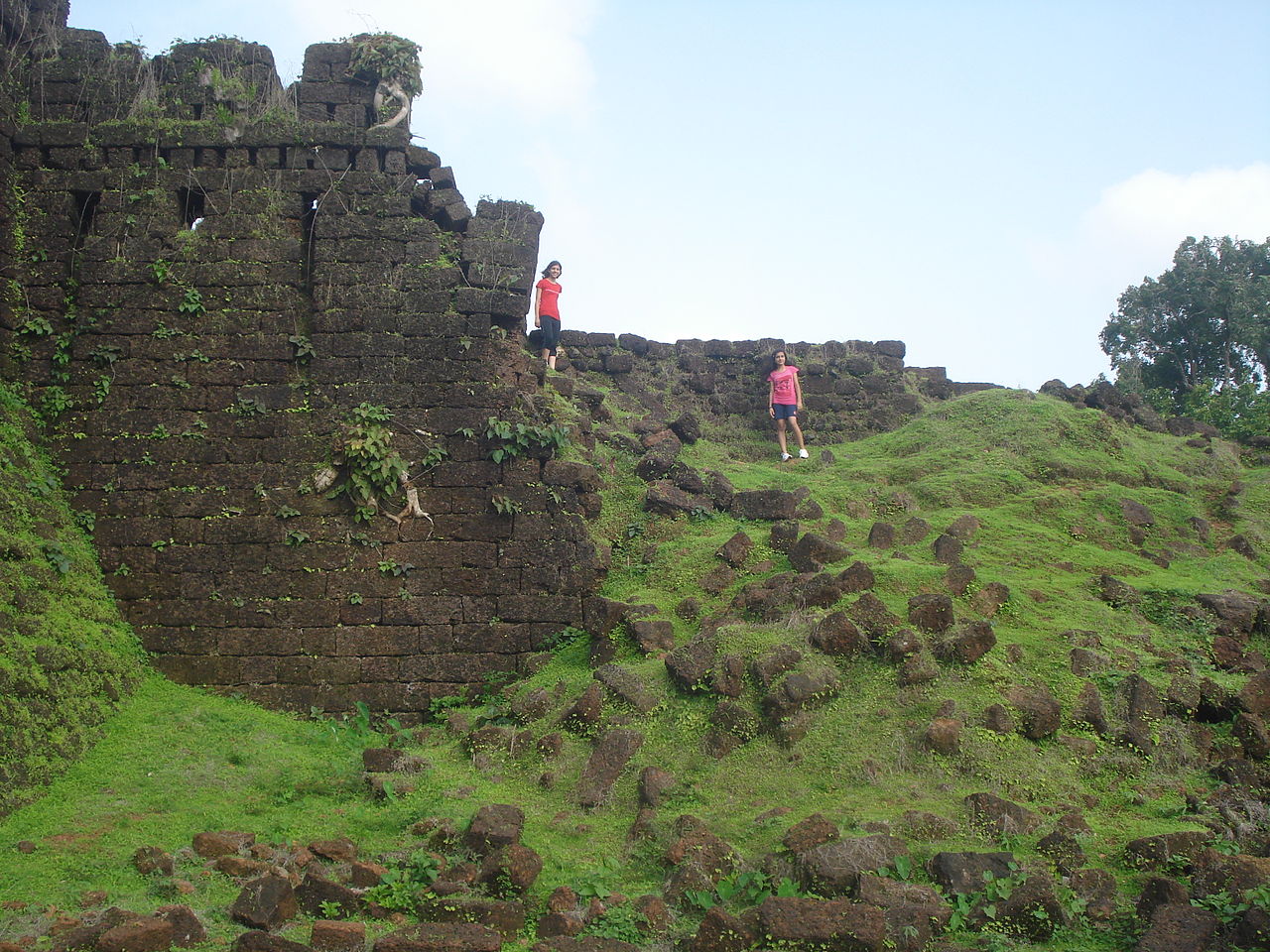
A laterite-stone fort near Kumta on the Aghanashini estuary, with high bastions and stepped wells amid greenery, linked to the 16th-century pepper-trading queen Chennabhairadevi.
48.2 km · ~80 min by cab · straight lineOctober to February; sunsets over the harbour and islands are lovely.
Entry: Free (warship museum ticketed). Timings: Beach all day; museum has fixed hours.
In Karwar town, ~60 km north of Gokarna and ~90 km south of Goa; on the Konkan railway and NH-66. The warship museum has fixed hours and a ticket; swim in the calmer flagged areas and be mindful of the naval/port zones.
1 to 2 hours.
Nearby you can pair Tagore Beach & INS Chapal Museum (370 m), Sadashivgad Fort (3.4 km), Kurmagad Island (4.1 km), Gokarna Beach (35.6 km).
We have not published a story about Karwar Beach itself yet. These cover Karwar and the wider district, with separate journeys between stops.
These guides explore Karwar and the surrounding area. Choose a visit that fits your interests, allowing separately for travel between stops.


Route-level itineraries and practical guides for the rest of Karnataka.
Photographs: DeepakBerwal12, CC BY-SA 4.0, via Wikimedia Commons (CC BY-SA 4.0), Vinuta Nayak, CC BY-SA 4.0, via Wikimedia Commons (CC BY-SA 4.0), R. Indu Mathi, CC BY-SA 4.0, via Wikimedia Commons (CC BY-SA 4.0). Wikimedia Commons.


