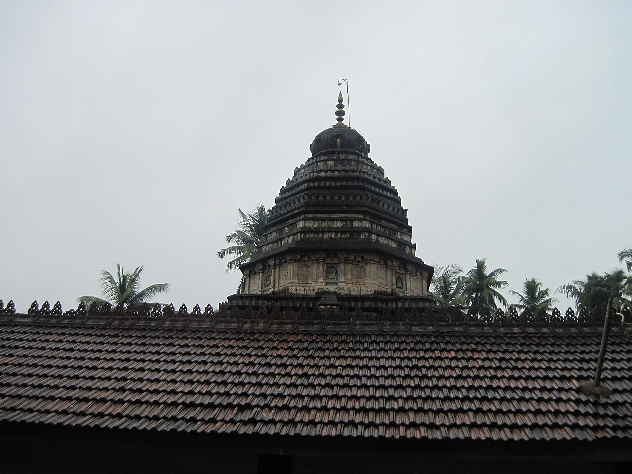
Sadashivgad Fort

A Sonda-era hill fort of 1715 above the mouth of the Kali river, about 5 km from Karwar, with the Shantadurga temple and a 17th-century dargah on the way up and the Arabian Sea and its islands below. This fort guide is organized from Karwar in Uttara Kannada district, with practical planning for routes, timing, nearby stays, food, operators and direct local inventory. Use it to compare what to see, how long to spend, when to go and which heritage stays, local guides, restaurants, shops, wellness options, transport and visitor services should be verified around Sadashivgad Fort.

Sadashivgad Fort, Karwar
Practical guide

Plan Sadashivgad Fort

Who's going?Tailor Sadashivgad Fort to your trip
Typefort
Nearest baseKarwar
DistrictUttara Kannada
Best timeOctober to February
Time needed1 to 1.5 hours
EntryFree
Places to visit4Listed businesses12

Sadashivgad is the ruin of a Sonda-dynasty hill fort of 1715, standing on a 200-foot headland where the Kali river meets the Arabian Sea, about 5 km from Karwar.

It was built to command the river mouth, and it did — within five years it had squeezed the English trading factory at Karwar out of business altogether.

Little of it survives: a single arched gateway, stretches of rampart and the outline of a citadel, pulled down by an East India Company force in 1783.

Most people come for what the hill gives rather than what the fort has left — the estuary, the road bridge directly below, the offshore islands and the sunset.

The story

A fort built to strangle a rival’s trade, and it worked. Within five years of going up on this headland in 1715 it had shut the English out of Karwar; within seventy it had been pulled down by them. What is left is a gateway, some broken wall, and one of the best views on the Karnataka coast.

The story of Sadashivgad Fort

Sadashivgad is not a fort you visit for its architecture. Most of it is gone. What is worth the climb is the position, and once you are standing on it the whole history of the place explains itself without a signboard: you are on a 200-foot headland on the north bank of the Kali river, exactly where it empties into the Arabian Sea, and nothing can enter or leave that river without passing beneath you.

That was the entire point. In the seventeenth century Karwar was a pepper port of real consequence, and the English East India Company kept a factory here — a walled trading post, not a manufactory — buying what the 1883 Gazetteer calls the best pepper on the coast. The Portuguese wanted the same trade. So did the Sonda rajas who ruled the country behind it, and it was the Sonda raja who worked out that you do not need to attack a trading post if you can build a wall across its front door.

In 1715, according to a local manuscript history the Gazetteer’s compilers had in front of them, the old fort of Karwar was pulled down and Sadashivgad was built in its place at Chitakul on the north bank of the Kalinadi. The new fort, they wrote, "seriously interfered with the safety of the English factory". The factory was now "little more than a genteel prison".

What happened next is the part that makes this a story rather than a list of owners. The Sonda raja completed a battery at the mouth of the river, closing the position. The chief of the English factory, a Mr Taylor, responded by seizing a wreck that had come ashore about four miles away — a piece of opportunism aimed squarely at the raja. The Gazetteer’s judgement on this is unusually blunt for an official volume: he "was foolish enough to annoy the chief".

Basava Linga, the Sonda chief, besieged the factory for two months through the monsoon. Two attempts to relieve it were made and both, between the weather and what the record calls the inefficiency of some of the troops, "were little better than failures". The siege was eventually lifted with the help of a friendly Musalman whose name the Gazetteer does not give. It made no difference. Basava stayed hostile, and in 1720 the Company gave up and removed the factory from Karwar altogether.

The English spent thirty years trying to get back. They were not allowed to reopen until 1750, and the terms were humiliating: the factor could not repair the old house and could not fortify his own dwelling. He lasted two years. In September 1752 a Portuguese fleet arrived and took the fort — which the Portuguese knew not as Sadashivgad but as Pir fort, after the Muslim shrine on it. With the Portuguese holding the river mouth and claiming a monopoly on Karwar’s trade, an English agent had nothing left to do. He was recalled that November, and the Company never opened a factory at Karwar again.

The Portuguese did not keep it long either. In November 1756, on condition that they hand Pir fort back, the Sonda chief gave them four villages and let them build a fort of their own to the south of the Kalinadi near Baitakala. The hill changed hands twice more — an East India Company detachment under Brigadier-General Richard Mathews occupied it in 1783 and pulled most of it down, and by 1799 it was garrisoned by Tipu Sultan’s troops. In 1800 Sadashivgad and Haliyal were the only two places in the district from which Tipu’s garrisons had not been driven out.

By 1801 Karwar itself was in ruins, and the Gazetteer records that the only trace left of its old commerce was a small trade in salt and catechu. It ends its Karwar pages on a note of quiet resignation: writing in July 1882, the compiler expected the town’s importance as a seaport to "greatly diminish" once the Marmagao–Hubli railway opened, and noted that several old Karwar shopkeepers had already left for Goa with more expected to follow. A century later the Konkan Railway came through Karwar after all, and the town is now the headquarters of its own railway division. The fort on the hill had stopped mattering long before that.

Legend & myth

The tradition attached to this hill is Shivaji’s. It holds that he crossed the Kali on 21 February 1665, took the fort, installed the goddess Shantadurga here and entrusted her worship to the local Bhandari community — the seafaring families of this coast, known as the darya sarangs, the navigators, of the old rulers. He is said to have come again in 1673.

It is worth being straight about how that fits with the dates. The fort you are standing in was built in 1715, fifty years after 1665, so whatever Shivaji took here it was not this fort — it was the older Karwar fort that stood on the same headland and was pulled down to make way for this one. The 1883 Gazetteer, which is detailed about almost everything else at Karwar, does not carry the episode at all. That does not make it false; local temple tradition is often older and better-kept than a colonial revenue survey. It does mean we cannot present it as established fact, and we are not going to.

What is not in doubt is the Bhandari connection, because it is still visible. The Durgamma temple on the hill was rebuilt and enlarged in 1928 by Daria Sarang of the Bhandari community, and the community’s custody of the shrine has continued unbroken into living memory. Whatever the truth of 1665, the people the tradition names are the people who have looked after the goddess ever since.

The Portuguese, meanwhile, never called it Sadashivgad. To them it was Forte de Piro — Pir fort — named not for the raja who built it but for the dargah on the slope, the tomb of the Sufi saint Shah Shamsuddin Kharobat. Three faiths have kept a foothold on one small hill for three hundred years, and the fort that was meant to control it all is the only one of the three that is now a ruin.

Read the full history of Sadashivgad Fort 928 more words

History

Before 1715 — an older fort of Karwar stands on this headland at Chitakul, north bank of the Kali (Kalinadi), commanding the river mouth. Karwar is a working pepper port; the English East India Company holds a factory here, and the Gazetteer of 1883 records its pepper as the best on the coast. Local tradition places Shivaji’s crossing and conquest here on 21 February 1665, with a second visit in 1673.

1715 — the old fort is pulled down and Sadashivgad built in its place, on the authority of a local manuscript history cited in the Gazetteer. It is raised by Basavalinga (Basava Linga) of the Sonda dynasty, chief from about 1695 to 1745, and named for his father Sadashiva, the fifth chief of Sonda, who ruled 1674–1697. Ramparts about 8 m high and 2 m wide at the top, with towers and gun openings; a citadel at the summit entered by a single arched gateway; a western work near the sea called the Pani Killa and a further fortification on the eastern slope.

1715 — October. Stephen Strutt, Deputy Governor of Bombay, reaches Karwar on the 31st to investigate charges of mismanagement against the Karwar, Tellicherry, Calicut and Anjengo factors. He finds three Portuguese vessels cruising the river mouth to keep the coast clear of pirates. Karwar passes the inquiry without censure.

c. 1715–1720 — the Sonda raja completes a battery at the river mouth. Mr Taylor, chief of the English factory, seizes a wreck four miles from the factory and provokes Basava Linga, who besieges the factory for two months through the rains. Two relief attempts fail. The siege is raised with the help of a friendly Musalman, but hostility continues.

1720 — the Company is forced to remove its factory from Karwar.

1750 — the English are finally permitted to reopen a factory, but may not repair the old house or fortify the factor’s dwelling.

September 1752 — a Portuguese fleet takes possession of "Pir fort or Sadashivgad" at the mouth of the river. (Some later accounts give May 1752; the Gazetteer gives September and links it to the agent’s recall that November. The month is contested; the year is not.) With the Portuguese enforcing a monopoly on Karwar’s trade, the English agent is recalled in November 1752 and the Company never again opens a factory at Karwar.

November 1756 — on condition that they give up Pir fort, the Sonda chief grants the Portuguese four villages and permission to build a fort south of the Kalinadi near Baitakala. In 1758 Anquetil Du Perron notes the Sonda chief holding a fort on the Karwar river with the Portuguese at its mouth.

1783 — a detachment of Brigadier-General Richard Mathews’ East India Company force is sent to occupy Sadashivgad. Most of the fort is pulled down. It has been a ruin ever since.

1799 — Sadashivgad is garrisoned by Tipu Sultan’s troops. In 1800 it and Haliyal are the only two places in the district from which Tipu’s garrisons have not been driven out.

1801 — Karwar is described as in ruins, its former commerce reduced to a little trade in salt and catechu.

1928 — the Durgamma (Shantadurga) temple on the hill is rebuilt and enlarged by Daria Sarang of the Bhandari community, the darya sarang or navigator families of this coast.

⚠ One widely-repeated claim is left out above. Several sites state the Portuguese captured Sadashivgad in 1510. The fort was not built until 1715, so as written that cannot be right; if it refers to an earlier work on the same headland, no source we could check says so. We have not repeated it.

Why visit

Go for the view, and be honest with yourself that this is why you are going. From the top you look straight down onto the Kali river bridge, out across the estuary to the Arabian Sea, and off to the islands — Kurmagad closest, with the Karwar group beyond. It is the single best vantage point on this stretch of coast and it costs nothing.

Go late in the day. This is a west-facing headland over open water, and the light between about four o’clock and sunset is the whole reason photographers come up here. Morning is fine for the walk and for the temple, but the view is an evening view.

Go for the three things sharing one hill. A Sonda fort, a Hindu shrine still in worship and looked after by the same seafaring community for a century, and a seventeenth-century Sufi dargah that gave the Portuguese their name for the place. You can see all three inside an hour, and the fact that they have coexisted here for three hundred years is more interesting than any one of them alone.

Go knowing what is actually left. This is not Bidar or Chitradurga. Mathews’ men did their job in 1783 and what survives is a gateway, broken lengths of rampart and the shape of a citadel under scrub. If you arrive expecting a fort to explore you will be disappointed in ten minutes; if you arrive expecting a ruin on a headland with a remarkable outlook, you will not be.

And go as part of Karwar rather than as a trip in itself. It is about 5 km from the bus stand, it takes an hour, and it sits naturally either side of the Tagore beach seafront, the warship museum or a boat to Kurmagad. Building a day around it would be a mistake; leaving it out of a day at Karwar would be a bigger one.

What to expect

Highlights

  • The ruined ramparts and the one surviving arched gateway on the summit.
  • The Shantadurga temple, roughly midway up the hill and still in worship.
  • The 17th-century dargah that gave the Portuguese their name for the place — Pir fort.
  • The view down onto the Kali river bridge and out to Kurmagad and the Karwar islands.
Getting there

How to visit

  • About 5 km north of Karwar bus stand, just off NH-66 where it crosses the Kali; a road climbs most of the way.
  • Park at or below the Durga temple and walk the last stretch — the surviving track and steps are rough underfoot.
  • Allow an hour or so, and come late in the afternoon if you want the light.

Distance by road

  • Panaji (Goa)100 km
  • Hubballi165 km
  • Udupi175 km
  • Mangaluru270 km
  • Bengaluru500 km

Road km to Uttara Kannada; ghat roads and traffic vary — allow extra.

Timing

Best time

October to February; late afternoon into sunset for the estuary and the islands.

Weather in Sadashivgad FortSeasonal guide

Live forecast loads in your browser.

Today at Sadashivgad Fort
Sunrise6:22 am
Sunset6:44 pm
Golden hour best light5:44 pm–6:44 pm
Blue hour after sunset6:44 pm–7:09 pm
Sun sets toward compass bearingW · 278°
Moon tonight🌗 Last quarter · 49%
South-west monsoon. June to September is the south-west monsoon in Karnataka. Expect heavy showers, mostly in bursts rather than all day — carry rain cover, allow extra time for getting around, and note that ferries and open-air sites are the first things affected.

Sun and moon are calculated for this location and shown in IST. Photography windows are the hour around sunrise and sunset; the sunset bearing is degrees clockwise from true north. Moon phase is accurate to about half a day.

Visitor notes

  • Broken, unfenced ramparts on a headland — keep well back from the edges and keep children close.
  • The temple on the way up is a working shrine: footwear off, and dress as you would for any temple.
Safety

Good to know

  • The ramparts are broken and unfenced and they stand on the edge of the headland. There is no barrier between the walking ground and the drop at several points, so keep well back and do not walk along the wall tops.
  • Do not climb on the ruins. The masonry was deliberately pulled down in 1783 and has had no consolidation since — loose three-hundred-year-old stone above a cliff is the specific hazard here.
  • There is no water, no shop and no shade on the summit, and no toilet anywhere on the hill. The nearest of all of it is in Karwar, 5 km away.
  • Nothing on the hill is lit, and the descent is the harder direction. If you stay for sunset, carry a torch and start down while you can still see the steps.
  • Keep the auto or taxi waiting. There is no passing traffic at the top and no reliable way to summon a ride from it.
  • The hill is quiet and often empty outside weekends. If you are on your own, go earlier rather than later and tell someone where you are.
Stay · eat · do · rent · see · shop

Stays, food & things to do near Sadashivgad Fort

Verified hotels, homestays, restaurants, experiences, sights, shops and rentals around Sadashivgad Fort — commission-free, with direct contact. Filter by what you need.

E
Emerald Bay, Karwar, Sterling Holidays
Place to stay
Top pick
Hotel
Emerald Bay, Karwar, Sterling Holidays
310 m · 4 min walk 3-star

A three-star resort operated by Sterling Holidays on the coast about 5 km south of the town centre, and the largest branded hotel in Karwar. OpenStreetMap's surveyors visited it on the ground and recorded wi-fi, wheelchair access and the three-star grade. It is a package resort rather than a town hotel: expect to be driven in and out for everything in Karwar itself.

Directions Commission-freeView details
P
Prafulla Homestay
Place to stay
Top pick
Homestay
Prafulla Homestay
2.8 km · ~7 min by auto

Homestay on Ocean Deck Road at Sadashivgad, north of the river and roughly 8 km round from the town centre, near the estuary rather than the town beach. OpenStreetMap records its address as Ocean Deck Rd, Sadashivgad, Karwar 581352 and a mobile number for it; there is no website, so confirm rooms and rates on the phone.

Directions Commission-freeView details
E
Estuary View Resort
Place to stay
Top pick
Homestay
Estuary View Resort
60 m · 1 min walk

Guest house on the Sadashivgad side of the Kali, named for the view it is built to face — the river mouth where the Kali meets the Arabian Sea, with the islands beyond it. About 6 km round by road from the town centre, which puts it away from the town beach and beside the estuary instead. It publishes no website or tariff we could verify; ring ahead in season.

Directions Commission-freeView details
S
Shree Mahamaya Temple
Sight
Top pick
Temple
Shree Mahamaya Temple
1.9 km · 24 min walk

A Mahamaya temple about 7 km round from the town centre, on the north side of the river. Mahamaya is the goddess in her form as the great illusion, and temples to her are a Konkan-coast pattern rather than an inland Karnataka one. A neighbourhood temple in use, not a monument, and it shares its name with a hotel on the Link Road nearby.

DirectionsView details
S
Shejjeshwar Temple
Sight
Top pick
Temple
Shejjeshwar Temple
5.1 km · ~13 min by auto

A Shiva temple roughly 4.5 km round from the town centre, recorded in OpenStreetMap under its Kannada name as well as its English one. It is a working local temple with no published history, no timings and no ticket — the ordinary religious furniture of a Konkan town rather than a visitor attraction, and worth a look only if you are passing.

DirectionsView details
S
Shree Mahaladeva Mahasati Devi Devastana
Sight
Temple
Shree Mahaladeva Mahasati Devi Devastana
9.0 km · ~15 min by cab

A temple to Mahaladeva and the Mahasati goddess, out at about 9 km round from the town centre and the furthest of the town's recorded shrines. Mahalasa and the sati goddesses belong to the same Goan-Konkan religious world as the Shantadurga temple on the fort hill. Nothing about its history or its hours is published anywhere we could check.

DirectionsView details
S
Shree Annapurneshwari Hotel
Where to eat
Restaurant
Shree Annapurneshwari Hotel
1.0 km · 13 min walk

A small eating house near the Kali River Garden at Kodibag, at the north end of the town about forty minutes' walk from the centre. "Hotel" here means what it means all over coastal Karnataka — a plate-meals restaurant, not a place to sleep. Named for Annapurneshwari, the goddess of food, which on this coast usually signals a vegetarian kitchen; it publishes nothing, so check before you count on it.

Directions Commission-freeView details
H
Hotel Happinezz
Where to eat
Restaurant
Hotel Happinezz
4.3 km · ~11 min by auto

A roadside restaurant on the Panvel–Kochi–Kanyakumari highway — NH-66 — at Kodibag, on the northern edge of town about half an hour's walk from the centre. A highway kitchen rather than a destination, and a straightforward stop if you are driving in from Goa. Nothing about its hours or menu is published.

Directions Commission-freeView details
S
Shagun Hotel
Where to eat
Restaurant
Shagun Hotel
4.4 km · ~11 min by auto

A restaurant at Kodibag, beside the Indian Bank and near the Radha Krishna temple, and one of the closest eating houses to the town centre — about thirteen minutes on foot. OpenStreetMap carries the address; there is no website, no published menu and no hours we can vouch for.

Directions Commission-freeView details
K
Karwar Chicken
Where to eat
Restaurant
Karwar Chicken
4.5 km · ~11 min by auto

A meat restaurant on KEB Road opposite the Sagar Complex, a quarter of an hour's walk from the town centre, and one of the handful of non-vegetarian kitchens in the middle of town. Karwar's cooking is Konkan and Goan more than Kannadiga — coconut, cashew and ginger in the gravy — and the everyday version of it is eaten in rooms like this rather than in hotels.

Directions Commission-freeView details
B
Bangarappa Hotel
Where to eat
Restaurant
Bangarappa Hotel
5.6 km · ~14 min by auto

An eating house on INP Road at Baithkol, by the fishing harbour about fifty minutes' walk south of the town centre. Baithkol is where the catch actually lands — mackerel, sardine, seer, prawns, clams and crab — and the kitchens around the harbour road are the reason to be down there at all. Nothing about it is published; go and look.

Directions Commission-freeView details
V
Vihar Hotel
Where to eat
Restaurant
Vihar Hotel
6.5 km · ~16 min by auto

A restaurant at the Mahalasa cross on the Karwar road, listed in OpenStreetMap with a Binaga and Ankola address — that is the stretch south of Karwar towards the naval base, not the town centre, and it is about 3.5 km out. Useful if you are already on that road; not somewhere to walk to from the beach.

Directions Commission-freeView details
G
Geeta Chicken Center a
Where to eat
Restaurant
Geeta Chicken Center a
8.9 km · ~15 min by cab

A meat kitchen at Arga, on the coast road well south of the town — the same Arga whose beach went into naval property when the base at Binaga was built. About 9 km round from the town centre, so a drive rather than a walk. The trailing "a" in the name is how it is recorded in OpenStreetMap and is almost certainly a typing slip in the survey, not part of the name.

Directions Commission-freeView details
H
Hotel Mahamaya
Place to stay
Hotel
Hotel Mahamaya
760 m · 9 min walk

Hotel on Link Road at Sadashivgad, on the Majali side of the river bridge and about 5 km from the town centre — a useful position if you are heading for Majali beach or driving on to Goa rather than staying on the town seafront. No official website or published tariff could be verified for it.

Directions Commission-freeView details
S
St. Joseph's Church
Sight
Church
St. Joseph's Church
2.6 km · ~6 min by auto

A Catholic parish church in the town, half an hour's walk from the centre, and recorded in OpenStreetMap under its Portuguese and Spanish names as well as its English one — Igreja São José. That is not decoration: Christianity came to this coast with the Portuguese in Goa in the sixteenth and seventeenth centuries, and Karwar's Catholic families descend from those congregations. A working parish; visit outside Mass.

DirectionsView details
S
Shantadurga Temple
Sight
Temple
Shantadurga Temple
300 m · 4 min walk

A Shantadurga temple on the Sadashivgad hill, about 6 km round from the town centre and on the way up to the fort. Shantadurga is one of the great Goan goddesses — the peacemaker form of Parvati — and her presence here is a plain marker of how far the Konkan cultural world reaches south of the state border. A living temple: shoes off, and it is used, not exhibited.

DirectionsView details
S
Shan Shamsuddin Kharobat Dargah
Sight
Mosque
Shan Shamsuddin Kharobat Dargah
340 m · 4 min walk

The tomb of Sayed Shamsuddin, called Shah Karamuddin Auliya, on the Sadashivgad side of the river — and the single oldest thing in the Karwar story that you can still stand in front of. When the Portuguese captured and burned the fort at this river mouth in 1510, they named the place Forte de Piro after the dargah of a Sufi saint they found there, and this is that saint. Nearly five centuries later it is still a working shrine.

DirectionsView details
I
Inspection Bungalow
Place to stay
Guest house
Inspection Bungalow
3.2 km · ~8 min by auto

The government inspection bungalow in the town centre, eleven minutes' walk from the seafront — the old Public Works rest house of the kind every district headquarters in India has, built for touring officials and let to the public only when it is free and only through the department. Not a hotel: there is no booking site, no tariff card and no reception in the usual sense. Worth knowing about, not worth planning around.

Directions Commission-freeView details
C
Community Park
Nature
Park
Community Park
3.6 km · ~9 min by auto

A public park about fifteen minutes' walk from the town centre — a neighbourhood green rather than a destination, with the ordinary benches, paths and evening walkers of a small district town. Free and open; nothing is published about its hours.

DirectionsView details
S
Swami Vivekananda Statue
Sight
Attraction
Swami Vivekananda Statue
1.2 km · 15 min walk

A statue of Swami Vivekananda about 3.5 km round from the town centre, recorded in OpenStreetMap as an attraction under its Kannada name. It is a civic monument of the kind found in most Indian district towns rather than a historic one — a five-minute stop if you are already going past, and no more than that.

DirectionsView details
C
Children Park
Nature
Park
Children Park
3.7 km · ~9 min by auto

The closest of the town's parks to the centre, eleven minutes on foot — a children's playground rather than a garden, and the obvious release valve if you are travelling with small children and the beach is too hot in the middle of the day. Free, unticketed, and no published hours.

DirectionsView details
K
Kali River Garden
Nature
Park
Kali River Garden
1.0 km · 12 min walk

A riverside public garden at Kodibag, at the north end of the town where the Kali comes down to the sea, about 3.5 km round from the centre. It is named in the district's own list of places of interest in Karwar. What it is for is an evening hour by the water with the bridge and the estuary in front of you — free, unticketed, and busiest at sunset.

DirectionsView details

Book with the place itself. India’s cyber-crime coordination centre warned in April 2025 that convincing copies of hotel and pilgrimage booking sites are being pushed through sponsored search and social ads, taking payment for rooms the property never hears about. Every listing here links to the business’s own contact details and its own Google or Bing profile — we take no commission and sit in nobody’s payment path. If a booking page reached you through an ad, check the address bar against the property’s own site before you pay. Fraud can be reported on cybercrime.gov.in or on 1930.

Ranked

The best of Karwar, ranked

Sadashivgad Fort sits in Karwar, and these rank everything verified across the town rather than this one spot — built from the same listings shown above, ordered by the strength of the source evidence behind each entry rather than by anyone's star score. Every card shows how many places are really on it. Nobody pays to appear.

Across the whole of Karwar

Ranked guides

Top experiences around Karwar

3 more places around Karwar, each worth a day of its own.

beachKarwar Beach

3.4 km · ~8 min by auto

The long shallow town strand of Karwar under its headland, running south from the mouth of the Kali river — the evening promenade of the district headquarters, with fishing boats drawn up on the sand and the Western Ghats behind.

islandKurmagad Island

3.5 km · ~9 min by auto

A tortoise-shaped island ~4 km off Karwar with a hilltop Narasimha temple, snorkelling and an annual jatra; reached by boat.

beachTagore Beach & INS Chapal Museum

3.6 km · ~9 min by auto

Karwar’s main promenade beach, named for Rabindranath Tagore, who stayed here in 1882 and wrote a chapter of his memoirs about it — with the decommissioned missile boat INS Chapal preserved on the sand as a walk-through warship museum and a retired Tu-142 patrol aircraft beside it.

Roampedia is commission-free — own or know a stay, eatery, guide or shop near Sadashivgad Fort? List it and it appears here once verified.

Add a nearby business
Before you go

Sadashivgad Fort — at a glance

TimingsOpen hillside, walkable in daylight; the Durga temple on the approach is generally described as open from around 9:00 AM to 5:00 PM (indicative — confirm on the day).
Best timeOctober to February is the season, when the air is dry and the view is clear; late afternoon into sunset is the time of day, because this is a west-facing headland over open water. March to May is workable but hot and hazy, and there is almost no shade on the summit. Avoid June to September if the view is what you came for: the south-west monsoon puts this coast under heavy rain, the rock and the steps turn slippery, and the estuary you came to look at disappears into grey.

Entry: Free. There is no ticket for the fort, no gate and nobody collecting money at the top — it is an open hillside with a ruin on it. The Durga temple on the way up takes no entry fee either, though there is usually a donation box, and any offering there is a matter for you. Parking below the temple is informal and free.

Dress code: Nothing is required for the fort itself. The Durga temple partway up is a live shrine and the ordinary temple courtesies apply: remove footwear before entering, cover shoulders and knees, and follow whatever the priest asks. The same respect is due at the dargah. Since you will be taking shoes on and off, slip-ons are easier than laces — but wear something with grip for the climb rather than flat sandals.

Festivals: The Durga temple keeps its own festival calendar and the hill is busiest, and the parking impossible, on those days. Dates move with the lunar calendar and we do not publish a fixed one here because a wrong date sends someone on a wasted journey; ask in Karwar before you plan a visit around a festival. The dargah has its own annual urs. Nearby, the hilltop Narasimha temple on Kurmagad island draws large crowds for its jatra on Pushya Purnima in early January, which is worth knowing if you are combining the two.

Photography: The reason to bring a camera is the outlook rather than the ruin. From the summit you look straight down onto the Kali river bridge — the classic frame, and it works best in the last hour of light — and out over the estuary mouth to the Arabian Sea with the offshore islands strung across it. A moderate wide angle covers the estuary; something longer picks the islands and the fishing boats out of the haze. The fort itself photographs poorly in flat midday light and well in low raking light, when the broken rampart lines finally read as walls. Two courtesies: the Durga temple on the way up is a working shrine and interiors are usually not the place for a camera, so ask first, and the same goes for the dargah. Drones are a genuinely bad idea here — Karwar is a naval port and the approaches are sensitive airspace.

Parking: There is no car park as such. Vehicles get up the hill road as far as the Durga temple, where there is an informal area to leave a car, and most people walk the last stretch from there. It is tight, it is unsurfaced, and in the monsoon the surface is soft — in an ordinary car after rain, park lower down and walk further rather than risk it. Nothing is attended, so take valuables with you.

Getting here

How to reach Sadashivgad Fort

  • ✈︎ By air Goa International Airport at Dabolim (GOI) is the nearest, 85 km by routed road — about an hour and a quarter on a clear run, measured 24 August 2026. Manohar International Airport at Mopa (GOX) in north Goa is the newer and busier airport but is further from here, 123 km and close to two hours, because you have to come down the length of Goa to reach the Karwar road. If you are choosing purely on driving time, Dabolim wins; if you are choosing on flights, check both, since Mopa now takes much of Goa’s traffic. Pre-paid and app taxis run from both. We have not verified current airport taxi rates and do not publish them — ask at the counter on the day.
  • 🚆︎ By train Karwar (station code KAWR) is on the Konkan Railway and is 8.7 km from the fort by road, about ten minutes by auto or taxi. It is the headquarters of the Konkan Railway’s Karwar division, so it is a real station rather than a halt, with long-distance trains to Mumbai, Mangaluru and — via the Yesvantpur–Karwar service — Bengaluru. The station sits east of the town, not in it, so you will need transport from the platform whichever way you are going. There is a small irony worth knowing: the 1883 Gazetteer predicted Karwar would decline once the railway went to Marmagao instead of here, and the line it needed did not arrive for another century.
  • 🚗︎ By road The fort is a few hundred metres off NH-66, the coastal highway that runs Mumbai–Mangaluru, on the north side of the Kali river bridge. Coming from Goa you cross nothing — the hill is on your left as the road comes down to the river. Coming from Karwar or the south you cross the Kali bridge and take the turning up the hill immediately after it. The climb is a narrow, twisting hill road, fine for a car in dry weather and unpleasant for a large vehicle at any time. It is roughly 5 km from Karwar bus stand, 100 km from Panaji and about 260 km from Mangaluru.
  • 🚌︎ By bus Karwar bus stand is 5.0 km away, about ten minutes by auto-rickshaw. KSRTC and private buses run through Karwar along NH-66 in both directions, and buses heading north towards Goa pass the foot of the hill — you can be dropped at the Sadashivgad turning, but that leaves you the whole climb on foot with no shade, which is a long way in the middle of the day. The practical answer without your own vehicle is an auto from Karwar. Agree the fare before you get in, and — this is the part people forget — agree that the driver waits for you. There is nothing to flag down at the top of an empty hill, and walking back down to the highway in the dark after sunset is not a good end to the day.
  • ⛴︎ By boat There is no ferry to the fort and no boat service that lands beneath it; the hill is reached by road. Boats matter here in the other direction — the Kali estuary and the bay below are worked by local boatmen, and trips out to Kurmagad island run from Karwar when the sea is calm. Those are weather-dependent and stop in the monsoon. If you want the fort and a boat on the same day, do the fort late and the boat in the morning, not the other way round.
Getting back

Work out your return before you settle in for the sunset. Public transport here thins out sharply in the evening, and Sadashivgad Fort is easier to reach than to leave. We do not publish departure times: there is no official live feed we are permitted to republish, and a wrong time here would strand you. Check the operator directly on the day.

Ask at the jetty or stand for the time of the last service back, not the next one. If you miss it, an auto or app cab is the fallback — agree the fare before you get in.

Do

Things to do

  • Walk out to the surviving ramparts on the summit and follow what is left of the wall line — originally about 8 m high and 2 m thick across the top, with towers and openings for guns.
  • Find the single arched gateway that led into the citadel at the highest point. It is the one piece of built fort that still reads clearly as architecture rather than rubble.
  • Stand on the seaward side and look down on the Kali river bridge. This is the view the fort existed for, and it explains the whole history of the place better than any plaque.
  • Pick out the islands offshore — Kurmagad is the nearest, with the Karwar group beyond it — and the fishing boats working the estuary mouth.
  • Stop at the Shantadurga (Durga) temple roughly midway up the hill on the way. It is older than the fort, still in worship, and was rebuilt in 1928 by the Bhandari seafaring community who have looked after it since.
  • Visit the 17th-century dargah of Shah Shamsuddin Kharobat on the slope — the shrine that gave the Portuguese their name for the whole place, Forte de Piro, or Pir fort.
  • Stay for sunset if the sky is clear. West-facing, open water, nothing in the way: it is the best free thing to do in Karwar on a good evening.
  • Combine it with the Karwar seafront — Rabindranath Tagore beach and the INS Chapal warship museum are a few kilometres south, and a boat to Kurmagad goes from the same town.
Plan

Good to know

  • Come in the last two hours of daylight. The view is west over water and everything about this place improves as the light drops.
  • Wear shoes with grip. The last stretch is a rough track and steps over bare rock, and flat sandals are the most common reason people turn back short of the top.
  • Carry water. There is no shop, no stall and no tap on the summit, and the hill has almost no shade.
  • Bring a torch if you are staying for sunset. The way down is uneven, unlit and easy to misjudge once the light goes.
  • Keep the auto waiting. Nothing passes the top of the hill and there is no way to summon a ride from it.
  • Set expectations honestly before you climb. Most of the fort was pulled down in 1783 and what is left is fragments — you are going up for the position and the view, with a ruin attached, not the other way round.
  • There is no signage of any use on the hill. Nothing up there will tell you what you are looking at, so read the history before you go or it is just a wall.
  • Do the temple on the way up rather than the way down, while you still have the light and the legs for the steps.
  • In the monsoon, treat the whole thing as optional. The view is gone, the rock is slick, and the hill road is not where you want to discover your tyres are worn.
  • Leave nothing in the car. Parking is informal, unattended and out of sight of the road.
Facilities

On site

  • No ticket office, no visitor centre, no guides and no signage of any substance.
  • No shops, stalls, drinking water or toilets on the hill — the nearest of everything is in Karwar, 5 km away.
  • Informal, unsurfaced and unattended parking near the Durga temple; nothing higher up.
  • The Durga temple partway up is a working shrine with its own hours and its own donation box.
  • No lighting anywhere on the hill or the approach path.
Stay safe

Safety

  • The ramparts are broken and unfenced and they stand at the edge of a 60 m headland. Keep well back from the drops, and do not walk the wall tops.
  • Do not climb on the ruins. The masonry is three hundred years old, was deliberately demolished in 1783 and has had no consolidation since; loose stone on a cliff edge is the specific hazard here.
  • Watch your footing in the scrub. The ground is uneven, the vegetation hides holes and broken stone, and this is snake country in the warm months — stay on the worn paths rather than cutting across.
  • After rain the rock and the steps are genuinely slippery. Slow down, and if it is actively raining, do not go up.
  • Keep children within arm’s reach for the whole visit. There is no barrier between the walking ground and the edge at several points.
  • Do not plan on being up there after dark. There is no lighting on the hill or the path, and the descent is the dangerous part.
  • The hill is quiet and often empty outside weekends and evenings. If you are on your own, tell someone where you are going, and go earlier rather than later.
  • Karwar is a naval port. Do not fly a drone here, and take the ordinary care with photography that you would anywhere near military infrastructure.
  • Mobile coverage on the summit is workable but not guaranteed. Do not rely on being able to call a ride from the top — arrange it before you go up.
Getting around Sadashivgad FortNot wheelchair accessible
Terrain
Steep
Steps
No counted flight. The mapped approach is an unsurfaced track from near the Durga temple plus a section of rough stone steps cut into the hillside; neither is even, and neither has a handrail.
From the entrance
A hill road takes vehicles up to about the level of the Durga temple, roughly midway. From the informal parking there, the remaining climb to the ramparts and the summit viewpoint is a few hundred metres of rough track, loose stone and steps, rising to about 60 m at the top.
Step-free access
Not usable in a wheelchair beyond the parking area. There is no surfaced path, no ramp and no handrail anywhere above the temple level, and the final approach is loose stone and steps. A companion cannot reasonably push or carry a chair up it. From the parking area itself there is some outlook over the estuary, so the drive up is not pointless — but the fort, the gateway and the summit view are out of reach.
Prams
Not practical. A pram will not go up the track or the steps, and there is nowhere safe or supervised to leave one. With a small child, a carrier is the only workable option.

No accessible toilet — in fact no toilet of any kind on the hill.No handrails, ramps, benches or shelter on the approach or at the summit.No lighting on the road, the path or the ruins.No wheelchairs available on loan and no assistance on site; the fort is unstaffed.

  • The ramparts are broken and unfenced at the edge of the headland — there is no barrier between the walking ground and the drop at several points.
  • The rock and the steps become genuinely slippery after rain, and the whole hill is best avoided during the south-west monsoon.
  • There is no shade on the summit and no drinking water anywhere on the hill; in March to May the climb is hot enough to matter.
  • Uneven ground with vegetation hiding holes and loose stone; walking shoes rather than sandals.
  • The descent is the harder direction, and there is no lighting — do not be caught up there after dark without a torch.

Checked 24 August 2026 against source 1source 2source 3. Conditions change and surfaces vary with weather — if step-free access is essential, confirm with the site before you travel.

If you need help at Sadashivgad Fort
112All emergencies (police · fire · medical)The single number to call in any emergency (ERSS).

Emergency numbers are verified against official government and state tourism sources. 112 works anywhere in India.

Nearby

What’s near Sadashivgad Fort

beachKarwar Beach 3.4 km · ~8 min by auto · straight line
islandKurmagad Island 3.5 km · ~9 min by auto · straight line
beachTagore Beach & INS Chapal Museum 3.6 km · ~9 min by auto · straight line
beachGokarna Beach 38.0 km · ~63 min by cab · straight line
templeMahabaleshwara Temple, Gokarna 39.1 km · ~65 min by cab · straight line
beachKudle Beach 40.5 km · ~68 min by cab · straight line
beachOm Beach 41.9 km · ~70 min by cab · straight line
beachHalf Moon Beach 42.3 km · ~71 min by cab · straight line
beachParadise Beach 42.7 km · ~71 min by cab · straight line
backwaterAghanashini Estuary 44.0 km · ~73 min by cab · straight line
templeUlavi Channabasaveshwara Temple 44.3 km · ~74 min by cab · straight line
viewpointSyntheri Rocks 49.8 km · ~83 min by cab · straight line

All 4 places to visit in Karwar →

On the map

Where Sadashivgad Fort is

Good to know

Sadashivgad Fort — frequently asked

Who built Sadashivgad Fort, and when?

Basavalinga of the Sonda dynasty built it in 1715 and named it after his father Sadashiva, who had been the fifth chief of Sonda from 1674 to 1697. The 1883 Gazetteer of the Bombay Presidency records, on the authority of a local manuscript history, that the older fort of Karwar on the same headland was pulled down and this one raised in its place.

Why was it built there?

To control the mouth of the Kali river, and specifically to squeeze the English East India Company factory at Karwar, which traded in pepper. The Gazetteer says plainly that the new fort "seriously interfered with the safety of the English factory" and left it "little more than a genteel prison". Within five years the Company had abandoned Karwar.

Did Shivaji capture this fort?

Not this one. Tradition holds that he crossed the Kali on 21 February 1665, took the fort here, installed the goddess Shantadurga and gave her worship to the local Bhandari community, returning in 1673. But the fort standing today was built in 1715, fifty years later, so whatever he took was the older Karwar fort on the same hill. The 1883 Gazetteer does not carry the episode at all. We record it as tradition, which is what it is.

Why is it called Pir fort in old accounts?

Because of the dargah on the hill — the tomb of the Sufi saint Shah Shamsuddin Kharobat, dated to the seventeenth century. The Portuguese named the place for the shrine rather than the raja and called it Forte de Piro, or Pito. The dargah is still there and still visited.

What actually survives on the hill today?

Not much of the fort. A single arched gateway to what was the citadel at the highest point, stretches of rampart — originally about 8 m high and 2 m wide across the top, with towers and openings for guns — and the outline of further works, including one near the sea called the Pani Killa. Most of it was pulled down in 1783 by a detachment of Brigadier-General Richard Mathews’ East India Company force, and it has been a ruin since.

Is there an entry fee, and what are the timings?

There is no ticket for the fort. It is an open hillside and you can walk up in daylight. The Durga temple on the way up keeps its own hours and is generally described as open from around 9 in the morning to 5 in the evening; confirm on the day rather than relying on a published time. Nobody collects money at the top.

How long does a visit take?

About an hour to an hour and a half is right for most people — the drive up, the walk to the ramparts, the view and the temple. Give it longer only if you are staying for sunset, which is the best reason to be up there.

Can you drive to the top?

Most of the way. A road climbs the hill and vehicles get close, but the last stretch to the ramparts and the summit is a rough track and steps rather than a surfaced path. The usual approach is to park at or below the Durga temple and walk the rest. In an ordinary car in the monsoon, park lower and walk more.

Is it safe to walk around the ruins?

With care. The ramparts are broken, unfenced and stand on the edge of a headland, the ground is uneven and the scrub hides holes. Wear shoes with grip rather than sandals, keep well back from the edges, keep children within reach, and do not climb on the walls. After rain the rock and the steps are slippery, and this is not a place to be scrambling in the dark — if you stay for sunset, carry a torch for the way down.

What is the temple on the way up?

The Shantadurga temple, also known locally as the Durga or Durgamma temple and often described as some six hundred years old — considerably older than the fort. It sits roughly midway up the hill and is a working shrine, not a monument: remove footwear, dress modestly and follow whatever the priest asks. It was rebuilt and enlarged in 1928 by Daria Sarang of the Bhandari community, whose families have looked after it since.

Is the view worth the trip on its own?

Yes, and for most visitors it is the trip. You look down on the Kali river bridge, out over the estuary where the river meets the Arabian Sea, and across to the offshore islands. It is a short detour from NH-66 and it is free, which makes the arithmetic easy.

How far is it from Karwar, and how do I get there without a car?

About 5 km from the Karwar bus stand, on the north side of the Kali bridge just off NH-66. An auto-rickshaw from Karwar is the simplest way and the usual choice; agree the fare before you set off and — this is the part people forget — agree that the driver will wait, because there is nothing to flag down at the top of an empty hill. Local buses running north on NH-66 pass the bottom of the hill, which leaves you the climb.

When is the best time to visit Sadashivgad Fort?

October to February; late afternoon into sunset for the estuary and the islands.

What are the entry fee and timings at Sadashivgad Fort?

Entry: Free. There is no ticket for the fort, no gate and nobody collecting money at the top — it is an open hillside with a ruin on it. The Durga temple on the way up takes no entry fee either, though there is usually a donation box, and any offering there is a matter for you. Parking below the temple is informal and free.. Timings: Open hillside, walkable in daylight; the Durga temple on the approach is generally described as open from around 9:00 AM to 5:00 PM (indicative — confirm on the day).

How do I reach Sadashivgad Fort?

About 5 km north of Karwar bus stand, just off NH-66 where it crosses the Kali; a road climbs most of the way. Park at or below the Durga temple and walk the last stretch — the surviving track and steps are rough underfoot. Allow an hour or so, and come late in the afternoon if you want the light.

How much time do I need for Sadashivgad Fort?

1 to 1.5 hours.

What else is near Sadashivgad Fort?

Nearby you can pair Karwar Beach (3.4 km), Kurmagad Island (3.5 km), Tagore Beach & INS Chapal Museum (3.6 km), Gokarna Beach (38.0 km).

What should I know before visiting Sadashivgad Fort?

The ramparts are broken and unfenced and they stand on the edge of the headland. There is no barrier between the walking ground and the drop at several points, so keep well back and do not walk along the wall tops. Do not climb on the ruins. The masonry was deliberately pulled down in 1783 and has had no consolidation since — loose three-hundred-year-old stone above a cliff is the specific hazard here. There is no water, no shop and no shade on the summit, and no toilet anywhere on the hill. The nearest of all of it is in Karwar, 5 km away. Nothing on the hill is lit, and the descent is the harder direction. If you stay for sunset, carry a torch and start down while you can still see the steps. Keep the auto or taxi waiting. There is no passing traffic at the top and no reliable way to summon a ride from it. The hill is quiet and often empty outside weekends. If you are on your own, go earlier rather than later and tell someone where you are.