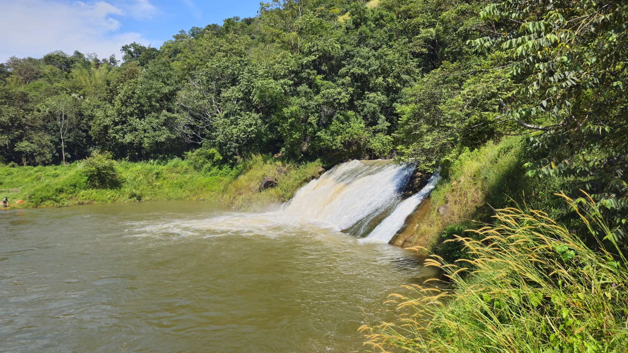
Two photographs of Anchuruli can look like different destinations. One concentrates on white water spreading over a rock slope. Another shows a quiet reservoir, with broad bare bands of earth around its coves. The fixed landform connects them, while water level and discharge change which parts dominate the view.
Follow the short cascade
The cascade beside the tunnel outlet travels over exposed rock towards the reservoir. In a fuller-flow image it becomes a broad white sheet. In a drier-looking view, separate channels leave more stone visible between them. This is a short meeting between discharge and stored water, rather than a second distant waterfall reached by an independent forest trek.
Notice where the falling water loses its white texture and meets the darker receiving surface. Spray, foam and disturbed water occupy a small area relative to the wider reservoir. The change gives the eye a way to follow movement through the frame without assuming that the whole lake is moving at the same apparent speed.
The shoreline has more than one edge
A lower-water photograph often shows two boundaries: the present waterline and the higher line where established vegetation begins. Between them lies exposed reservoir margin, sometimes marked by parallel bands. The upper green edge can seem like a permanent bank, while the lower edge changes with storage conditions. The bare strip is therefore part of the reservoir’s operating space.
That matters when looking at a photograph for route ideas. A broad uncovered bank can resemble a convenient path. It may include soft ground, sloping rock or places that disappear when levels rise. Read it as evidence of changing water, not as a walking terrace. The admitted viewpoint can explain the pattern without requiring a descent onto it.
The reservoir receives more than tunnel water
The Irrigation Department’s Periyar report records Kattappanayar meeting Idukki reservoir at Anjurali and describes local drainage reaching the same area. The tunnel is the famous feature, but it is not the only watercourse in the landscape. Local channels and the engineered transfer share a receiving reservoir while retaining different origins.
From the visitor side, those connections may not all be visible at once. The practical way to understand the scene is to identify what is actually in front of you: the outlet, a cascade, a cove or a wooded promontory. A distant patch of white water should not be assigned a stream name merely because it appears near the tunnel in a map search.
Cloud also changes the impression. Under a heavy sky, the reservoir can look dark and the bare banks become more pronounced. In stronger light, foliage and the water surface separate into brighter colours. Neither appearance gives a complete account of the weather upstream or the dam system’s operation.
A good viewing stop leaves time for both the small and broad scene. Look first at the water crossing the rock, then at the line it joins, and finally at the hills around the reservoir. The sequence is specific to Anchuruli: a compact engineering outlet opens into a much larger stored-water landscape.
Visit context: Kerala Tourism: Anjuruli. Keep the observation within the exterior areas admitted on the day.
Plan the visit: Anchuruli.